Showing Unsold Lots(remove filter)
Filtered by Category:United States(Show All Categories)
Current Auction
80 lots
Page 1 of 2
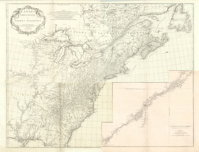
Lot 119
Subject: Colonial Eastern United States & Canada
Anville, Jean Baptiste Bourguignon d'
[On 4 Sheets] Canada Louisiane et Terres Angloises, 1755
Size: 21.9 x 18.8 inches (55.6 x 47.8 cm)
Estimate: $1,200 - $1,500
D'Anville's Spectacular Map of Eastern Seaboard
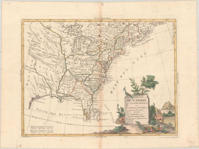
Lot 121
Subject: Colonial Eastern United States & Canada
Zatta, Antonio
Il Canada, le Colonie Inglesi con la Luigiana, e Florida di Nuova Projezione, 1778
Size: 15.9 x 11.9 inches (40.4 x 30.2 cm)
Estimate: $400 - $475
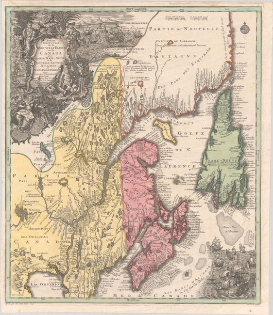
Lot 126
Subject: Colonial Northeastern United States & Canada
Seutter/Lotter
Partie Orientale de la Nouvelle France ou du Canada avec l'Isle de Terre-Neuve et de Nouvelle Escosse, Acadie et Nouv. Angleterre avec Fleuve de St. Laurence, 1756
Size: 19.4 x 22.6 inches (49.3 x 57.4 cm)
Estimate: $1,200 - $1,500
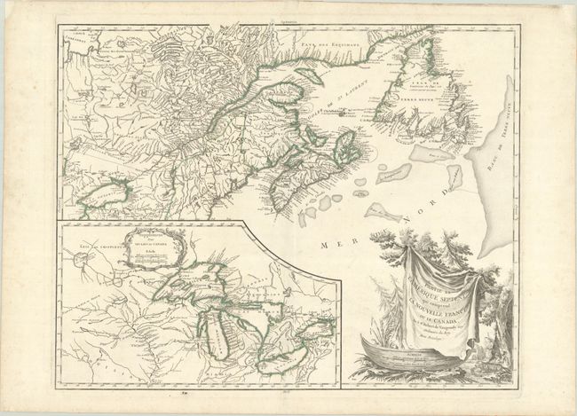
Lot 127
Subject: Colonial Northeastern United States & Canada, Great Lakes
Robert de Vaugondy, Didier
Partie de l'Amerique Septent? qui Comprend la Nouvelle France ou le Canada, 1784
Size: 23.8 x 19 inches (60.5 x 48.3 cm)
Estimate: $475 - $600
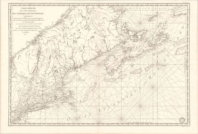
Lot 128
Subject: Colonial Northeastern United States & Canada
Sartine
Carte Reduite des Cotes Orientales de l'Amerique Septentrionale Contenant Celles des Provinces de New-York et de la Nouvelle Angleterre, Celles de l'Acadie ou Nouvelle Ecosse, de l'Ile Royale de l'Ile St. Jean..., 1780
Size: 34.3 x 23.1 inches (87.1 x 58.7 cm)
Estimate: $1,100 - $1,400
Revolutionary War-Era Sea Chart Covering New England & Eastern Canada
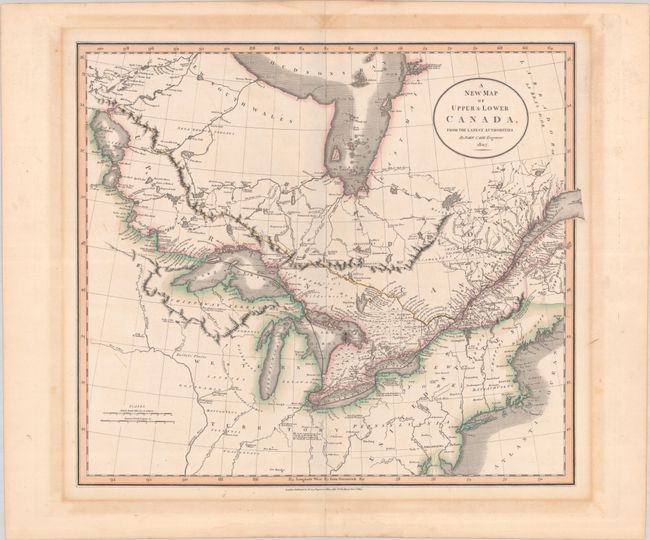
Lot 129
Subject: Northeastern United States & Canada
Cary, John
A New Map of Upper & Lower Canada, from the Latest Authorities, 1807
Size: 20.6 x 18.1 inches (52.3 x 46 cm)
Estimate: $475 - $600
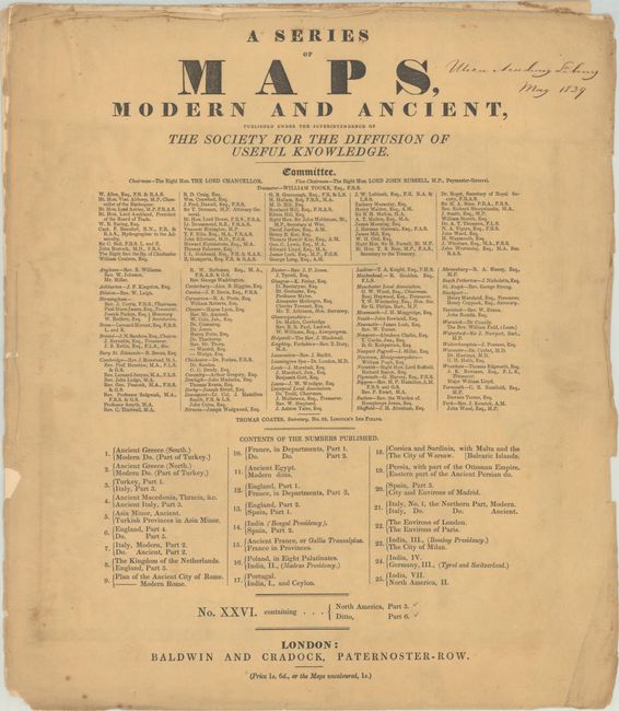
Lot 130
Subject: Northeastern United States & Canada
SDUK Society for the Diffusion of Useful Knowledge
[2 Maps] A Series of Maps, Modern and Ancient ... No. XXVI. Containing... North America, Part 3 - Ditto, Part 6, 1832
Size: 14.6 x 16.7 inches (37.1 x 42.4 cm)
Estimate: $180 - $220
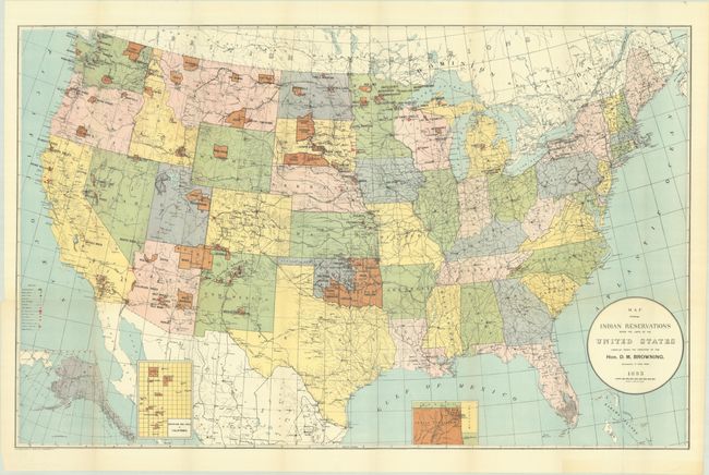
Lot 134
Subject: United States
U.S. Bureau of Indian Affairs
[Lot of 2] Map Showing Indian Reservations Within the Limits of the United States Compiled Under the Direction of the Hon. D.M. Browning... [and] ... Compiled Under the Direction of the Hon. F.E. Leupp..., 1893-1906
Size: 33.3 x 21 inches (84.6 x 53.3 cm)
Estimate: $200 - $250
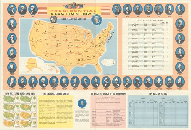
Lot 144
Subject: United States
Hammond, C. S.
Presidential Election Map Compliments of Disabled American Veterans, 1964
Size: 37 x 25 inches (94 x 63.5 cm)
Estimate: $110 - $140
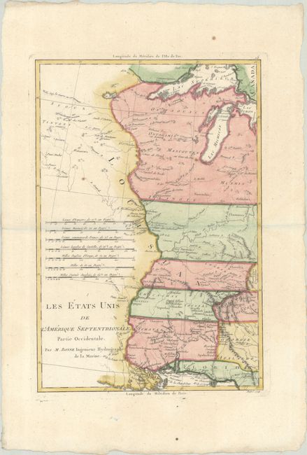
Lot 145
Subject: Eastern United States
Bonne, Rigobert
[Lot of 2] Les Etats Unis de l'Amerique Septentrionale, Partie Occidentale [and] ... Partie Orientale, 1787
Size: 9.3 x 13.6 inches (23.6 x 34.5 cm)
Estimate: $350 - $425
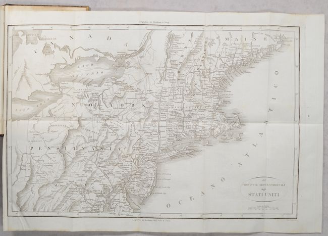
Lot 146
Subject: Eastern United States, Revolutionary War
Botta, Carlo
[2 Maps in 3 Volumes] Le Provincie Meridionali degli Stati Uniti [and] Le Provincie Settentrionali degli Stati Uniti [in] Storia della Guerra della Independenza degli Stati Uniti di America Volume Primo [and] Volume Secondo [and] Volume Terzo, 1820
Size: 5.5 x 8.5 inches (14 x 21.6 cm)
Estimate: $300 - $400
"The Most Valuable History of the Revolution Up to its Date" - Howes
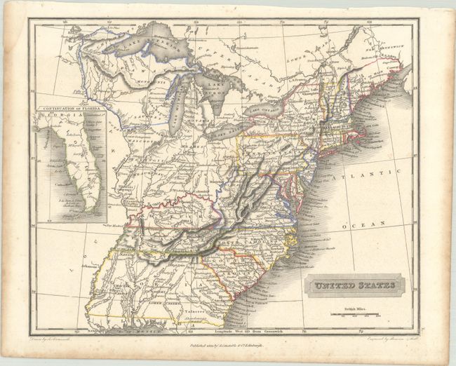
Lot 147
Subject: Eastern United States
Arrowsmith, Aaron, Jr.
United States, 1823
Size: 10 x 8.1 inches (25.4 x 20.6 cm)
Estimate: $200 - $230
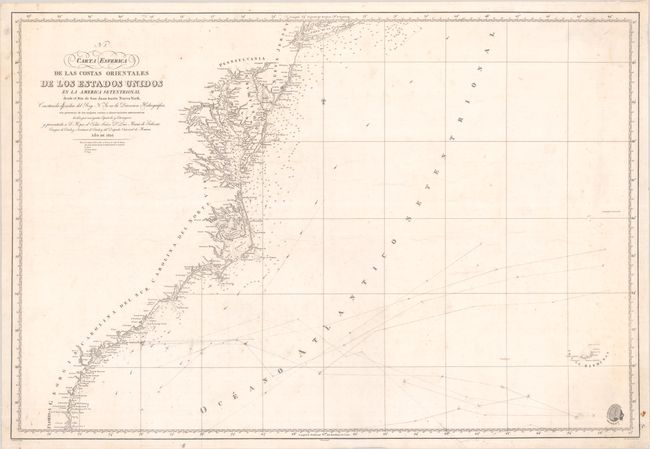
Lot 148
Subject: Eastern United States
Direccion de Hidrografia
Carta Esferica de las Costas Orientales de los Estados Unidos en la America Setentrional Desde el Rio de San Juan Hasta Nueva York..., 1826
Size: 35.4 x 24.1 inches (89.9 x 61.2 cm)
Estimate: $475 - $600
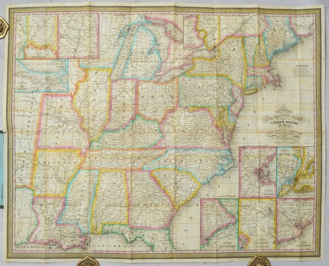
Lot 149
Subject: Eastern United States
Mitchell/Young
Mitchell's Travellers Guide Through the United States. A Map of the Roads, Distances, Steam Boat & Canal Routes &c., 1834
Size: 21.8 x 17.4 inches (55.4 x 44.2 cm)
Estimate: $550 - $700
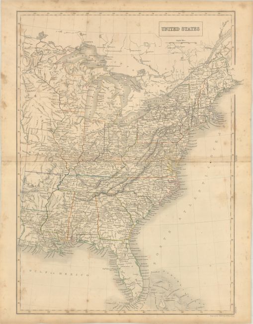
Lot 150
Subject: Eastern United States, Iowa
Black, Adam & Charles
United States, 1840
Size: 15 x 20 inches (38.1 x 50.8 cm)
Estimate: $100 - $130
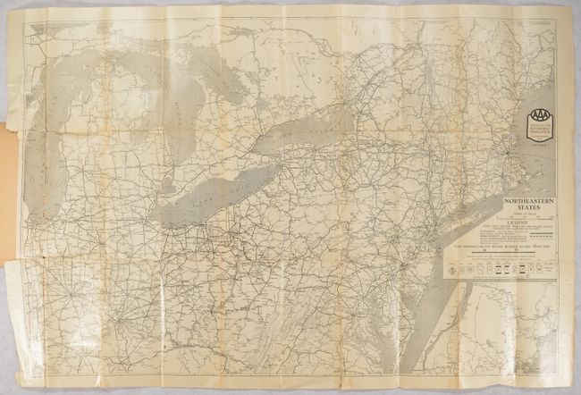
Lot 152
Subject: Northeastern United States
American Automobile Assoc.
[Map in Book] Northeastern States [in] AAA Official Tour Book and Map of Northeastern States..., 1926
Size: 35.4 x 23.4 inches (89.9 x 59.4 cm)
Estimate: $140 - $170
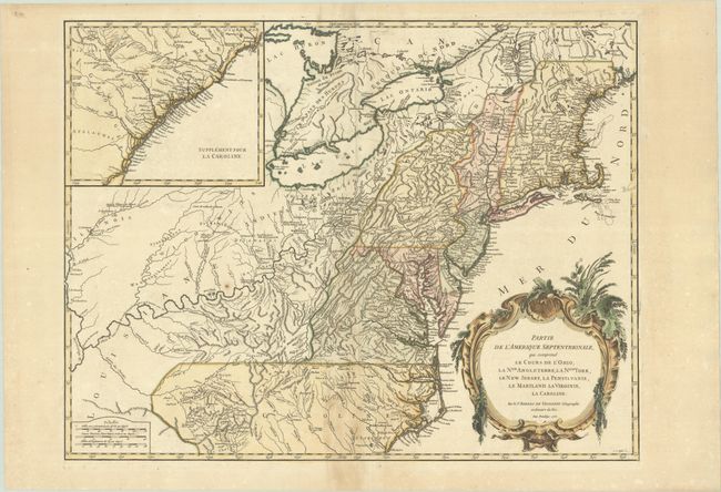
Lot 153
Subject: Colonial New England & Mid-Atlantic United States
Robert de Vaugondy, Didier
Partie de l'Amerique Septentrionale, qui Comprend le Cours de l'Ohio, la Nlle. Angleterre, la Nlle York, le New Jersey, la Pensylvanie, le Maryland le Virginie, la Caroline, 1755
Size: 24.5 x 18.8 inches (62.2 x 47.8 cm)
Estimate: $550 - $700
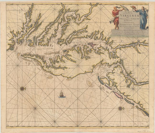
Lot 157
Subject: Colonial Mid-Atlantic United States, Chesapeake & Delaware Bays
Keulen, Johannes van
Pas Kaart van de Zee Kusten van Virginia Tusschen C Henry en t Hooge Land van Renselaars Hoek, 1695
Size: 22.6 x 20 inches (57.4 x 50.8 cm)
Estimate: $4,500 - $5,500
One of the Earliest Maps to Show Philadelphia
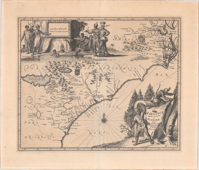
Lot 160
Subject: Colonial Southeastern United States
Montanus/Ogilby
Virginiae Partis Australis, et Floridae Partis Orientalis, Interjacentiumq Regionum Nova Descriptio, 1671
Size: 13.8 x 11.4 inches (35.1 x 29 cm)
Estimate: $700 - $850
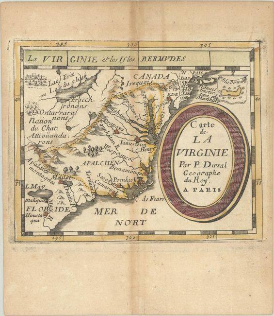
Lot 161
Subject: Colonial Southeastern United States
Duval, Pierre
Carte de la Virginie, 1682
Size: 4.9 x 3.9 inches (12.4 x 9.9 cm)
Estimate: $550 - $700
Lot 162
Subject: Colonial Southeastern United States
Bonne, Rigobert
Carte de la Partie Sud des Etats Unis de l'Amerique Septentrionale, 1780
Size: 12.6 x 8.5 inches (32 x 21.6 cm)
Estimate: $100 - $130
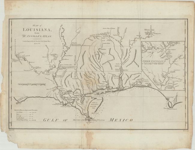
Lot 164
Subject: Gulf Coast
Harrison, John
Map of Louisiana, from d'Anville's Atlas, 1788
Size: 19.4 x 12.1 inches (49.3 x 30.7 cm)
Estimate: $700 - $850
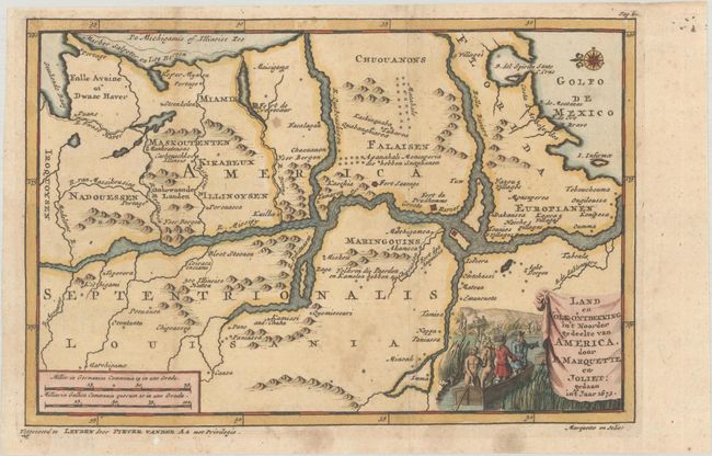
Lot 165
Subject: Central United States, Mississippi River
Aa, Pieter van der
Land en Volk-Ontdekking in't Noorder Gedeelte van America, door P. Marquette en Joliet; Gedaan in't Jaar 1673, 1707
Size: 9 x 6 inches (22.9 x 15.2 cm)
Estimate: $700 - $850
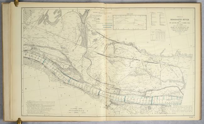
Lot 166
Subject: Mississippi River, Missouri, Illinois
U.S. Government
Atlas Illustrating Report of March 20, 1909, of Board on Examination and Survey of Mississippi River..., 1909
Size: 22.8 x 36.8 inches (57.9 x 93.5 cm)
Estimate: $300 - $400
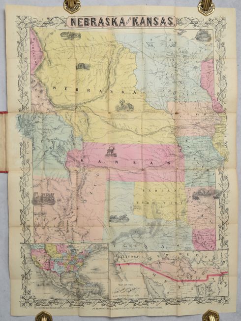
Lot 168
Subject: Central United States
Colton, Joseph Hutchins
Nebraska and Kansas, 1854
Size: 20.5 x 27.8 inches (52.1 x 70.6 cm)
Estimate: $5,500 - $7,000
The First Separate Map of Kansas & Nebraska Territories
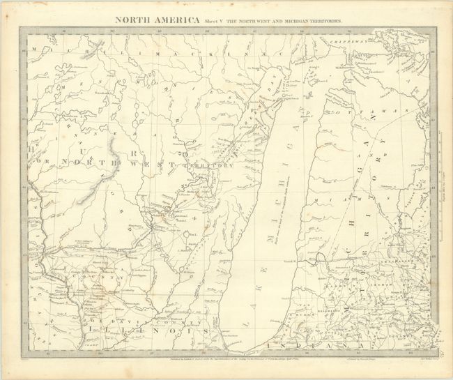
Lot 173
Subject: Upper Midwestern United States
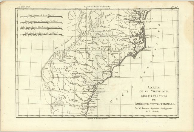
SDUK Society for the Diffusion of Useful Knowledge
North America Sheet V The North West and Michigan Territories, 1833
Size: 15.3 x 11.9 inches (38.9 x 30.2 cm)
Estimate: $120 - $150
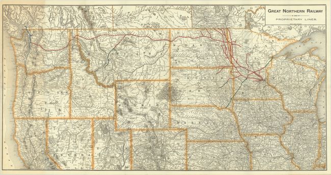
Lot 174
Subject: Northern United States, Railroads
Poole Bros.
[Map with Report] Great Northern Railway and Proprietary Lines [with] Eighth Annual Report of the Great Northern Railway Company, 1897
Size: 32.3 x 16.7 inches (82 x 42.4 cm)
Estimate: $180 - $220
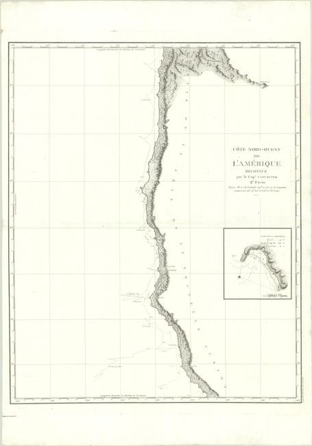
Lot 175
Subject: West Coast, United States
Vancouver, George (Capt)
Cote Nord-Ouest de l'Amerique Reconnue par le Cape. Vancouver 2e. Partie..., 1799
Size: 24.1 x 29.8 inches (61.2 x 75.7 cm)
Estimate: $350 - $425
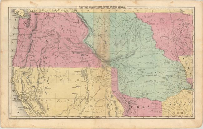
Lot 176
Subject: Western United States, Texas
Robinson, D.F. & Co.
Western Territories of the United States, 1849
Size: 17.5 x 10.6 inches (44.5 x 26.9 cm)
Estimate: $240 - $300
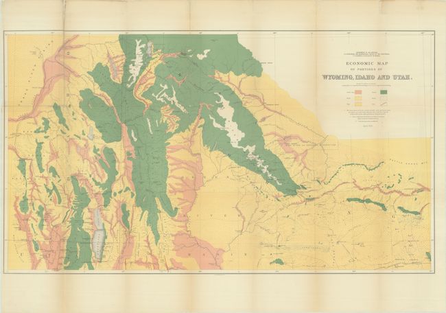
Lot 179
Subject: Western United States
Hayden, Ferdinand Vandeveer
[Lot of 3] Economic Map of Portions of Wyoming, Idaho and Utah [and] Part of Central Wyoming [and] Part of Central Wyoming, 1883
Size: See Description
Estimate: $200 - $230
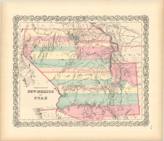
Lot 182
Subject: Southwestern United States
Colton, Joseph Hutchins
Territories of New Mexico and Utah, 1855
Size: 15.7 x 12.9 inches (39.9 x 32.8 cm)
Estimate: $220 - $250
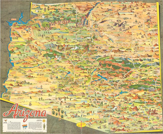
Lot 187
Subject: Arizona
[Lot of 2] A Pic-Tour Map of Arizona [and] Reg Manning's Cartoon Map of Arizona, 1938-50
Size: See Description
Estimate: $200 - $230
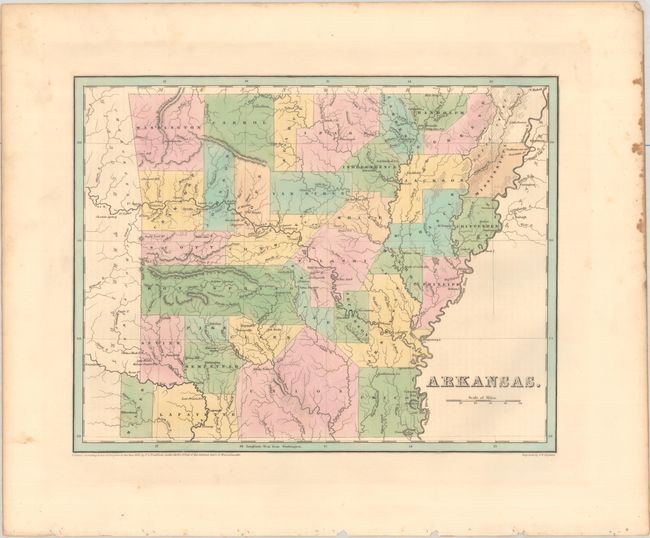
Lot 189
Subject: Arkansas, Texas
Bradford, Thomas Gamaliel
Arkansas, 1838
Size: 14.4 x 11.3 inches (36.6 x 28.7 cm)
Estimate: $180 - $220
Features Disputed Land with the Republic of Texas
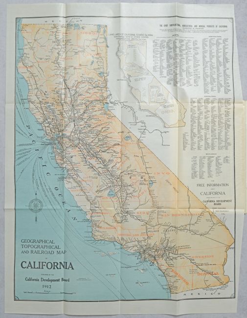
Lot 190
Subject: California
Britton & Rey
[Map in Report] Geographical Topographical and Railroad Map of California [in] California Resources and Possibilities - Twenty-Second Annual Report of the California Development Board..., 1912
Size: 19.8 x 25.3 inches (50.3 x 64.3 cm)
Estimate: $160 - $190
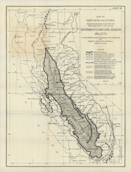
Lot 191
Subject: California
Map of Northern California Showing General Plan for the Reclamation of the Entire Sacramento and San Joaquin Valleys to Accompany a Discussion of the Problem, 1919
Size: 16.5 x 22.1 inches (41.9 x 56.1 cm)
Estimate: $140 - $170
Illustrates the Marshall Water Plan
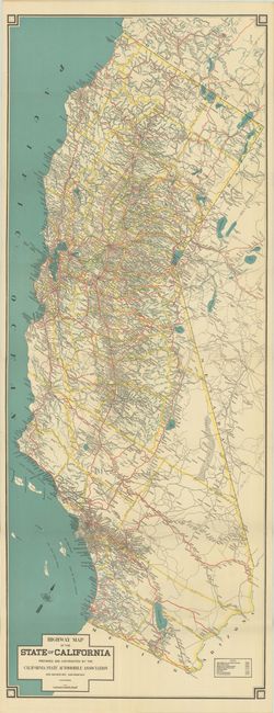
Lot 192
Subject: California
Highway Map of the State of California, 1925
Size: 15.4 x 40.5 inches (39.1 x 102.9 cm)
Estimate: $180 - $220
Lot 193
Subject: California
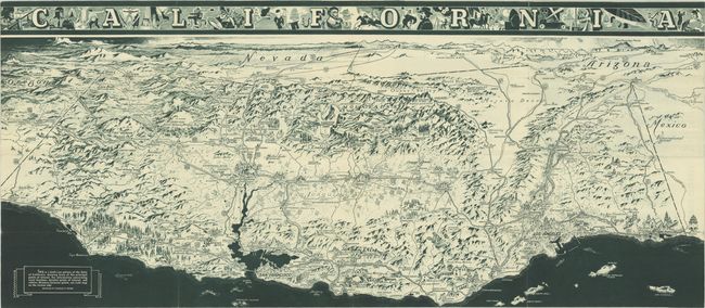
California Official Tourist Picture Map, 1936
Size: 38 x 16.6 inches (96.5 x 42.2 cm)
Estimate: $150 - $180
Depression-Era California Pictorial Map Welcoming Tourists but Not Settlers
Lot 194
Subject: Lake Tahoe, California, Nevada
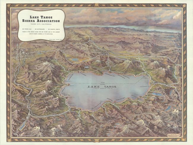
Eddy, Gerald
Lake Tahoe Sierra Association Tahoe City, California, 1945
Size: 22.4 x 17.3 inches (56.9 x 43.9 cm)
Estimate: $200 - $230
Lot 195
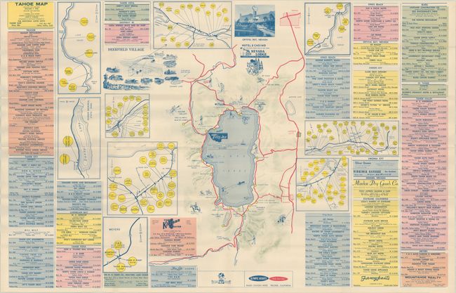
Subject: Lake Tahoe, California
Tahoe Map, 1961
Size: 33.9 x 21.9 inches (86.1 x 55.6 cm)
Estimate: $150 - $180
Unrecorded Map of Lake Tahoe Following the 1960 Olympics
Lot 196
Subject: Yosemite, California
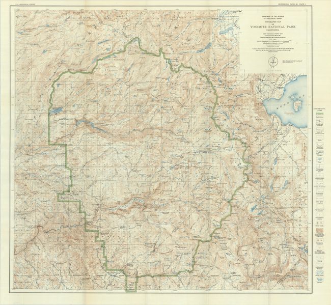
U.S. Geological Survey (USGS)
Topographic Map of Yosemite National Park California..., 1932
Size: 28.8 x 27.3 inches (73.2 x 69.3 cm)
Estimate: $150 - $180
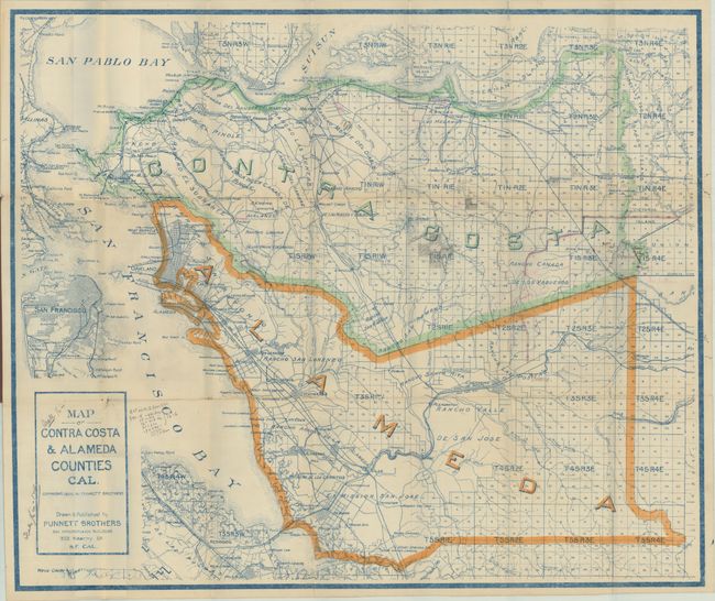
Lot 197
Subject: East Bay, California
Map of Contra Costa & Alameda Counties Cal., 1908
Size: 29 x 24.3 inches (73.7 x 61.7 cm)
Estimate: $140 - $170
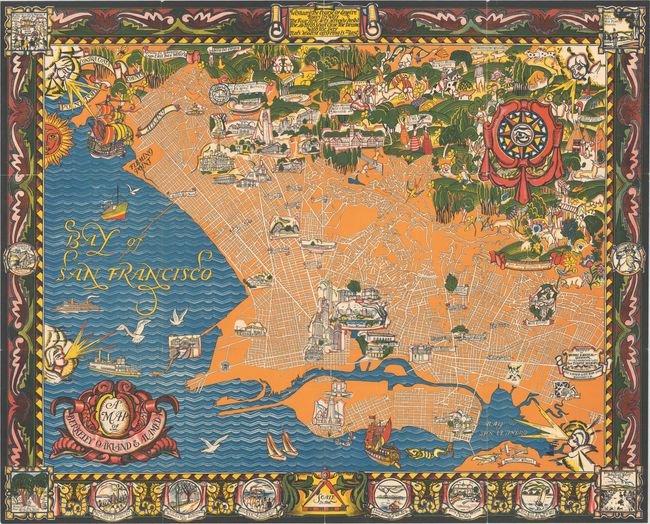
Lot 198
Subject: East Bay, California
A Map of Berkeley Oakland & Alameda, 1930
Size: 42.5 x 34.3 inches (108 x 87.1 cm)
Estimate: $1,100 - $1,400
"One of the Most Dramatic and Boldly Colored Pictorial Maps of the 1930s"
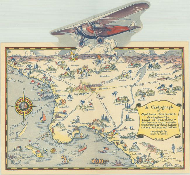
Lot 201
Subject: Southern California
White, Ruth Taylor
A Cartograph of Southern California Showing How the Land of Sunshine... Has Become So Air-Minded That Everybody Flies Hither and Yon and Yon and Hither, 1929
Size: 10.1 x 9.4 inches (25.7 x 23.9 cm)
Estimate: $275 - $350
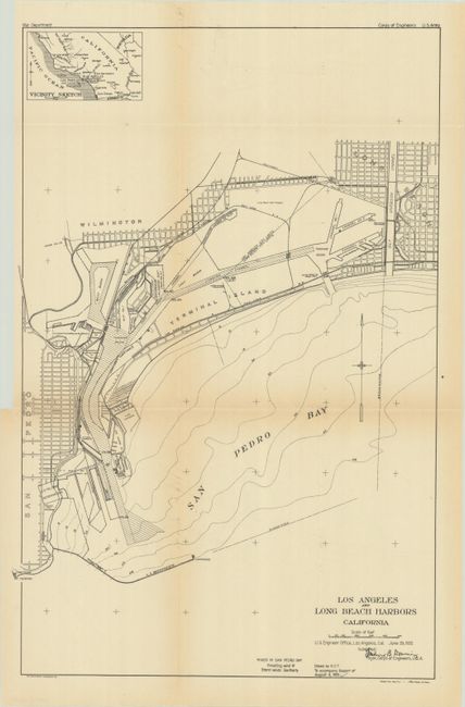
Lot 204
Subject: Los Angeles, California
U.S. Corps of Engineers
[Map with Report] Los Angeles and Long Beach Harbors California, 1921
Size: 12.9 x 19.7 inches (32.8 x 50 cm)
Estimate: $140 - $170
Lot 205
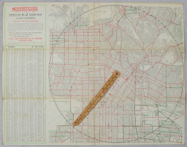
Subject: Los Angeles, California
Clason Map Company
Improved E-Z Guide Map of Los Angeles, 1927
Size: 16.6 x 12.8 inches (42.2 x 32.5 cm)
Estimate: $160 - $190
Lot 206
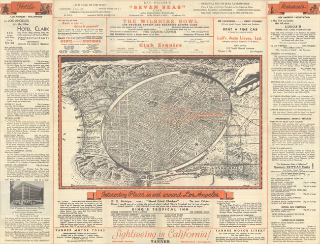
Subject: Los Angeles, California
Interesting Places In and Around Los Angeles [on verso] California Pacific International Exposition, 1935
Size: 23.9 x 18.3 inches (60.7 x 46.5 cm)
Estimate: $160 - $190

Lot 207
Subject: Los Angeles, California, Literary Map
The Literary Map of Los Angeles, 1987
Size: 26.5 x 20.3 inches (67.3 x 51.6 cm)
Estimate: $140 - $170
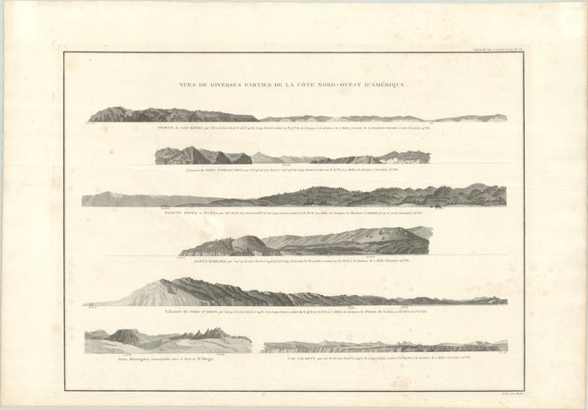
Lot 210
Subject: California & Baja California
Vancouver, George (Capt)
Vues de Diverses Parties de la Cote Nord-Ouest d'Amerique, 1799
Size: 20.1 x 14.8 inches (51.1 x 37.6 cm)
Estimate: $300 - $375
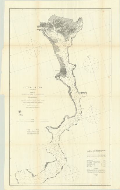
Lot 215
Subject: Potomac River & Washington, D.C.
U.S. Coast Survey
[On 4 Sheets] Potomac River (In Four Sheets)... , 1862-64
Size: See Description
Estimate: $500 - $650
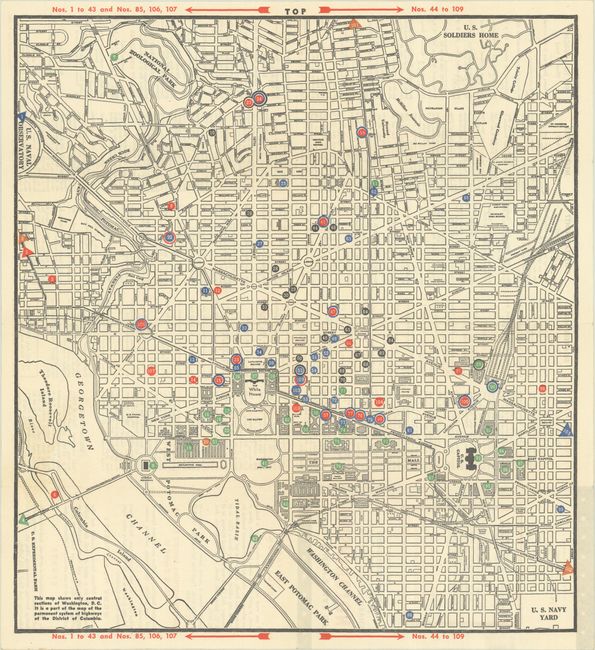
Lot 218
Subject: Washington, D.C.
Service Men’s Map of Washington - Full Information on Service Clubs, Entertainment Sightseeing and Lodging, 1945
Size: 14.1 x 15.4 inches (35.8 x 39.1 cm)
Estimate: $200 - $230
Service Men's Map Documents World War II Segregation in Washington, D.C.
80 lots
Page 1 of 2