Current Auction
"Western Territories of the United States", Robinson, D.F. & Co.
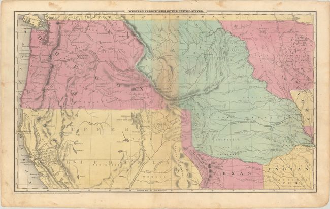
Subject: Western United States, Texas
Period: 1849 (circa)
Publication: Olney's School Atlas
Color: Hand Color
Size:
17.5 x 10.6 inches
44.5 x 26.9 cm
Download High Resolution Image
(or just click on image to launch the Zoom viewer)
(or just click on image to launch the Zoom viewer)
This is a map of the transitional American West. Oregon Territory is massive, stretching all the way from the Pacific to the Rocky Mountains and meeting up with an extension of Texas' panhandle at the 42nd parallel. Upper California reaches east to Texas, and Nebraska Territory extends from Canada's border down to Texas and Indian Territory. Minnesota is a large territory as well, as the Dakotas have yet to be formed. Copyright dated 1847. Drawn and engraved by Sherman & Smith.
References:
Condition: B+
Contemporary color with light toning along the upper centerfold. There is some minor foxing mostly in the blank margins.
Estimate: $240 - $300
Price: $180
Bid Increments
$100 - $249$10
$250 - $499$25
$500 - $999$50
$1,000 - $2,499$100
Terms & Conditions