Subject: Colonial Southeastern United States
Period: 1780 (circa)
Publication: Atlas de Toutes les Parties Connues du Globe Terrestre
Color: Black & White
Size:
12.6 x 8.5 inches
32 x 21.6 cm
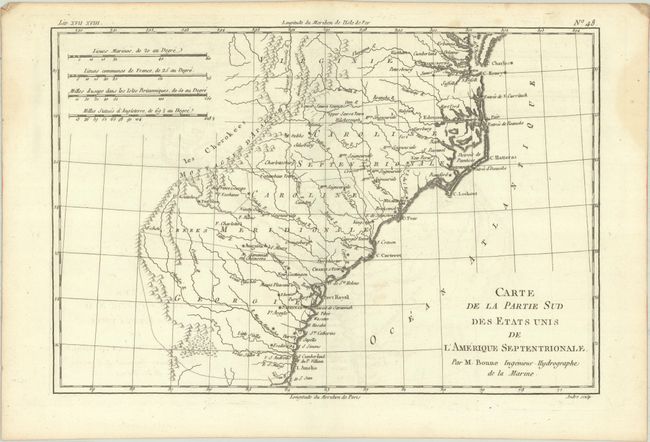
A basic copper-engraved map that covers the states of Virginia, North and South Carolina, and Georgia in the new United States. All settlement is confined east of the Appalachians with les Cherokees the only note in the otherwise blank region west of the mountains. Four distance scales are located in the top left corner of the map.
Rigobert Bonne was an important French cartographer of the late 18th century. In 1773 he succeeded Jacques Bellin as the Royal Cartographer in the office of the Hydrographer at the Depot de la Marine. Working in his official capacity, Bonne compiled some of the most detailed and accurate maps of the period.
References: Sellers & Van Ee #1406.
Condition: A
A crisp impression on watermarked paper with faint offsetting. There are a couple of minor dampstains confined to the side margins.