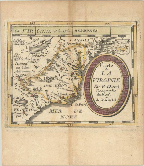
Subject: Colonial Southeastern United States
Period: 1682 (published)
Publication: Le Monde ou la Geographie Universelle
Color: Hand Color
Size:
4.9 x 3.9 inches
12.4 x 9.9 cm
This charming miniature map covers the coastline from Long Island to the May R. in South Carolina and inland to Lake Erie and the mythical Lake May. It depicts the defunct Swedish colony, the Dutch colony of New York (Nouvel Amsterdam), and the French claim to Florida. Several Native Indian tribes are named, including Iroquois. A tiny inset map of the island of Bermuda is included above the bold oval title cartouche. This is the fourth state. Pierre Duval was Nicolas Sanson's nephew and pupil. He published a wide range of atlases and individual maps including a fine miniature world geography with many of the maps based on Sanson.
References: Burden #341; cf. Cumming (SE) #56; King (3rd ed) #1660; Pastoureau, Duval XI Fa.
Condition: B+
A nice impression with original outline color in the map and later color in the cartouche, on a watermarked sheet with light toning along the centerfold and edges of the sheet. There is a light dampstain along the right edge of the sheet.