Current Auction
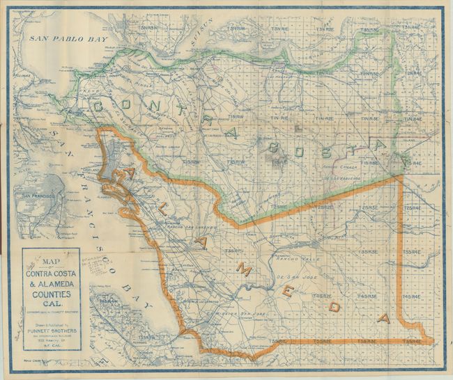
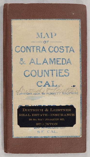
"Map of Contra Costa & Alameda Counties Cal."
Subject: East Bay, California
Period: 1908 (dated)
Publication:
Color: Printed Color
Size:
29 x 24.3 inches
73.7 x 61.7 cm
Download High Resolution Image
(or just click on image to launch the Zoom viewer)
(or just click on image to launch the Zoom viewer)
This early map of Alameda and Contra Costa counties was printed in blue ink and published by Punnett Brothers in San Francisco. The most prominent feature of the map is the township grid of the Public Land Survey System, with development mostly confined along the San Francisco Bay and the railroad lines. The street grid pattern of cities are depicted including Oakland, San Pablo, and Hayward, and a number of ranchos, railroads, and rivers are located. San Francisco is shown across the Bay. Folds into brown cloth covers (4.8 x 8.6") with printed title label and additional pastedown label for Dietrich & Leistner Real Estate Insurance.
References:
Condition: B
Issued folding with a couple of archivally repaired short fold separations along the edges, several short splits at the fold junctions, and one small hole beneath Dublin. There are numerous manuscript notations and shadings in the image. Covers have average wear.
Estimate: $140 - $170
Price: $100
Bid Increments
$50 - $99$5
$100 - $249$10
$250 - $499$25
$500 - $999$50
Terms & Conditions