Current Auction
"[Lot of 3] Economic Map of Portions of Wyoming, Idaho and Utah [and] Part of Central Wyoming [and] Part of Central Wyoming", Hayden, Ferdinand Vandeveer
Subject: Western United States
Period: 1883 (published)
Publication:
Color:
Size:
See Description
Download High Resolution Image
(or just click on image to launch the Zoom viewer)
(or just click on image to launch the Zoom viewer)
This lot features three eye-catching maps from Hayden's Twelfth Annual Report of the United States Geological and Geographical Survey of the Territories, published in 1883:
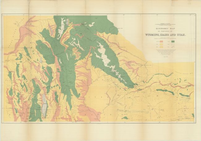
A. Economic Map of Portions of Wyoming, Idaho and Utah, dated 1879, printed color (36.3 x 20.5"). This is a beautifully executed chromolithographed map that details the land types of the region. The map covers the area from Jackson Lake and the Tetons in the north to Bear Lake, Logan and Robinson's Ferry on the Green River in the south. It extends from Blackfoot, Idaho in the west to Rawlings, Wyoming in the east. A color/style legend identifies land types, including arable land, grass, sage, forest, and rock. Coal deposits are identified via red overprinted lines. It is a very detailed chart drawn on a scale of 1 inch per 8 miles with geology by A.C. Peale, Orestes St. John, and F.M. Endlich. Condition: A vibrant example, issued folding, with fold separations, most of which have been closed on verso with archival tape. There is minor chipping along folds at top left, faint toning along folds, and minor extraneous creasing at bottom right.
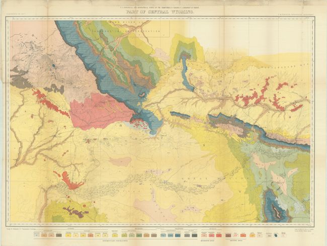
B. Part of Central Wyoming, printed color (33.3 x 24.4"). This excellent map extends from part of the Wind River Reservation south to Rawlins. It displays the full course of the Sweetwater River, South Pass, etc. and depicts trails throughout the region. Remarkable detail is shown with contour intervals at 200 feet and a scale of 4 miles = 1 inch. Old wagon roads, trails, and the Union Pacific Railroad are featured. Color and pattern icons at the bottom provides the key to the 32 different geological types. Wheat draws attention to the map's value to students of the fur trade and overland immigration routes. Based on surveys conducted in 1877. Condition: A colorful example, issued folding, with fold separations, including a 4" horizontal split at top left, that have been closed on verso with archival tape. There is minor toning along the folds, a hint of foxing, and soiling in the top blank margin.
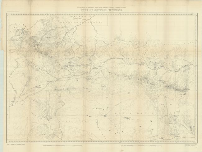
C. Part of Central Wyoming, black & white (33.4 x 22.9"). This map is identical to the map above, except sans the colorful geological information. Condition: Issued folding with minor toning, soiling in the top blank margin, and fold separations along the top horizontal fold that have been closed on verso with archival tape.
References: Wheat (TMW) #1296.
Condition: B+
See description above.
Estimate: $200 - $230
Price: $150
Bid Increments
$100 - $249$10
$250 - $499$25
$500 - $999$50
$1,000 - $2,499$100
Terms & Conditions