Subject: Eastern United States
Period: 1787 (circa)
Publication: Atlas Encyclopedique...
Color: Hand Color
Size:
9.3 x 13.6 inches
23.6 x 34.5 cm
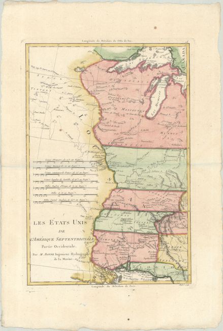
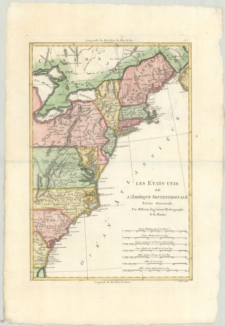
Matched pair of maps covering the territory of the newly created United States. Partie Orientale covers the eastern seaboard from New England to the coast of Georgia. Partie Occidentale presents the territory from the Appalachian Mountains to the Mississippi River. The southern states are shown with their western boundaries extended to the Mississippi River. Early settlements, frontier forts, missions, mines, Indian villages, as well as some trails and portages are revealed in great detail. Both maps feature seven distance scales. Engraved by Andre.
Rigobert Bonne was an important French cartographer of the late 18th century. In 1773 he succeeded Jacques Bellin as the Royal Cartographer in the Office of the Hydrographer at the Depot de la Marine. Working in his official capacity, Bonne compiled some of the most detailed and accurate maps of the period.
References: McCorkle #788-1; Sellers and Van Ee #794; Phillips (Atlases) #666, Vol. 2 #117 & 118.
Condition: A
Crisp impressions on watermarked paper with a few faint spots. The first image is a composite image - the map is on two separate sheets.