Subject: Northeastern United States & Canada
Period: 1832 (dated)
Publication:
Color: Hand Color
Size:
14.6 x 16.7 inches
37.1 x 42.4 cm
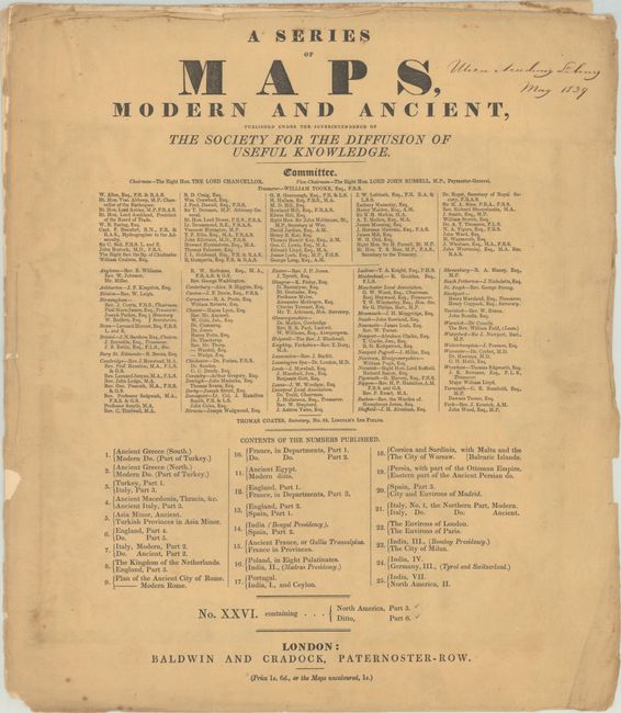
The beginning of the nineteenth century saw a period of rapid market growth and innovation in the map publishing world. Increased literacy and public interest in new frontiers and colonies overwhelmed the market because it was oriented toward the small, affluent market of the previous century. With the intent to fill this void, The Society for the Diffusion of Useful Knowledge (SDUK) was founded in 1828 in London, by Lord Brougham and a group of men dedicated to the education of the aspiring working class and the Utilitarian ideal of 'Knowledge is Power.' The society produced an array of education materials, but the series of maps was one of their most successful ventures. A number of engravers and printers were used to produce the maps, which eventually exceed 200 sheets, and continued to be published after the Society as a whole ceased to function.
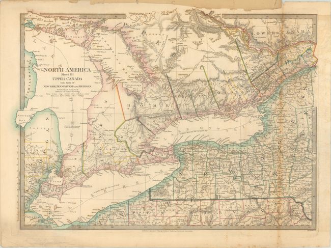
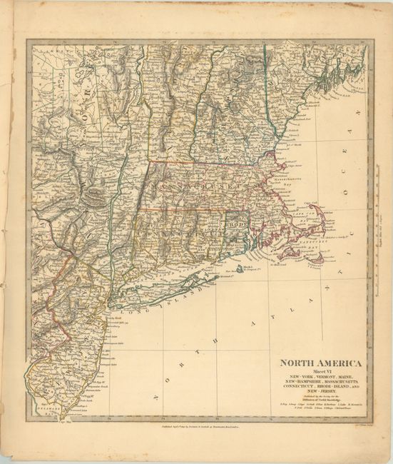
This lot includes two SDUK maps in their original paper wrappers. Starting in September 1829, the SDUK issued maps to their subscribers in a series of "Numbers" (or fascicles), each of which included a pair of maps. This is No. XXVI, with maps of Upper Canada and the Northeastern United States. The Canada map is centered on Toronto and extends from eastern Michigan to beyond Cornwall, Ontario on the St. Lawrence River. The map of the Northeastern United States extends from New Jersey to Penobscot Bay, Maine and west to the Adirondack Mountains. Each map is filled with precise details including political boundaries, towns and cities, roads, canals, rivers, mountains, and more. Published by Baldwin & Cradock.
References:
Condition:
The maps have contemporary outline color with some scattered foxing mostly along the borders. The Canada map has some light offsetting to the right of the fold and an archivally repaired 5" tear also at right. The U.S. map has an archivally repaired edge tear that enters 1.5" into the image at top. Front wrapper is chipped along the left edge and creased at lower right. Rear wrapper is missing. Upper Canada (B) / New England (B+)