Subject: Northeastern United States & Canada
Period: 1807 (dated)
Publication:
Color: Hand Color
Size:
20.6 x 18.1 inches
52.3 x 46 cm
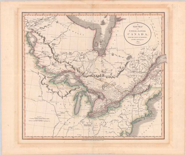
This is the first state of Cary’s map of eastern Canada and the northeastern United States. Centered on the Great Lakes, it extends to Lake Winnipeg, Hudson Bay, the St. Lawrence estuary, and the New England coast. The map is filled with place names, excellent detail of interior watersheds, and notations concerning the land, animals, and native inhabitants. In the United States, a large Western Territory stretches from the Ohio River to the headwaters of the Mississippi River with the fictitious Isle Philippeaux in Lake Superior serving as a boundary point with Canada. Several forts are located, including Fort Miami now Fort Wayne, Fort Recovery (incorrectly located well south of the Wabash's headwaters), and Michilimackinack the last N.W. Fort.
References: Phillips (Atlases) #714-53.
Condition: B+
A crisp impression with contemporary outline color on a sturdy sheet with an "1806" watermark. There is light toning and dampstaining that is entirely confined to the blank margins.