Subject: United States
Period: 1964 (dated)
Publication:
Color: Printed Color
Size:
37 x 25 inches
94 x 63.5 cm
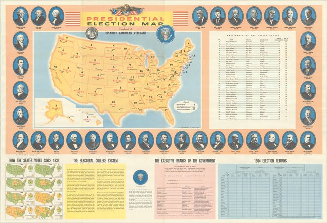
This basic map of the United States displays number of electoral votes, date of admission, and the capital of each state. Although issued for the 1964 election between Johnson and Goldwater, the fields for the candidates' names are left blank, indicating a publication date before the primaries. The map is flanked on the right by a table of past presidents and both are surrounded by presidential portraits. Eight smaller maps appear in the lower left corner, illustrating how the states voted in every election since 1932. In the lower right corner is an unused tally sheet for the upcoming 1964 election. Blank verso.
References: Rumsey #8711.
Condition: A
A colorful example, issued folding, with a few minor creases adjacent to the fold junctions.