Current Auction
Features Disputed Land with the Republic of Texas
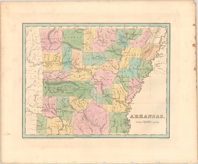
"Arkansas", Bradford, Thomas Gamaliel
Subject: Arkansas, Texas
Period: 1838 (dated)
Publication: An Illustrated Atlas, Geographical, Statistical, and Historical, of the United States...
Color: Hand Color
Size:
14.4 x 11.3 inches
36.6 x 28.7 cm
Download High Resolution Image
(or just click on image to launch the Zoom viewer)
(or just click on image to launch the Zoom viewer)
This fine map appeared two years after Arkansas statehood and is one of the earliest published maps of the state. Of particular interest are the counties of Miller and Lafayette in the southwest corner of the state. This region was in dispute with the then Republic of Texas. All of Miller County, as shown on this map, was ceded to Texas when it became a state in 1845. Other details include topography, river systems, county seats and several post offices, but most of the state is undeveloped. Not to be confused with the maps from the Comprehensive Atlas, this map is several inches larger and carries much more information. Engraved by G. W. Boynton.
References: Phillips (Atlases) #1381; Ristow pp. 270-271.
Condition: A
Contemporary color with some foxing in the right blank margin.
Estimate: $180 - $220
Price: $130
Bid Increments
$50 - $99$5
$100 - $249$10
$250 - $499$25
$500 - $999$50
Terms & Conditions