Current Auction
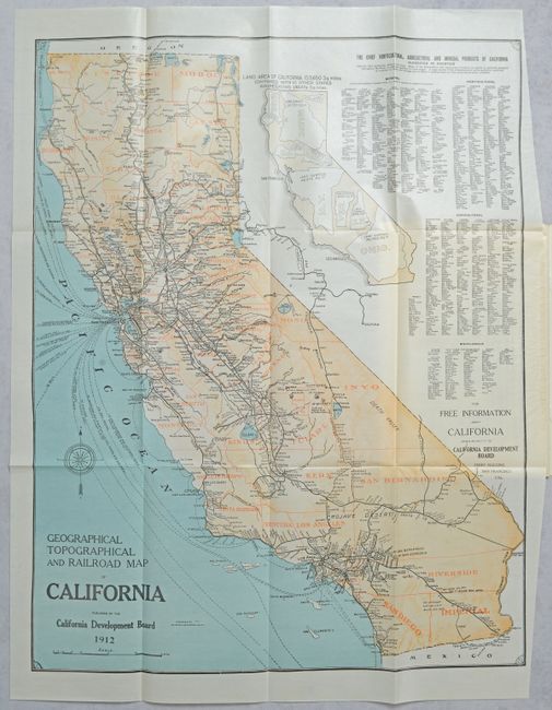
"[Map in Report] Geographical Topographical and Railroad Map of California [in] California Resources and Possibilities - Twenty-Second Annual Report of the California Development Board...", Britton & Rey

Subject: California
Period: 1912 (published)
Publication:
Color: Printed Color
Size:
19.8 x 25.3 inches
50.3 x 64.3 cm
Download High Resolution Image
(or just click on image to launch the Zoom viewer)
(or just click on image to launch the Zoom viewer)
A detailed map of the state that is delineated by county and presents the railroad network and shipping routes. Relief is presented through light orange shading with a three-dimensional effect. An unusual large inset map visually demonstrates how 10 other states would easily fit within California's footprint, and tables to its right present the state's economic output. The map is located at the rear of the California Development Board's 22nd Annual Report that covers population, financial condition, reconstruction of San Francisco, agriculture, climate, advertisements for the 1915 Panama–California Exposition, and more. Pictorial paper wrappers (6.8 x 10.1").
References:
Condition: A
Folding map is clean, bright and fine. Text is clean and covers have minor wear.
Estimate: $160 - $190
Price: $100
Bid Increments
$50 - $99$5
$100 - $249$10
$250 - $499$25
$500 - $999$50
Terms & Conditions