Subject: Colonial Eastern United States & Canada
Period: 1755 (dated)
Publication: Atlas General
Color: Black & White
Size:
21.9 x 18.8 inches
55.6 x 47.8 cm
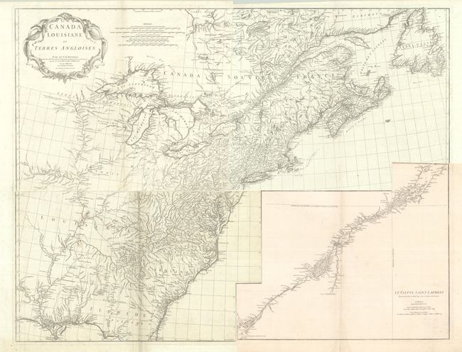
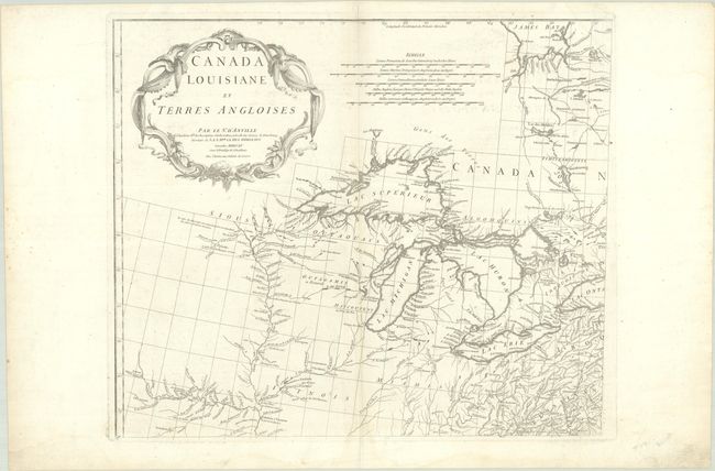
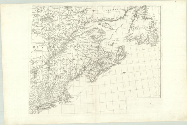
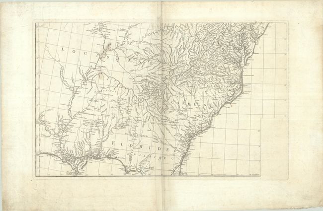
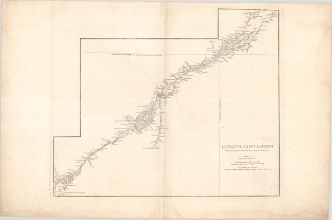
This large-scale map covers the region from Labrador to the north of Florida, and from the Mississippi River to the Atlantic Ocean. It also extends to include the southern end of James Bay, and shows all of Great Lakes and the course of the St. Lawrence. The map provides early detail along the lower portion of the Missouri (alternately the "Pekitanoui") and the upper waters of the Mississippi. The Keweenaw peninsula is named as Kiaonan, and Isle Royale is called I. Minong. It is filled with scores of Indian tribes and villages named and located. The map was based in part on Mitchell's famous map of the United States which appeared earlier in the same year. D'Anville developed his version of the map with an emphasis on French influence on the area, omitting Mitchell's legend, references to English factories in the disputed trans-Allegheny area, and drew on French sources for additional details over the Mitchell map. The most obvious change, however, is the large inset of the St. Lawrence River basin ("Le Fleuve Saint-Laurent") which appears on a separate sheet. D'Anville's usual, superb cartographic detail is seen throughout. A handsome cartouche designed by Gravelot fills the upper left of the map.
References: Sellers & Van Ee #17; Cumming (SE) #296; Tooley (Amer) p. 316.
Condition:
Crisp impressions on watermarked sheets with some light printer's ink residue and faint dampstaining that is more prominent in the blank margins. The top right sheet has an archivally repaired 2" centerfold separation at bottom and the bottom right sheet has light soiling. The lower left sheet has a few small stains around the word Louisiana, and there is some soiling and creasing along the centerfold. Upper Half (B+)/ Lower Half (B). The first image is a composite image - the map is on four separate sheets.