Subject: United States
Period: 1893-1906 (dated)
Publication:
Color: Printed Color
Size:
33.3 x 21 inches
84.6 x 53.3 cm
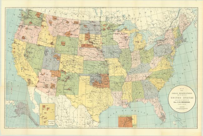
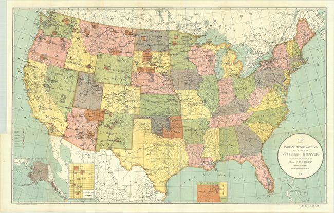
This lot contains two large maps of the United States focusing on the many Indian reservations at the end of the 19th century and the beginning of the 20th century. The reservations are named and shown in orange/tan overprinting. The maps also show military stations, towns and villages, railroads, Indian agencies, and schools with keys at lower left. They both include insets of Alaska and reservations in California and Indian Territory at bottom.
A. Map Showing Indian Reservations Within the Limits of the United States Compiled Under the Direction of the Hon. D.M. Browning. Commissioner of Indian Affairs, dated 1893.
B. Map Showing Indian Reservations Within the Limits of the United States Compiled Under the Direction of the Hon. F.E. Leupp Commissioner of Indian Affairs, dated 1906.
References:
Condition: A
Colorful examples issued folding with a few tiny separations at fold intersections and binding trims in the left blank margin. A binding tear on the 1893 map just passes the neatline and has been closed on verso with archival tape.