Current Auction
"Topographic Map of Yosemite National Park California...", U.S. Geological Survey (USGS)
Subject: Yosemite, California
Period: 1932 (dated)
Publication:
Color: Printed Color
Size:
28.8 x 27.3 inches
73.2 x 69.3 cm
Download High Resolution Image
(or just click on image to launch the Zoom viewer)
(or just click on image to launch the Zoom viewer)
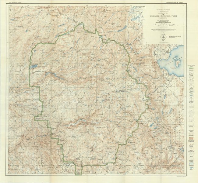
This attractive topographical map shows the entire park in great detail at a scale of 2 miles per inch. A legend at right identifies park limits (green), roads, trails, boundaries, contours, springs, marshes, glaciers, and more. The 7.5-mile long Yosemite Valley is located in the lower third of the image and locates Cathedral Rocks, Half Dome, Yosemite Falls, El Capitan, and more. Topography is finely rendered with contour intervals at 100 feet. This is 1929 edition, reprinted in 1932, with roads and trails added by the National Park Service in 1928.
References:
Condition: A
Issued folding on a clean sheet with a few short splits at the fold junctions.
Estimate: $150 - $180
Price: $100
Bid Increments
$50 - $99$5
$100 - $249$10
$250 - $499$25
$500 - $999$50
Terms & Conditions