Current Auction
"[On 4 Sheets] Potomac River (In Four Sheets)... ", U.S. Coast Survey


Subject: Potomac River & Washington, D.C.
Period: 1862-64 (dated)
Publication:
Color: Black & White
Size:
See Description
Download High Resolution Image
(or just click on image to launch the Zoom viewer)
(or just click on image to launch the Zoom viewer)
The Office of Coast Survey is the oldest U.S. scientific organization, dating from 1807 when Congress directed that a "survey of the coast" be carried out. By 1836, it was called the U.S. Coast Survey and in 1878, the name was changed to the U.S. Coast and Geodetic Survey. Today the Office of Coast Survey is a division of the National Oceanic and Atmospheric Administration NOAA.
The survey teams, composed of civilians as well as Army and Naval officers, charted the nation's waterways and produced a wide array of reports, survey charts, hydrographic studies of tides and currents, astronomical studies and observations, and coastal pilots. These charts are an important record of the changing nature of the nation's coastlines. In additional to coastal charts, the U.S. Coast and Geodetic Survey produced land sketches, Civil War battle maps, and the early aeronautical charts.
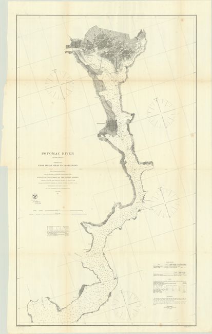
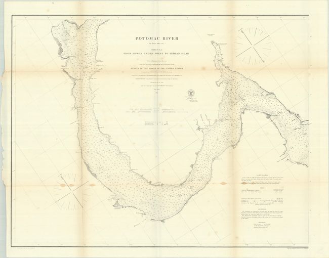
This is a complete set of 4 Civil War-era charts following the Potomac River from Washington, D.C. to its entrance into the Chesapeake Bay. The charts indicate soundings, tides, lighthouses, and the shoreline configuration. Of particular interest is sheet #4, which presents the street-grid pattern of Alexandria, Georgetown and Washington, and locates the White House, Capitol Building, Smithsonian, and Washington Monument.
A. Potomac River (In Four Sheets) Sheet No. 1 from Entrance to Piney Point... dated 1862 (29.4 x 23.3").
B. ... Sheet No. 2 from Piney Point to Lower Cedar Point... dated 1862 (30.1 x 23.2").
C. ... Sheet No. 3 from Lower Cedar Point to Indian Head... dated 1862 (29.5 x 22.9").
D. ... Sheet No. 4 from Indian Head to Georgetown... dated 1864 (22.8 x 39.1").
References:
Condition: B
Issued folding with light foxing. The third sheet has some small stains along the folds and the fourth sheet (D.C.) has two tiny splits at the fold junctions.
Estimate: $500 - $650
Price: $375
Bid Increments
$250 - $499$25
$500 - $999$50
$1,000 - $2,499$100
$2,500 - $4,999$250
Terms & Conditions