Filtered by Category:United States(Show All Categories)
Current Auction
186 lots
Page 1 of 4
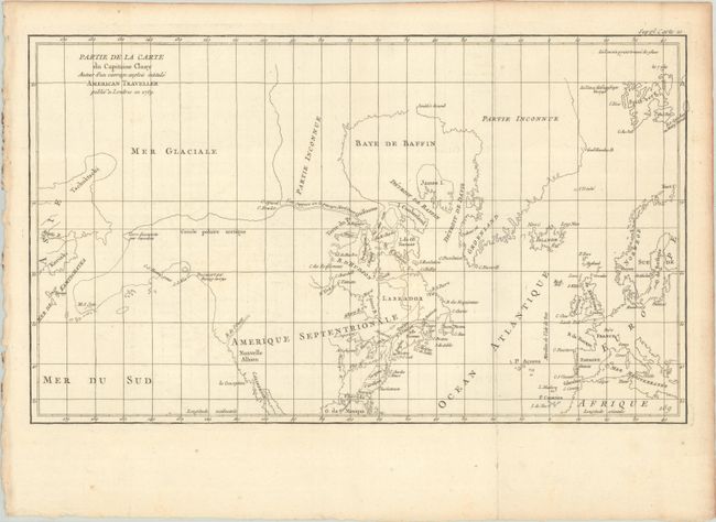
Lot 116
Subject: Colonial United States & Canada, Arctic
Robert de Vaugondy, Didier
Partie de la Carte du Capitaine Cluny Auteur d'un Ouvrage Anglois Intitule American Traveller, 1773
Size: 19.7 x 11.6 inches (50 x 29.5 cm)
Estimate: $95 - $120
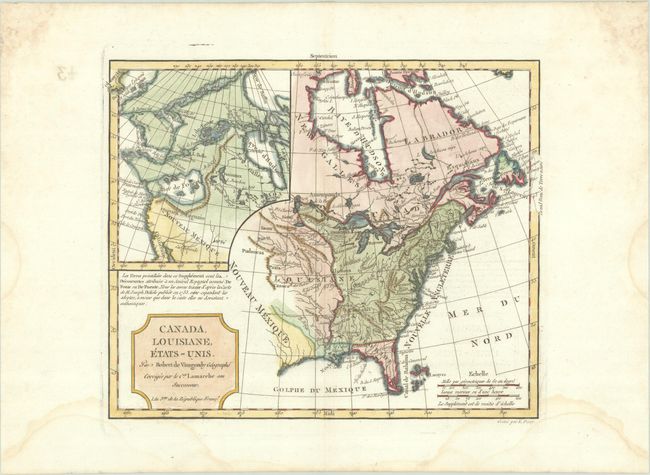
Lot 117
Subject: United States & Canada
Robert de Vaugondy/Delamarche
Canada, Louisiane, Etats-Unis, 1794
Size: 11.6 x 9.5 inches (29.5 x 24.1 cm)
Estimate: $220 - $250
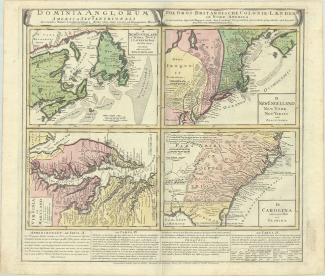
Lot 118
Subject: Colonial Eastern United States & Canada
Homann Heirs
Dominia Anglorum in America Septentrionali... / Die Gros-Britannische Colonie-Laender, in Nord-America..., 1740
Size: 21.9 x 19.8 inches (55.6 x 50.3 cm)
Estimate: $475 - $600
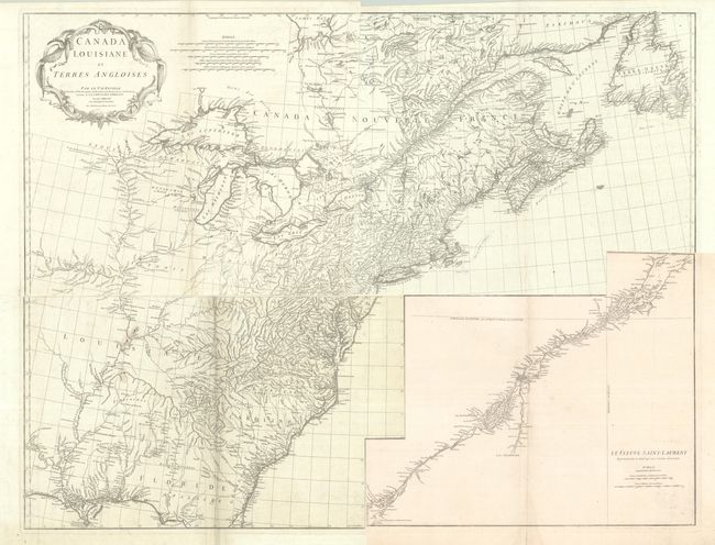
Lot 119
Subject: Colonial Eastern United States & Canada
Anville, Jean Baptiste Bourguignon d'
[On 4 Sheets] Canada Louisiane et Terres Angloises, 1755
Size: 21.9 x 18.8 inches (55.6 x 47.8 cm)
Estimate: $1,200 - $1,500
D'Anville's Spectacular Map of Eastern Seaboard
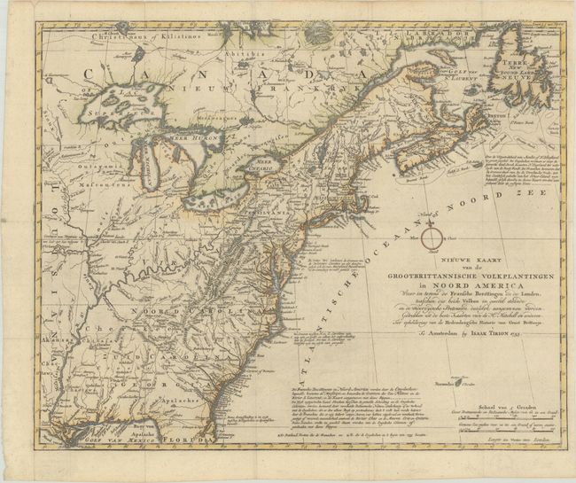
Lot 120
Subject: Colonial Eastern United States & Canada
Tirion, Isaac
Nieuwe Kaart van de Grootbrittannische Volkplantingen in Noord America waar in Tevens de Fransche Bezittingen en de Landen..., 1755
Size: 17.8 x 14.4 inches (45.2 x 36.6 cm)
Estimate: $600 - $750
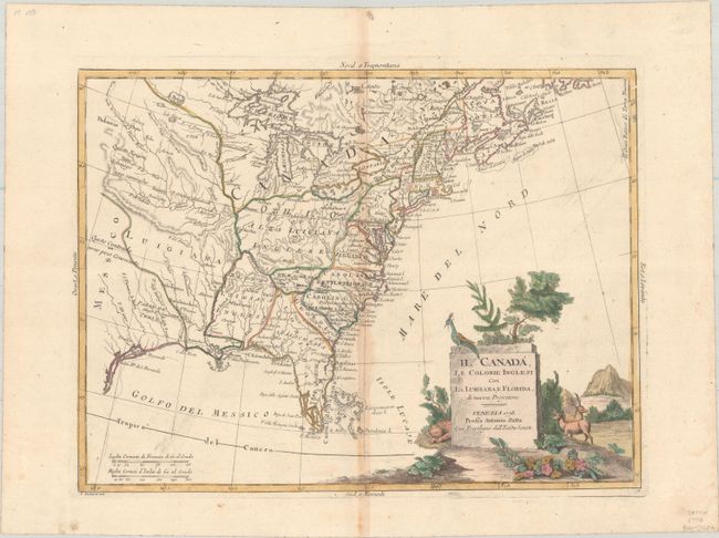
Lot 121
Subject: Colonial Eastern United States & Canada
Zatta, Antonio
Il Canada, le Colonie Inglesi con la Luigiana, e Florida di Nuova Projezione, 1778
Size: 15.9 x 11.9 inches (40.4 x 30.2 cm)
Estimate: $400 - $475
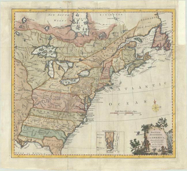
Lot 122
Subject: Colonial Eastern United States & Canada
Kitchin, Thomas
British Dominions in America, Drawn from the Latest and Best Authorities, 1780
Size: 14.9 x 13.5 inches (37.8 x 34.3 cm)
Estimate: $550 - $700
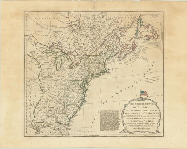
Lot 123
Subject: Eastern United States & Canada
Sayer, Robert
The United States of America with the British Possessions of Canada, Nova Scotia, New Brunswick and Newfoundland Divided with the French, Also the Spanish Territories of Louisiana and Florida..., 1790
Size: 20.3 x 18.2 inches (51.6 x 46.2 cm)
Estimate: $1,400 - $1,700
Celebrate 250 Years of Independence - This Map Features the Original Stars and Stripes
Lot 124
Subject: Colonial Northeastern United States & Canada
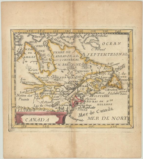
Duval, Pierre
Canada, 1682
Size: 4.8 x 3.9 inches (12.2 x 9.9 cm)
Estimate: $300 - $375
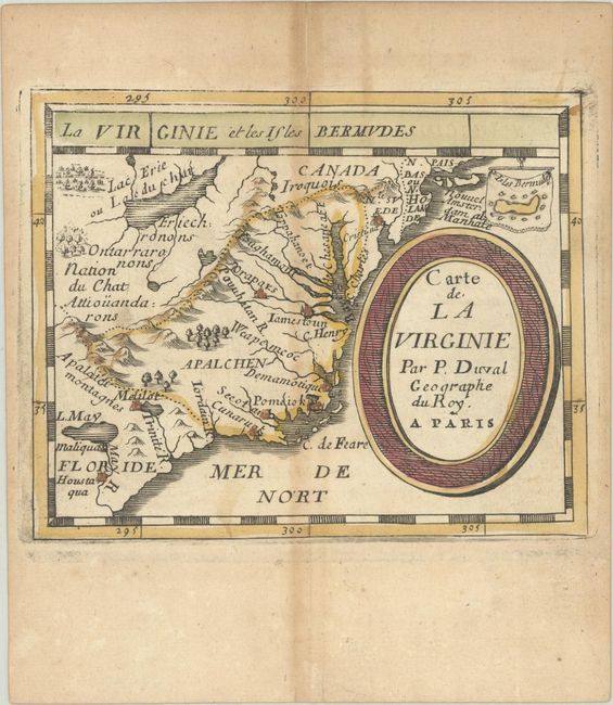
Lot 125
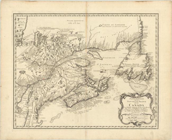
Subject: Colonial Northeastern United States & Canada
Bellin/Homann Heirs
Partie Orientale de la Nouvelle France ou du Canada..., 1755
Size: 21.3 x 17 inches (54.1 x 43.2 cm)
Estimate: $550 - $700
Lot 126
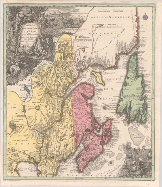
Subject: Colonial Northeastern United States & Canada
Seutter/Lotter
Partie Orientale de la Nouvelle France ou du Canada avec l'Isle de Terre-Neuve et de Nouvelle Escosse, Acadie et Nouv. Angleterre avec Fleuve de St. Laurence, 1756
Size: 19.4 x 22.6 inches (49.3 x 57.4 cm)
Estimate: $1,200 - $1,500
Lot 127
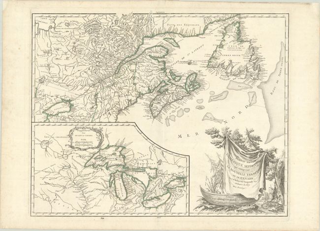
Subject: Colonial Northeastern United States & Canada, Great Lakes
Robert de Vaugondy, Didier
Partie de l'Amerique Septent? qui Comprend la Nouvelle France ou le Canada, 1778
Size: 23.8 x 19 inches (60.5 x 48.3 cm)
Estimate: $475 - $600
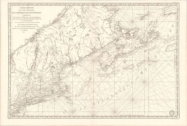
Lot 128
Subject: Colonial Northeastern United States & Canada
Sartine
Carte Reduite des Cotes Orientales de l'Amerique Septentrionale Contenant Celles des Provinces de New-York et de la Nouvelle Angleterre, Celles de l'Acadie ou Nouvelle Ecosse, de l'Ile Royale de l'Ile St. Jean..., 1780
Size: 34.3 x 23.1 inches (87.1 x 58.7 cm)
Estimate: $1,100 - $1,400
Revolutionary War-Era Sea Chart Covering New England & Eastern Canada
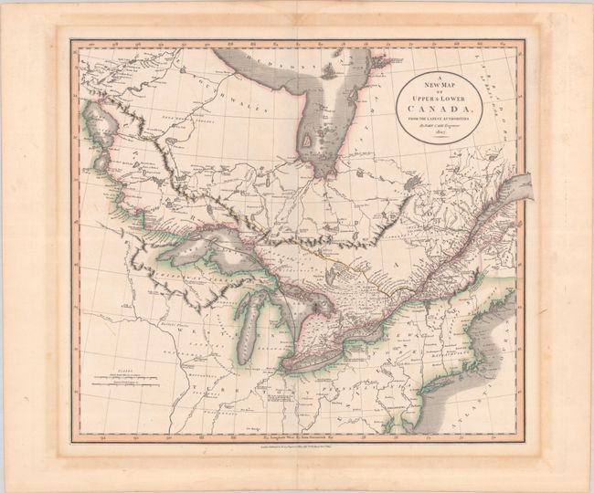
Lot 129
Subject: Northeastern United States & Canada
Cary, John
A New Map of Upper & Lower Canada, from the Latest Authorities, 1807
Size: 20.6 x 18.1 inches (52.3 x 46 cm)
Estimate: $475 - $600
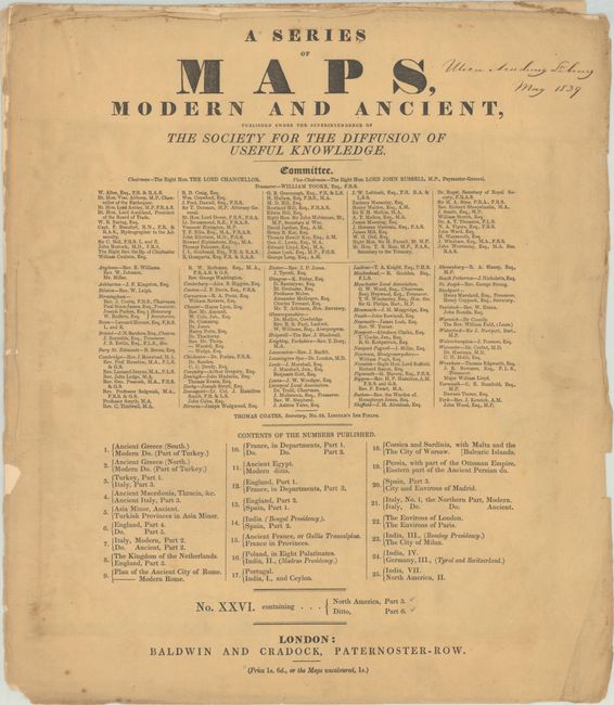
Lot 130
Subject: Northeastern United States & Canada
SDUK Society for the Diffusion of Useful Knowledge
[2 Maps] A Series of Maps, Modern and Ancient ... No. XXVI. Containing... North America, Part 3 - Ditto, Part 6, 1832
Size: 14.6 x 16.7 inches (37.1 x 42.4 cm)
Estimate: $180 - $220
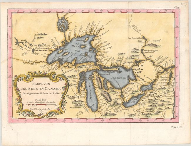
Lot 131
Subject: Colonial Great Lakes
Bellin, Jacques Nicolas
Karte von den Seen in Canada zur Allgemeinen Historie der Reisen, 1757
Size: 11.3 x 7.6 inches (28.7 x 19.3 cm)
Estimate: $400 - $475
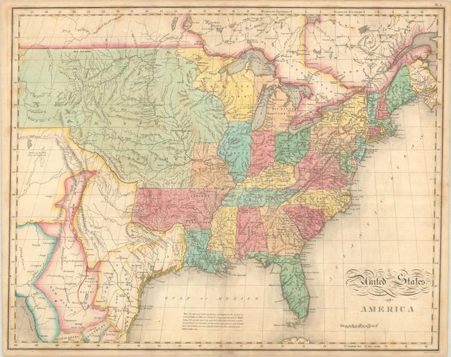
Lot 132
Subject: United States
Carey & Lea
United States of America, 1822
Size: 21.3 x 17 inches (54.1 x 43.2 cm)
Estimate: $600 - $750
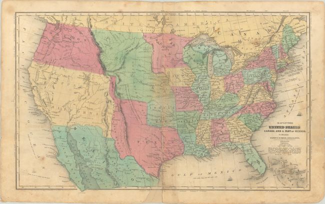
Lot 133
Subject: United States, Texas
Robinson, D.F. & Co.
Map of the United States Canada and a Part of Mexico. To Illustrate Olney's School Geography, 1849
Size: 17.5 x 10.8 inches (44.5 x 27.4 cm)
Estimate: $160 - $190
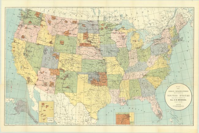
Lot 134
Subject: United States
U.S. Bureau of Indian Affairs
[Lot of 2] Map Showing Indian Reservations Within the Limits of the United States Compiled Under the Direction of the Hon. D.M. Browning... [and] ... Compiled Under the Direction of the Hon. F.E. Leupp..., 1893-1906
Size: 33.3 x 21 inches (84.6 x 53.3 cm)
Estimate: $200 - $250
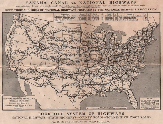
Lot 135
Subject: United States
Fifty Thousand Miles of National Highways Proposed by the National Highways Association [in] Along the Southern Highway, 1915
Size: 10 x 12.6 inches (25.4 x 32 cm)
Estimate: $50 - $70
NO RESERVE
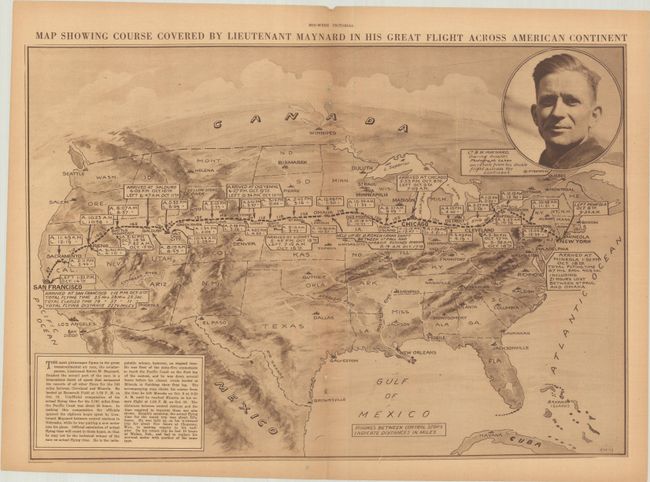
Lot 136
Subject: United States, Aviation
New York Times
[Map in Magazine] Map Showing Course Covered by Lieutenant Maynard in His Great Flight Across American Continent [in] Mid-Week Pictorial - Vol. X. No. 9. October 30, 1919, 1919
Size: 20.4 x 14.1 inches (51.8 x 35.8 cm)
Estimate: $275 - $350
Very Rare Map Commemorating the 1919 Transcontinental Aviation Race
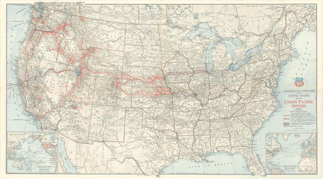
Lot 137
Subject: United States, Railroads
Railroad Companies, (Various)
Geographically Correct Map of the United States Issued by Union Pacific System, 1929
Size: 30.9 x 17.5 inches (78.5 x 44.5 cm)
Estimate: $50 - $70
NO RESERVE
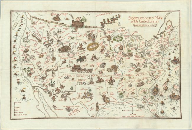
Lot 138
Subject: United States
Anon.
Bootlegger's Map of the United States, 1940
Size: 34 x 22 inches (86.4 x 55.9 cm)
Estimate: $475 - $600
Manuscript Copy on Cloth of the Famous Bootlegger's Map
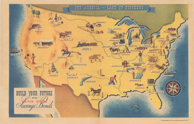
Lot 139
Subject: United States
Our America --- Land of Pioneers, 1946
Size: 20 x 12.6 inches (50.8 x 32 cm)
Estimate: $140 - $170
Unrecorded Pictorial "Poster" Map of the United States
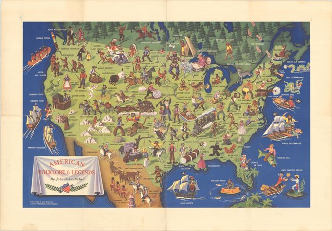
Lot 140
Subject: United States
American Folklore & Legends, 1950
Size: 31.1 x 20.1 inches (79 x 51.1 cm)
Estimate: $240 - $300
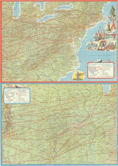
Lot 141
Subject: United States, Aviation
[Lot of 2] American Airlines System Map - America's Leading Airline [and] American Airlines System Map, 1953-61
Size: See Description
Estimate: $80 - $100
NO RESERVE
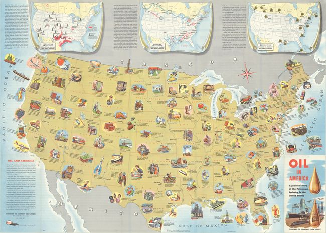
Lot 142
Subject: United States, Oil
Oil in America - A Pictorial Story of the Petroleum Industry in the United States, 1957
Size: 33.5 x 24.1 inches (85.1 x 61.2 cm)
Estimate: $150 - $180
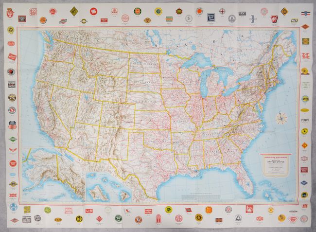
Lot 143
Subject: United States, Railroads
Rand McNally & Co.
American Railroads (Class I) - Map of the United States, 1959
Size: 47.8 x 30.4 inches (121.4 x 77.2 cm)
Estimate: $110 - $140
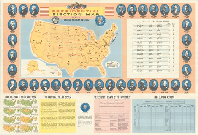
Lot 144
Subject: United States
Hammond, C. S.
Presidential Election Map Compliments of Disabled American Veterans, 1964
Size: 37 x 25 inches (94 x 63.5 cm)
Estimate: $110 - $140
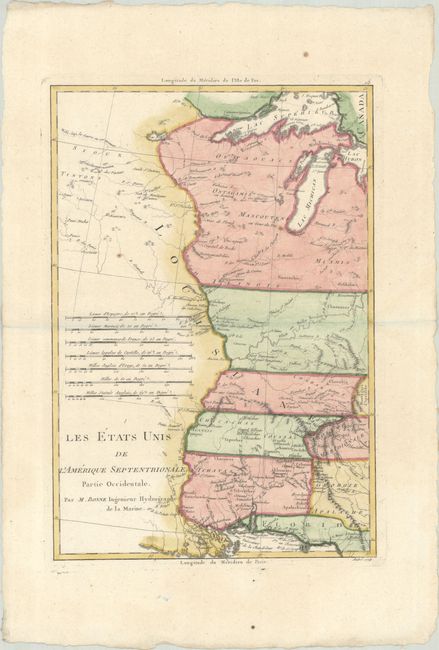
Lot 145
Subject: Eastern United States
Bonne, Rigobert
[Lot of 2] Les Etats Unis de l'Amerique Septentrionale, Partie Occidentale [and] ... Partie Orientale, 1787
Size: 9.3 x 13.6 inches (23.6 x 34.5 cm)
Estimate: $350 - $425
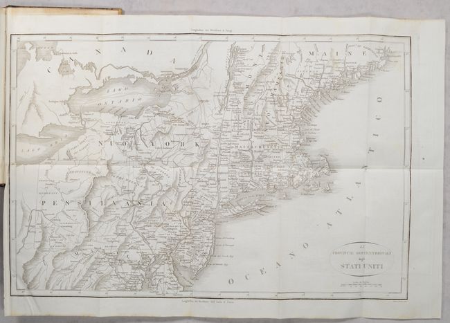
Lot 146
Subject: Eastern United States, Revolutionary War
Botta, Carlo
[2 Maps in 3 Volumes] Le Provincie Meridionali degli Stati Uniti [and] Le Provincie Settentrionali degli Stati Uniti [in] Storia della Guerra della Independenza degli Stati Uniti di America Volume Primo [and] Volume Secondo [and] Volume Terzo, 1820
Size: 5.5 x 8.5 inches (14 x 21.6 cm)
Estimate: $300 - $400
"The Most Valuable History of the Revolution Up to its Date" - Howes
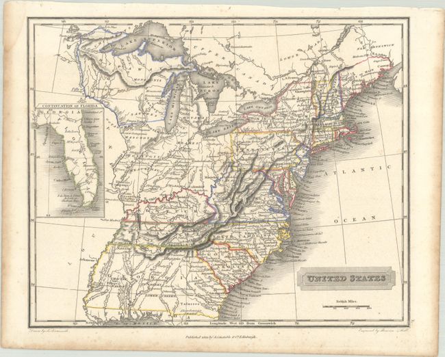
Lot 147
Subject: Eastern United States
Arrowsmith, Aaron, Jr.
United States, 1823
Size: 10 x 8.1 inches (25.4 x 20.6 cm)
Estimate: $200 - $230
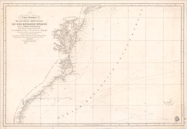
Lot 148
Subject: Eastern United States
Direccion de Hidrografia
Carta Esferica de las Costas Orientales de los Estados Unidos en la America Setentrional Desde el Rio de San Juan Hasta Nueva York..., 1826
Size: 35.4 x 24.1 inches (89.9 x 61.2 cm)
Estimate: $475 - $600
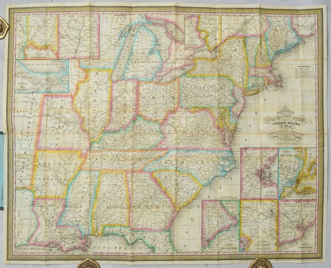
Lot 149
Subject: Eastern United States
Mitchell/Young
Mitchell's Travellers Guide Through the United States. A Map of the Roads, Distances, Steam Boat & Canal Routes &c., 1834
Size: 21.8 x 17.4 inches (55.4 x 44.2 cm)
Estimate: $550 - $700
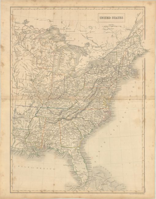
Lot 150
Subject: Eastern United States, Iowa
Black, Adam & Charles
United States, 1840
Size: 15 x 20 inches (38.1 x 50.8 cm)
Estimate: $100 - $130
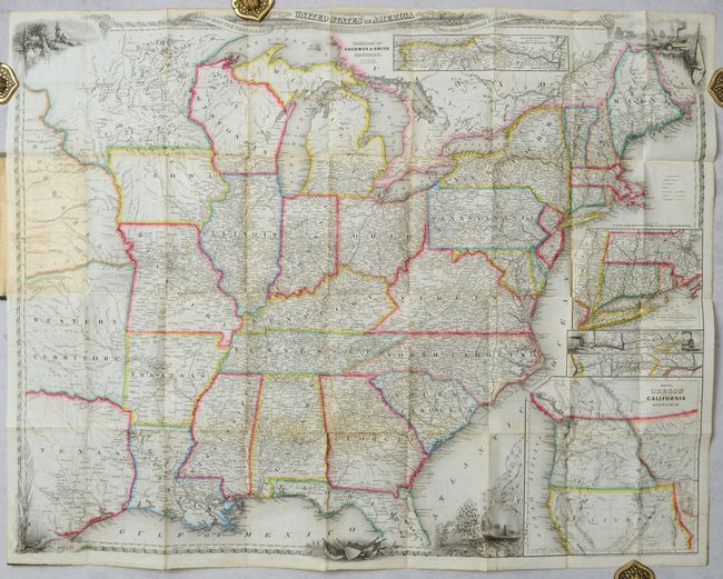
Lot 151
Subject: Eastern United States
Smith, J. Calvin
A New Map for Travelers Through the United States of America Showing the Railroads, Canals & Stage Roads [in] A New Guide for Travelers Through the United States of America..., 1850
Size: 27 x 21.1 inches (68.6 x 53.6 cm)
Estimate: $700 - $850
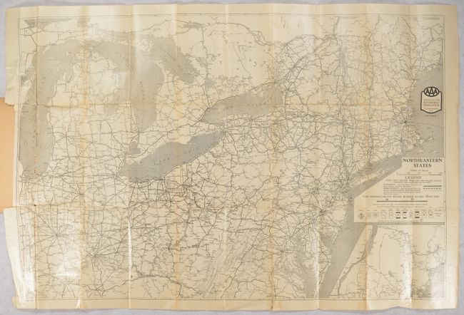
Lot 152
Subject: Northeastern United States
American Automobile Assoc.
[Map in Book] Northeastern States [in] AAA Official Tour Book and Map of Northeastern States..., 1926
Size: 35.4 x 23.4 inches (89.9 x 59.4 cm)
Estimate: $140 - $170
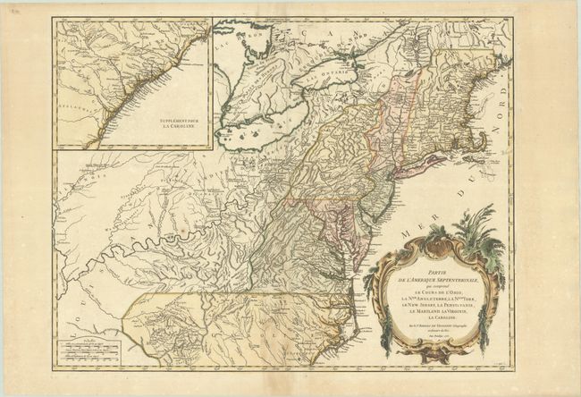
Lot 153
Subject: Colonial New England & Mid-Atlantic United States
Robert de Vaugondy, Didier
Partie de l'Amerique Septentrionale, qui Comprend le Cours de l'Ohio, la Nlle. Angleterre, la Nlle York, le New Jersey, la Pensylvanie, le Maryland le Virginie, la Caroline, 1755
Size: 24.5 x 18.8 inches (62.2 x 47.8 cm)
Estimate: $550 - $700
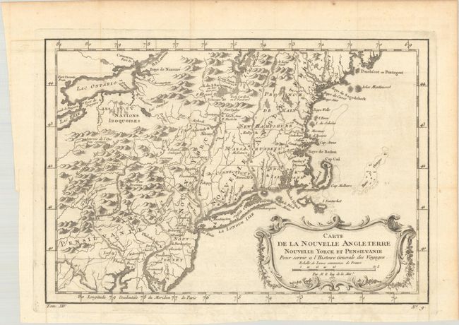
Lot 154
Subject: Colonial New England & Mid-Atlantic United States
Bellin, Jacques Nicolas
Carte de la Nouvelle Angleterre Nouvelle Yorck et Pensilvanie pour Servir a l'Histoire Generale des Voyages, 1757
Size: 11.8 x 8.1 inches (30 x 20.6 cm)
Estimate: $160 - $190
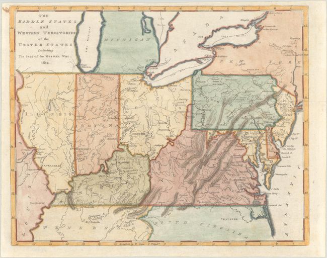
Lot 155
Subject: Mid-Atlantic & Central United States
Carey, Mathew
The Middle States and Western Territories of the United States Including the Seat of the Western War, 1812
Size: 9.6 x 7.8 inches (24.4 x 19.8 cm)
Estimate: $240 - $300
Lot 156
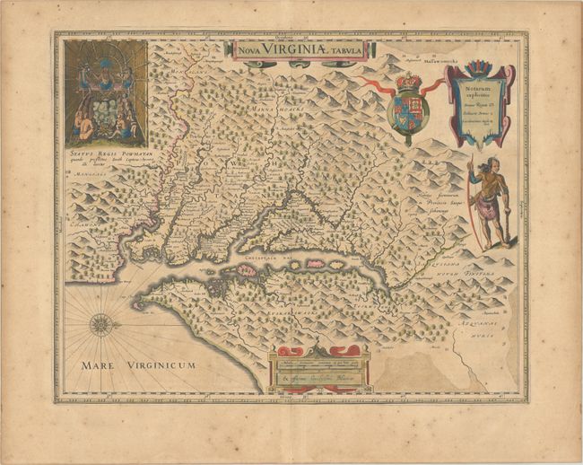
Subject: Colonial Mid-Atlantic United States
Hondius/Blaeu
Nova Virginiae Tabula, 1640
Size: 18.8 x 14.8 inches (47.8 x 37.6 cm)
Estimate: $1,600 - $1,900
One of the Most Important 17th Century Maps of the Chesapeake Bay
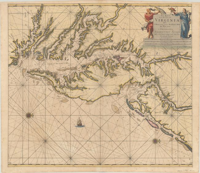
Lot 157
Subject: Colonial Mid-Atlantic United States, Chesapeake & Delaware Bays
Keulen, Johannes van
Pas Kaart van de Zee Kusten van Virginia Tusschen C Henry en t Hooge Land van Renselaars Hoek, 1695
Size: 22.6 x 20 inches (57.4 x 50.8 cm)
Estimate: $4,500 - $5,500
One of the Earliest Maps to Show Philadelphia
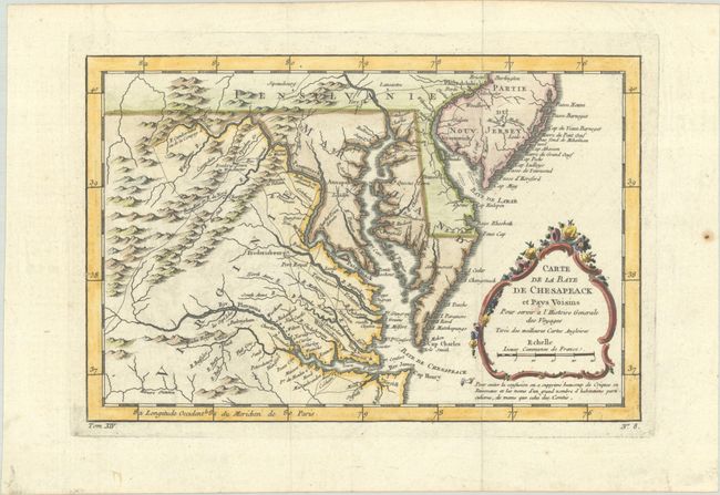
Lot 158
Subject: Colonial Mid-Atlantic United States
Bellin, Jacques Nicolas
Carte de la Baye de Chesapeack et Pays Voisins pour Servir a l'Histoire Generale des Voyages, 1757
Size: 11.4 x 7.6 inches (29 x 19.3 cm)
Estimate: $275 - $350
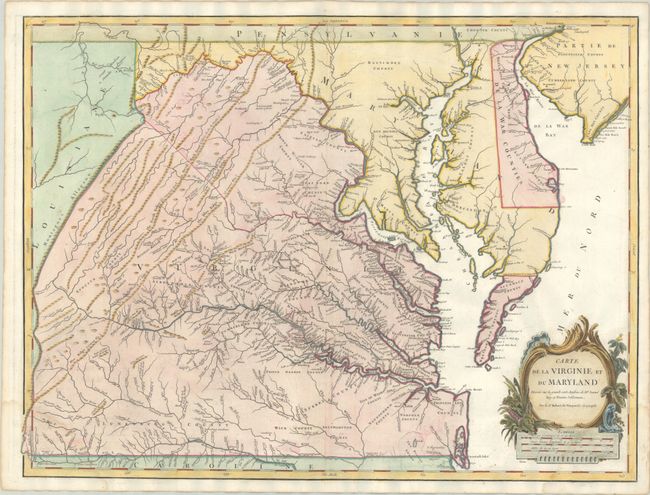
Lot 159
Subject: Mid-Atlantic United States
Robert de Vaugondy, Didier
Carte de la Virginie et du Maryland Dressee sur la Grande Carte Angloise de Mrs. Josue Fry et Pierre Jefferson, 1793
Size: 25.1 x 19 inches (63.8 x 48.3 cm)
Estimate: $1,400 - $1,700
An Essential Map of Virginia and Maryland
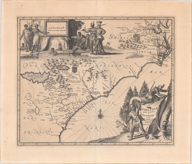
Lot 160
Subject: Colonial Southeastern United States
Montanus/Ogilby
Virginiae Partis Australis, et Floridae Partis Orientalis, Interjacentiumq Regionum Nova Descriptio, 1671
Size: 13.8 x 11.4 inches (35.1 x 29 cm)
Estimate: $700 - $850
Lot 161
Subject: Colonial Southeastern United States
Duval, Pierre
Carte de la Virginie, 1682
Size: 4.9 x 3.9 inches (12.4 x 9.9 cm)
Estimate: $550 - $700
Lot 162
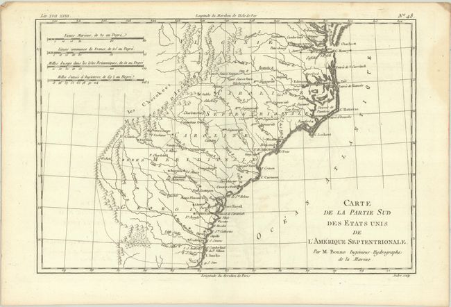
Subject: Colonial Southeastern United States
Bonne, Rigobert
Carte de la Partie Sud des Etats Unis de l'Amerique Septentrionale, 1780
Size: 12.6 x 8.5 inches (32 x 21.6 cm)
Estimate: $100 - $130
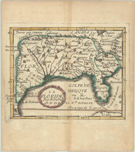
Lot 163
Subject: Colonial Southern United States
Duval, Pierre
La Floride, 1682
Size: 4.9 x 3.8 inches (12.4 x 9.7 cm)
Estimate: $350 - $425
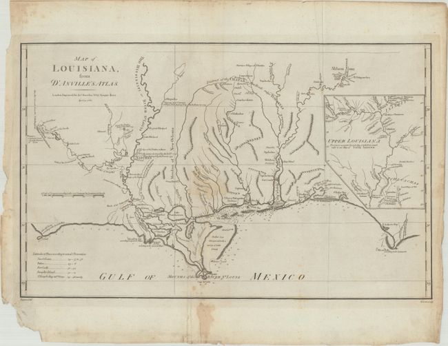
Lot 164
Subject: Gulf Coast
Harrison, John
Map of Louisiana, from d'Anville's Atlas, 1788
Size: 19.4 x 12.1 inches (49.3 x 30.7 cm)
Estimate: $700 - $850
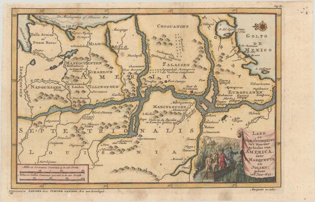
Lot 165
Subject: Central United States, Mississippi River
Aa, Pieter van der
Land en Volk-Ontdekking in't Noorder Gedeelte van America, door P. Marquette en Joliet; Gedaan in't Jaar 1673, 1707
Size: 9 x 6 inches (22.9 x 15.2 cm)
Estimate: $700 - $850
186 lots
Page 1 of 4