Catalog Archive
Auction 209, Lot 138
Manuscript Copy on Cloth of the Famous Bootlegger's Map
"Bootlegger's Map of the United States", Anon.
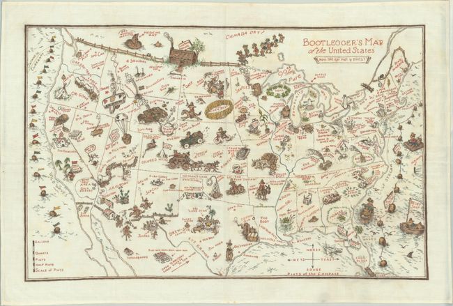
Subject: United States
Period: 1940 (circa)
Publication:
Color: Hand Color
Size:
34 x 22 inches
86.4 x 55.9 cm
Download High Resolution Image
(or just click on image to launch the Zoom viewer)
(or just click on image to launch the Zoom viewer)