Subject: United States, Aviation
Period: 1953-61 (circa)
Publication:
Color: Printed Color
This lot includes a pair of souvenir route maps from American Airlines:
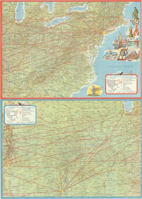
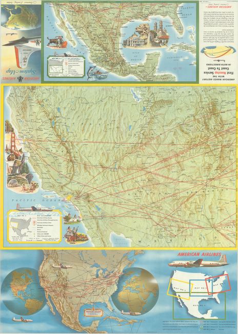
A. American Airlines System Map - America's Leading Airline, by General Drafting Co., circa 1953, printed color (24.0 x 33.5"). This brochure contains four large maps of American Airlines routes in the United States and Mexico. The recto presents routes along the east coast and central United States, while the verso covers the western United States and Mexico. Each features a legend showing routes, through service routes, cities served by American, mileages, railroads, rivers and more. Includes an additional index map on verso and numerous illustrations of airplanes and points of interest. Circa date is based upon text promoting the airline's first coast to coast service on their new DC-7 (which occurred on November 29, 1953). Condition: Clean, bright, and fine. (A+)
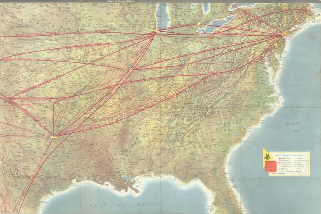
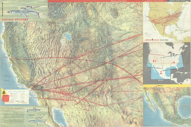
B. American Airlines System Map, by Rand McNally & Company, dated 1961 (36.0 x 24.0"). A similar production to the above with large maps of the Eastern and Western United States, a small map of Mexico, and two additional reference maps. American's routes are shown in thick red overprinted lines on top of a map with well-rendered topography. The brochure highlights the Boeing 707 and Lockheed Electra, which represented the company's "giant stride into the Jet Age." In January 1959, American became the first airline to offer coast-to-coast jet service with the 707. Condition: Light soiling and a few tiny splits at the fold junctions. (B+)
References:
Condition:
Issued folding. See description for additional details.