Subject: Eastern United States
Period: 1850 (dated)
Publication:
Color: Hand Color
Size:
27 x 21.1 inches
68.6 x 53.6 cm
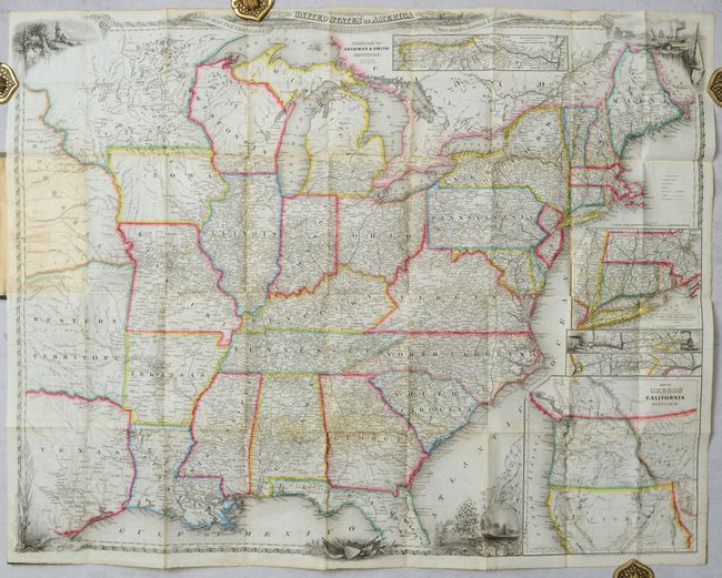
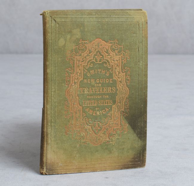
J. Calvin Smith produced some of the best travel guides and maps of the mid-nineteenth century, containing extensive information for travelers and emigrants during this period of great westward expansion. This map extends to the Great Plains including a large Nebraska Territory, Western Territory (Indian Territory) and eastern Texas, which is in its large stovepipe configuration (see inset). Minnesota Territory is oversized and includes the eastern half of the Dakotas. The emphasis is on the transportation network, the routes of which are prominently displayed with the distances between points. There are several small insets showing important railroad routes, as well as a large inset, "Map of Oregon Northern California, Santa Fe &c," in which the region labeled Santa Fe is included in the Texas panhandle. The map is beautifully engraved with vignettes of Native Americans, a harbor, trains, Niagara Falls and a decorative border. Published by Sherman & Smith. The map is accompanied by 79 pages of text showing various routes by state and an index. Folds into green cloth boards (3.7 x 5.6") with gilt title on the front cover.
References:
Condition: B+
A crisp impression with a few faint spots and a hint of toning along the folds. Covers are stained and sunned and the bottom half of the spine is split.