Catalog Archive
Auction 209, Lot 137
NO RESERVE
"Geographically Correct Map of the United States Issued by Union Pacific System", Railroad Companies, (Various)
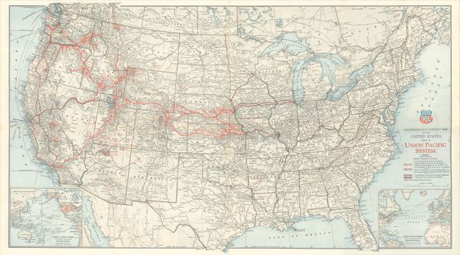
Subject: United States, Railroads
Period: 1929 (dated)
Publication:
Color: Printed Color
Size:
30.9 x 17.5 inches
78.5 x 44.5 cm
Download High Resolution Image
(or just click on image to launch the Zoom viewer)
(or just click on image to launch the Zoom viewer)