Subject: Colonial Mid-Atlantic United States
Period: 1757 (circa)
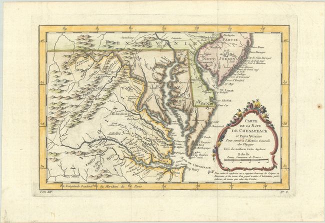
Publication: Histoire Generale des Voyages
Color: Hand Color
Size:
11.4 x 7.6 inches
29 x 19.3 cm
Finely engraved colonial map covering most of Virginia, Maryland, and Delaware, with a bit of Pennsylvania and New Jersey. The interior is fully engraved with mountains and good detail along the rivers. An early network of trails and wagon roads connects the communities along the seaboard and stretches as far west as Frederic Town ou Winchester, with one road continuing farther southwest. Fort Cumberland, Bukingham, and many frontier villages are located, along with the cities of Philadelphia, Annapolis, Fredericksburg, Williamsburg, and Norfolk. A delicate rococo-style title cartouche completes the composition.
References: cf. Sellers & Van Ee #1383; Tooley (MCC-96) #875.
Condition: A
A sharp impression, issued folding on watermarked paper with faint offsetting, a couple of spots of foxing in the title cartouche, and a small hole in the image at bottom center that has been professionally repaired, with a minute amount of the image replaced in facsimile. A paper flaw is in the right blank margin, far from the image.