Subject: Colonial Southern United States
Period: 1682 (published)
Publication: Le Monde ou la Geographie Universelle
Color: Hand Color
Size:
4.9 x 3.8 inches
12.4 x 9.7 cm
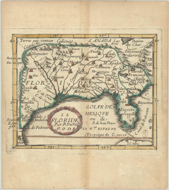
While the composition of this map is based on Sanson's famous map of 1657, Duval has given prominence to the Rio del Spiritu Sto over the other rivers flowing into the Gulf of Mexico. La Caroline is named on the R. de May, and the French claim to the region is shown as Floride Francoise. This is the third state, with Charlesford renamed Charlesfort. Pierre Duval was Nicolas Sanson's nephew and pupil. He published a wide range of atlases and individual maps including a fine miniature world geography with many of the maps based on Sanson.
References: Burden #352; cf. Cumming (SE) #86; King (3rd ed) #1660; Pastoureau, Duval XI Fa.
Condition: B+
A nice impression with original outline color in the map and later color in the cartouche, on a watermarked sheet with light toning along the centerfold and edges of the sheet.