Subject: Colonial Eastern United States & Canada
Period: 1780 (circa)
Publication: Guthrie's A New System of Modern Geography...
Color: Hand Color
Size:
14.9 x 13.5 inches
37.8 x 34.3 cm
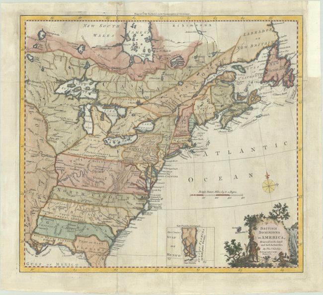
This handsome colonial period map covers the area east of the Mississippi River and from James Bay to the Gulf of Mexico. It shows the provinces and colonies, towns and cities, Indian villages and tribal territory, forts, and other points of interest. The British Colonies extend to the Mississippi River and include the Canadian Province of Quebec, Nova Scotia, Labrador and Newfoundland; thus relegating the French colonies to the frontier. Florida is divided into two provinces with the northern boundary of East Florida extending north of the 31° parallel, reflecting a long boundary dispute between Britain and Spain. The southern tip of Florida is presented as a group of large islands and is shown in an inset.
References: McCorkle #780.6; Goss (NA) #64.
Condition: B+
A dark impression, issued folding on a sheet with the watermarks of a horn coat of arms with the initials "GR" and "TC." There is light printer's ink residue, a vertical printer's crease, and archival repairs to a short fold separation at top and to a binding tear at right that just enters the map border. A binding trim at right has been replaced with old paper.