Subject: United States, Texas
Period: 1849 (circa)
Publication: Olney's School Atlas
Color: Hand Color
Size:
17.5 x 10.8 inches
44.5 x 27.4 cm
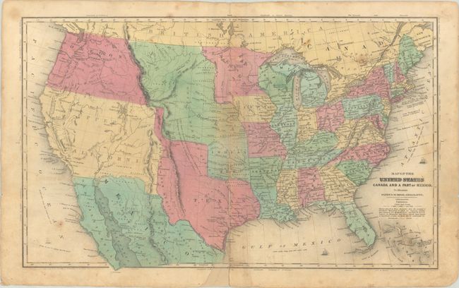
This map presents the new state of Texas in its large stovepipe configuration, extending north beyond Long's Peak to the 42nd parallel. To its west is a vast Upper California, which the U.S. acquired following the conclusion of the Mexican-American War in 1848. New Mexico is noted between Texas and California, but is not delineated. A huge Nebraska Territory occupies the northern plains with Indian Territory to its south. A large Oregon Territory incorporating present-day Washington extends to the Continental Divide. The map has terrific territorial configurations and is filled with information on forts, Indian tribes, waterways and more. Copyright date of 1844. Drawn and engraved by Sherman & Smith, N.Y.
References:
Condition: B
Contemporary color with a few archivally repaired centerfold separations and a 0.5" x 0.5" chip at the bottom of the centerfold that has been replaced in facsimile. There is soiling and minor foxing.