Subject: Colonial Northeastern United States & Canada
Period: 1755 (dated)
Publication:
Color: Black & White
Size:
21.3 x 17 inches
54.1 x 43.2 cm
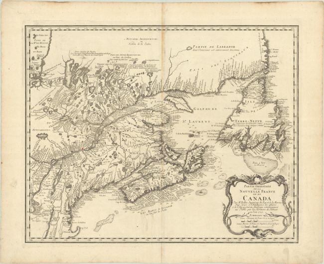
This is Bellin's definitive map of eastern Canada and New England showing the mouth of the St. Lawrence, the length of the river, the Maritime provinces and French claims in the region. There are some very interesting details of the coastal towns, showing Havre de Baston for Boston Harbor, up the coast to Portsmouth in New Hampshire, Wells, York and Cape Elizabeth in Maine. There is considerable information shown on the extent of French exploration in the region. A large decorative cartouche incorporates two distance scales. This example is from the second plate with the imprint "A Paris chez R.J. Julien a l'Hotel…" removed, the date changed and various geographical improvements. Blank verso. This large format Bellin map was published in several atlases by Homann.
References: Kershaw #690; cf. McCorkle #745.1, Sellers and Van Ee #273.
Condition: B+
A crisp impression with light toning along the centerfold, a pair of tiny wormtracks along the upper centerfold, and a bit of soiling.