Subject: United States
Period: 1822 (published)
Publication: A Complete Historical, Chronological, and Geographical American Atlas...
Color: Hand Color
Size:
21.3 x 17 inches
54.1 x 43.2 cm
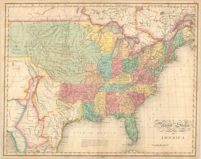
A great map by the important American cartographer John Melish that extends west to longitude 109° (the boundary line between present-day Colorado and Utah). It provides a detailed view of the Missouri River and the headwaters of the Columbia River, based on information from Lewis and Clark's expedition. The river system around Highest Peak is also well developed, where the headwaters of several major rivers all originate near one another, including Red River of California (Colorado), Multnomah (Willamette), Rio del Norte (Rio Grande), Arkansaw (Arkansas), and the Platte. In terms of political boundaries, the new state of Missouri is shown with a straight western border. Michigan Territory includes the eastern part of present-day Wisconsin, which is still a part of the North West Territory. The large Arkansas Territory takes in most of present-day Oklahoma. Texas is separately delineated within Mexico and locates San Antonio, Galvezton, and Fort Matagorda (no indication of Austin's Colony yet). Engraved by Benjamin Tanner.
References: Phillips (Atlases) #1373a-5.
Condition: B+
There is light scattered foxing and two tiny edge tears confined to the left blank margin that have been archivally repaired on verso.