Current Auction
Lot 154
Current Auction

"Carte de la Nouvelle Angleterre Nouvelle Yorck et Pensilvanie pour Servir a l'Histoire Generale des Voyages", Bellin, Jacques Nicolas

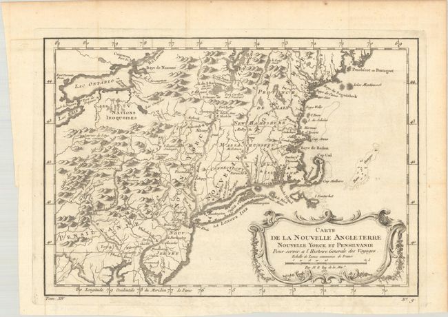
Subject: Colonial New England & Mid-Atlantic United States

Period: 1757 (dated)

Publication: Prevost's Histoire Generale des Voyages

Color: Black & White

Size:
11.8 x 8.1 inches
30 x 20.6 cm
Download High Resolution Image
(or just click on image to launch the Zoom viewer)

This French & Indian War period map details the English colonies from Pennsylvania through Penobscot Bay in Maine, with their early boundaries. It is fully engraved with topographical features and includes many early place names. The colonies are shown confined east of the Allegheny Mountains with the Nations Iroquoises, Indian villages, and several French forts located west of the mountains. It extends to show Lake Ontario and most of Lake Erie. A flourishing French rococo-style cartouche with distance scale decorates the map.

See also lot 723 for Barbara McCorkle's New England in Early Printed Maps 1513 to 1800 that lists this map.

References: McCorkle #757.1; Sellers & Van Ee #721.

Condition: A

Issued folding with a hint of offsetting.

Estimate: $160 - $190

Current High Bid:
$0

Reserve: Reserve Not Met
Next Bid: $80

Bid Increments
$50 - $99$5
$100 - $249$10
$250 - $499$25
$500 - $999$50
Terms & Conditions