Showing Unsold Lots $100 to $250(remove filter)
Current Auction
158 lots
Page 1 of 4
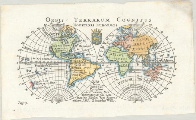
Lot 19
Subject: World
Wells, Edward
Orbis Terrarum Cognitus Hodiernis Europaeis, 1726
Size: 6.4 x 3.5 inches (16.3 x 8.9 cm)
Estimate: $240 - $300
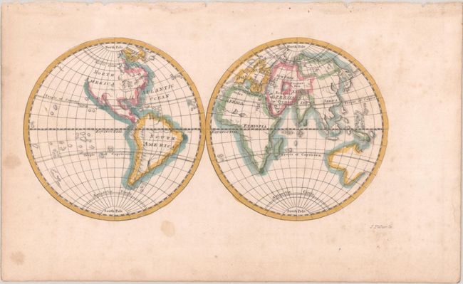
Lot 22
Subject: World
Fisher, Joshua
[Untitled - World], 1765
Size: 5.5 x 2.8 inches (14 x 7.1 cm)
Estimate: $120 - $150
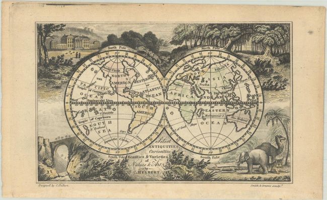
Lot 30
Subject: World
Select Antiquities, Curiosities, Beauties & Varieties of Nature & Art, 1822
Size: 4.8 x 3 inches (12.2 x 7.6 cm)
Estimate: $120 - $150
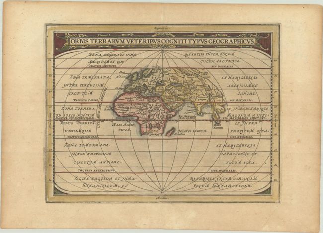
Lot 45
Subject: Ancient World
Cluver/Jansson
Orbis Terrarum Veteribus Cogniti Typus Geographicus, 1676
Size: 8.1 x 6.3 inches (20.6 x 16 cm)
Estimate: $160 - $190
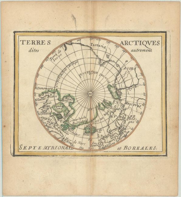
Lot 47
Subject: North Pole
Duval, Pierre
Terres Arctiques Dites Autrement Septemtrionales et Boreales, 1682
Size: 4.9 x 3.9 inches (12.4 x 9.9 cm)
Estimate: $180 - $210
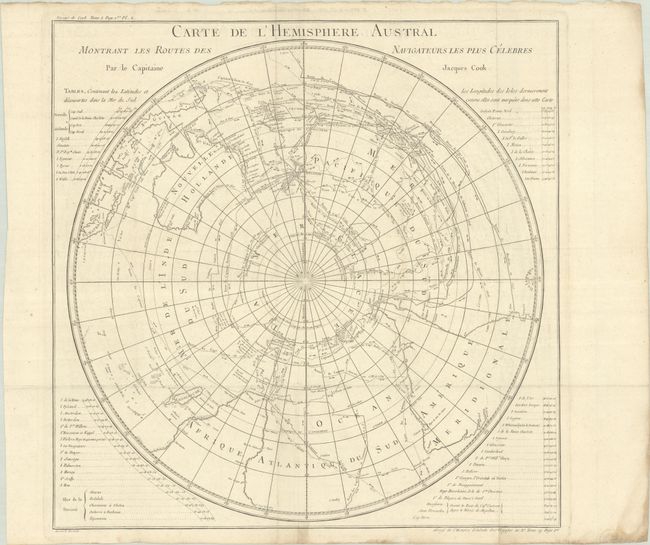
Lot 50
Subject: South Pole
Cook/Benard
Carte de l'Hemisphere Austral Montrant les Routes des Navigateurs Plus Celebres par le Capitaine Jacques Cook, 1774
Size: 21.2 x 21.1 inches (53.8 x 53.6 cm)
Estimate: $275 - $350
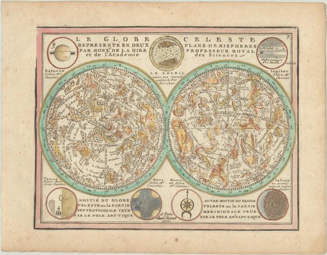
Lot 51
Subject: Celestial
Chiquet, Jacques
Le Globe Celeste Represente en Deux Plans-Hemispheres par Monsr. de la Hire Professeur Royal et de l'Academie des Sciences, 1719
Size: 8.6 x 6.6 inches (21.8 x 16.8 cm)
Estimate: $275 - $350
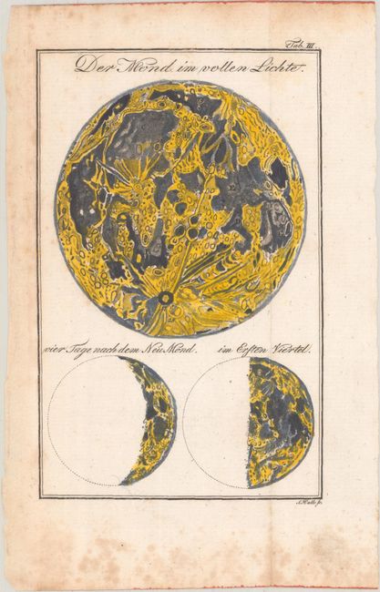
Lot 60
Subject: Moon
Bode, Johann Elert
Der Mond im Vollen Lichte, 1806
Size: 3.9 x 6.1 inches (9.9 x 15.5 cm)
Estimate: $140 - $170
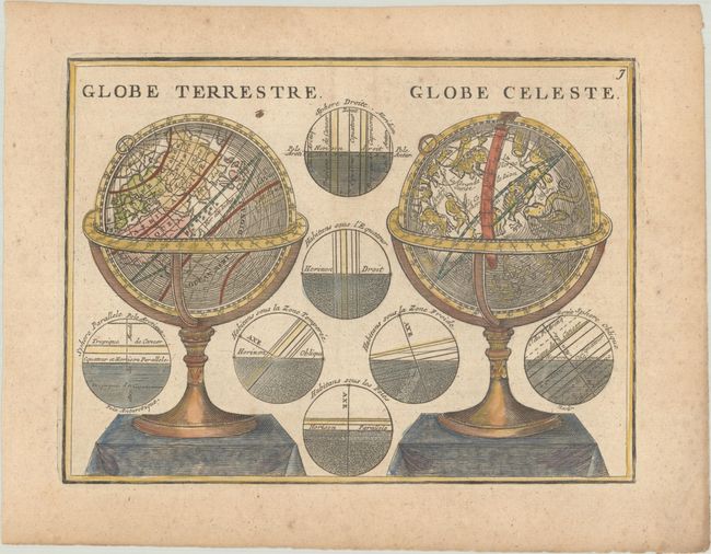
Lot 63
Subject: Cartographic Miscellany, Globes
Chiquet, Jacques
Globe Terrestre / Globe Celeste, 1719
Size: 8.6 x 6.4 inches (21.8 x 16.3 cm)
Estimate: $140 - $170
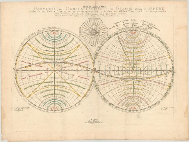
Lot 64
Subject: Cartographic Miscellany, World
Sanson, Nicolas
Harmonie ou Correspondance du Globe auecq la Sphere par les Points, Lignes, Cercles, &c..., 1699
Size: 21.3 x 14 inches (54.1 x 35.6 cm)
Estimate: $275 - $350
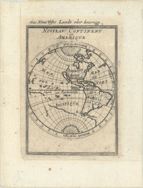
Lot 78
Subject: Western Hemisphere - America
Mallet, Alain Manesson
Nouveau Continent ou Amerique, 1685
Size: 4 x 5.5 inches (10.2 x 14 cm)
Estimate: $120 - $150
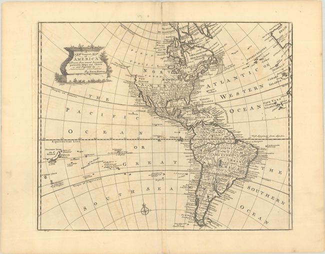
Lot 83
Subject: Western Hemisphere - America
Bowen, Emanuel
A New General Map of America, Drawn from Several Accurate Particular Maps and Charts, and Regulated by Astronomical Observations, 1747
Size: 17.1 x 14 inches (43.4 x 35.6 cm)
Estimate: $240 - $300
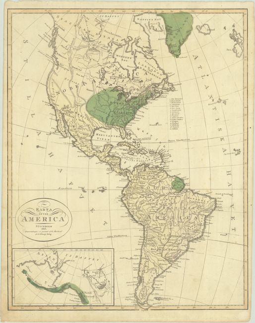
Lot 85
Subject: Western Hemisphere - America
Karta ofver America, 1818
Size: 13.7 x 17.2 inches (34.8 x 43.7 cm)
Estimate: $140 - $180
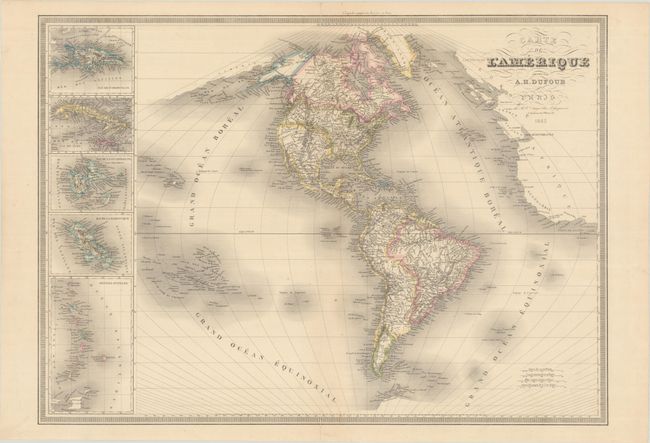
Lot 87
Subject: Western Hemisphere - America
Dufour, Auguste-Henri
Carte de l'Amerique, 1842
Size: 29.1 x 20.9 inches (73.9 x 53.1 cm)
Estimate: $200 - $230
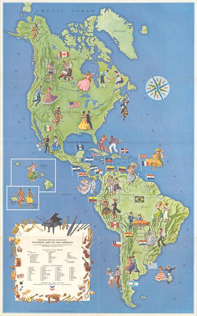
Lot 90
Subject: Western Hemisphere - America
Standard School Broadcast Pictorial Map of Pan-America, 1966
Size: 24.9 x 40.5 inches (63.2 x 102.9 cm)
Estimate: $180 - $220
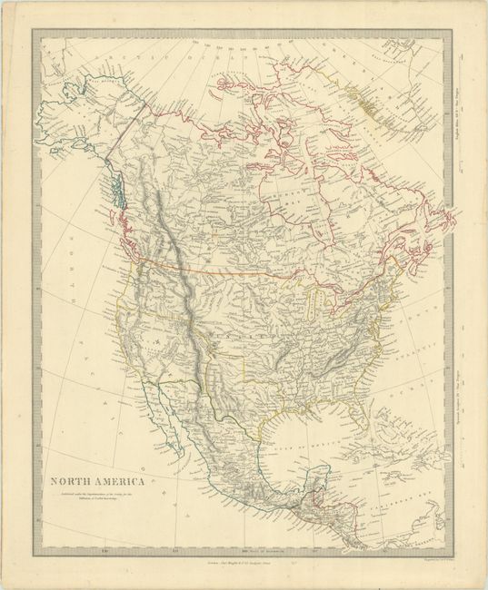
Lot 98
Subject: North America, Texas
SDUK Society for the Diffusion of Useful Knowledge
North America, 1845
Size: 12.4 x 15.3 inches (31.5 x 38.9 cm)
Estimate: $200 - $230
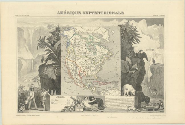
Lot 100
Subject: North America, Texas
Levasseur, Victor
Amerique Septentrionale, 1851
Size: 17.2 x 11.3 inches (43.7 x 28.7 cm)
Estimate: $140 - $170
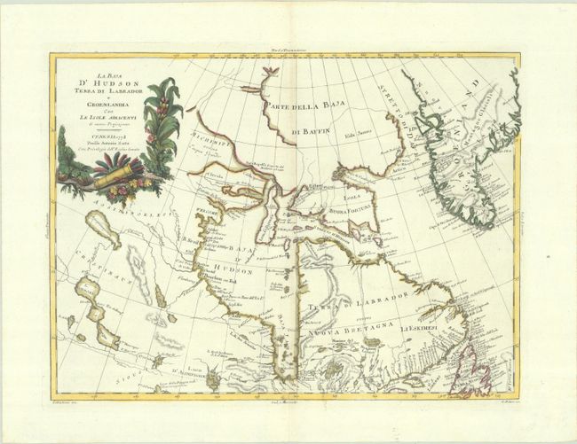
Lot 111
Subject: Eastern Canada & Greenland
Zatta, Antonio
La Baja d'Hudson Terra di Labrador e Groenlandia con le Isole Adiacenti di Nuova Projezione, 1778
Size: 16.1 x 11.8 inches (40.9 x 30 cm)
Estimate: $150 - $180
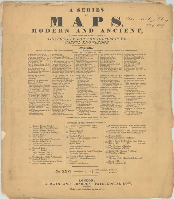
Lot 130
Subject: Northeastern United States & Canada
SDUK Society for the Diffusion of Useful Knowledge
[2 Maps] A Series of Maps, Modern and Ancient ... No. XXVI. Containing... North America, Part 3 - Ditto, Part 6, 1832
Size: 14.6 x 16.7 inches (37.1 x 42.4 cm)
Estimate: $180 - $220
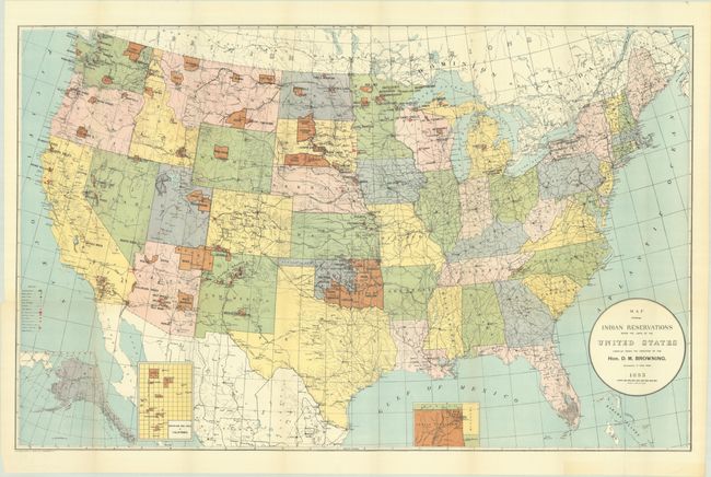
Lot 134
Subject: United States
U.S. Bureau of Indian Affairs
[Lot of 2] Map Showing Indian Reservations Within the Limits of the United States Compiled Under the Direction of the Hon. D.M. Browning... [and] ... Compiled Under the Direction of the Hon. F.E. Leupp..., 1893-1906
Size: 33.3 x 21 inches (84.6 x 53.3 cm)
Estimate: $200 - $250
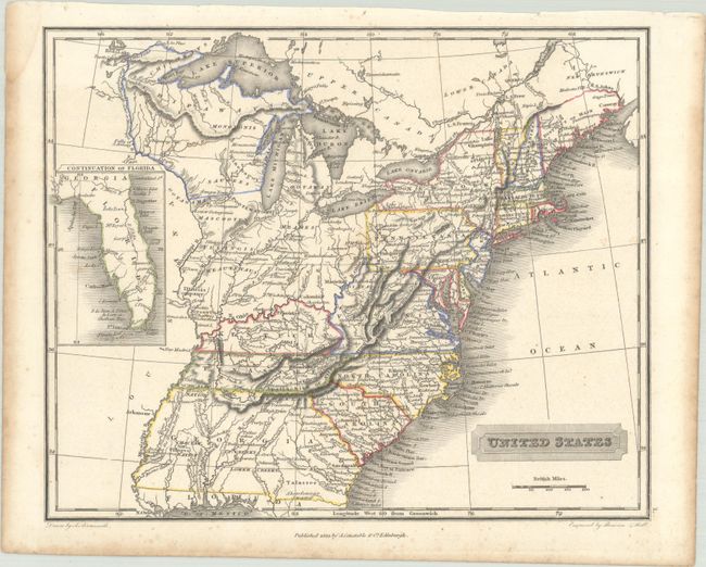
Lot 147
Subject: Eastern United States
Arrowsmith, Aaron, Jr.
United States, 1823
Size: 10 x 8.1 inches (25.4 x 20.6 cm)
Estimate: $200 - $230
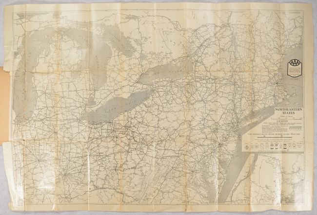
Lot 152
Subject: Northeastern United States
American Automobile Assoc.
[Map in Book] Northeastern States [in] AAA Official Tour Book and Map of Northeastern States..., 1926
Size: 35.4 x 23.4 inches (89.9 x 59.4 cm)
Estimate: $140 - $170
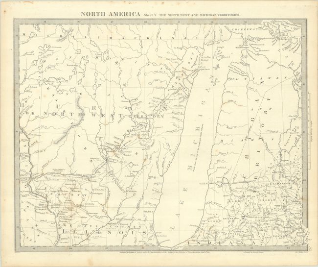
Lot 173
Subject: Upper Midwestern United States
SDUK Society for the Diffusion of Useful Knowledge
North America Sheet V The North West and Michigan Territories, 1833
Size: 15.3 x 11.9 inches (38.9 x 30.2 cm)
Estimate: $120 - $150
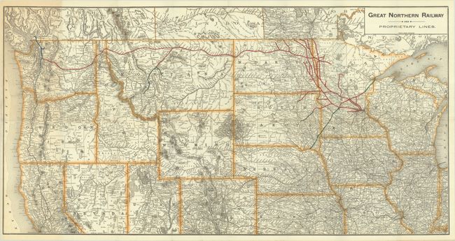
Lot 174
Subject: Northern United States, Railroads
Poole Bros.
[Map with Report] Great Northern Railway and Proprietary Lines [with] Eighth Annual Report of the Great Northern Railway Company, 1897
Size: 32.3 x 16.7 inches (82 x 42.4 cm)
Estimate: $180 - $220
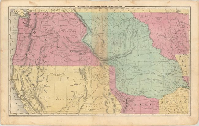
Lot 176
Subject: Western United States, Texas
Robinson, D.F. & Co.
Western Territories of the United States, 1849
Size: 17.5 x 10.6 inches (44.5 x 26.9 cm)
Estimate: $240 - $300
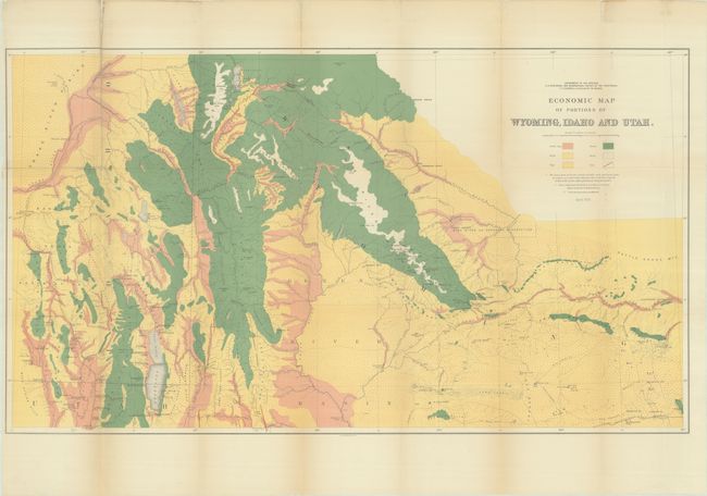
Lot 179
Subject: Western United States
Hayden, Ferdinand Vandeveer
[Lot of 3] Economic Map of Portions of Wyoming, Idaho and Utah [and] Part of Central Wyoming [and] Part of Central Wyoming, 1883
Size: See Description
Estimate: $200 - $230
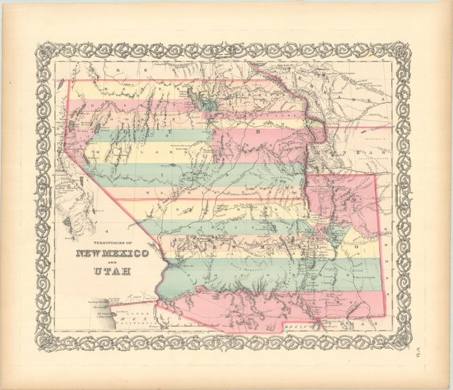
Lot 182
Subject: Southwestern United States
Colton, Joseph Hutchins
Territories of New Mexico and Utah, 1855
Size: 15.7 x 12.9 inches (39.9 x 32.8 cm)
Estimate: $220 - $250
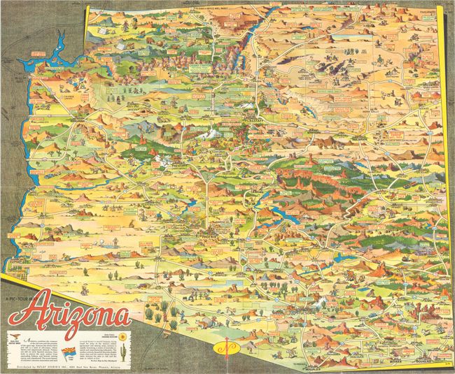
Lot 187
Subject: Arizona
[Lot of 2] A Pic-Tour Map of Arizona [and] Reg Manning's Cartoon Map of Arizona, 1938-50
Size: See Description
Estimate: $200 - $230
Lot 189
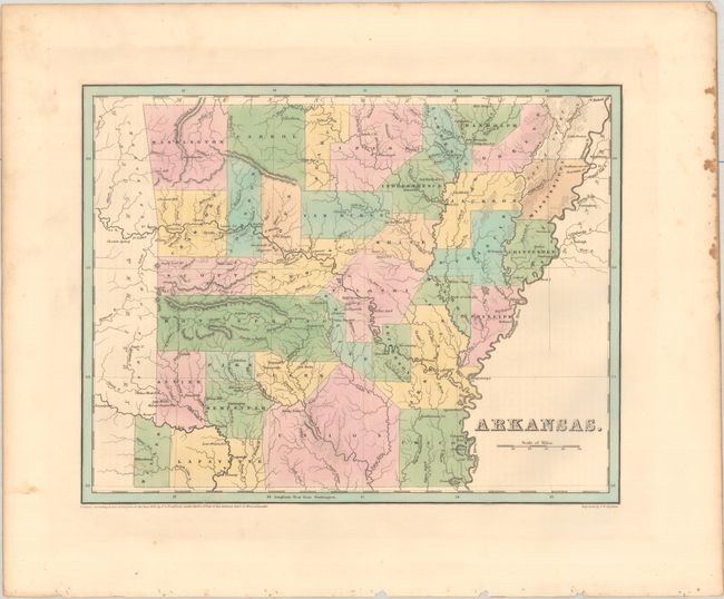
Subject: Arkansas, Texas
Bradford, Thomas Gamaliel
Arkansas, 1838
Size: 14.4 x 11.3 inches (36.6 x 28.7 cm)
Estimate: $180 - $220
Features Disputed Land with the Republic of Texas
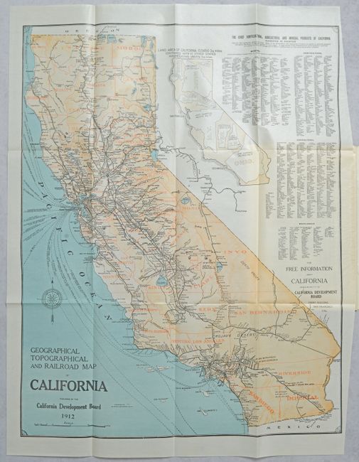
Lot 190
Subject: California
Britton & Rey
[Map in Report] Geographical Topographical and Railroad Map of California [in] California Resources and Possibilities - Twenty-Second Annual Report of the California Development Board..., 1912
Size: 19.8 x 25.3 inches (50.3 x 64.3 cm)
Estimate: $160 - $190
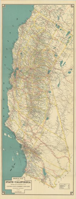
Lot 192
Subject: California
Highway Map of the State of California, 1925
Size: 15.4 x 40.5 inches (39.1 x 102.9 cm)
Estimate: $180 - $220
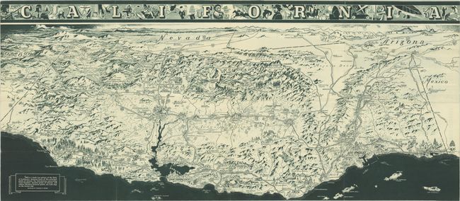
Lot 193
Subject: California
California Official Tourist Picture Map, 1936
Size: 38 x 16.6 inches (96.5 x 42.2 cm)
Estimate: $150 - $180
Depression-Era California Pictorial Map Welcoming Tourists but Not Settlers
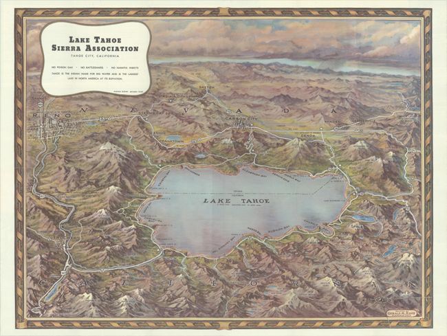
Lot 194
Subject: Lake Tahoe, California, Nevada
Eddy, Gerald
Lake Tahoe Sierra Association Tahoe City, California, 1945
Size: 22.4 x 17.3 inches (56.9 x 43.9 cm)
Estimate: $200 - $230
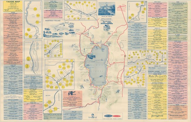
Lot 195
Subject: Lake Tahoe, California
Tahoe Map, 1961
Size: 33.9 x 21.9 inches (86.1 x 55.6 cm)
Estimate: $150 - $180
Unrecorded Map of Lake Tahoe Following the 1960 Olympics
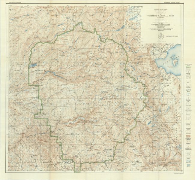
Lot 196
Subject: Yosemite, California
U.S. Geological Survey (USGS)
Topographic Map of Yosemite National Park California..., 1932
Size: 28.8 x 27.3 inches (73.2 x 69.3 cm)
Estimate: $150 - $180
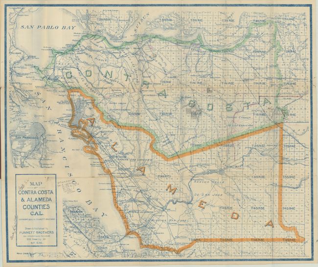
Lot 197
Subject: East Bay, California
Map of Contra Costa & Alameda Counties Cal., 1908
Size: 29 x 24.3 inches (73.7 x 61.7 cm)
Estimate: $140 - $170
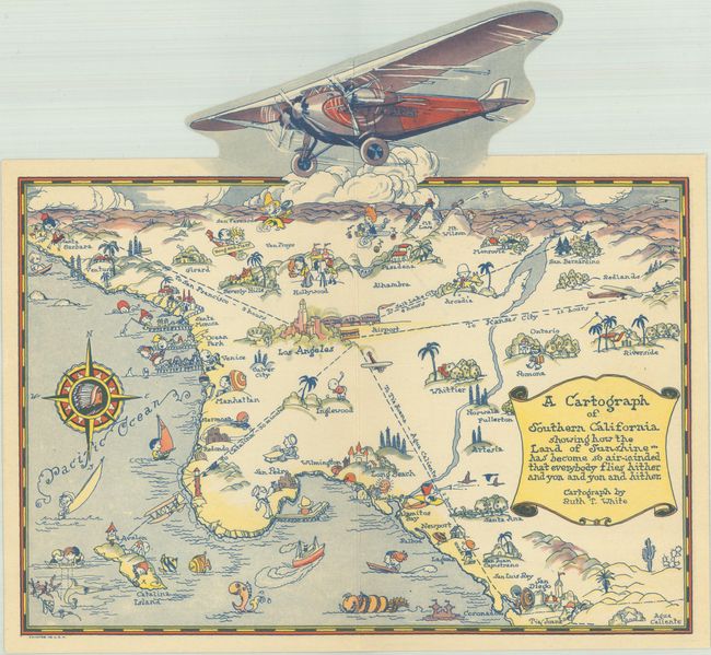
Lot 201
Subject: Southern California
White, Ruth Taylor
A Cartograph of Southern California Showing How the Land of Sunshine... Has Become So Air-Minded That Everybody Flies Hither and Yon and Yon and Hither, 1929
Size: 10.1 x 9.4 inches (25.7 x 23.9 cm)
Estimate: $275 - $350
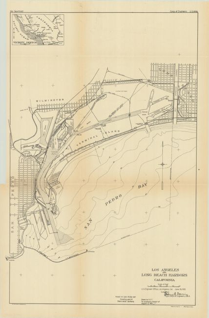
Lot 204
Subject: Los Angeles, California
U.S. Corps of Engineers
[Map with Report] Los Angeles and Long Beach Harbors California, 1921
Size: 12.9 x 19.7 inches (32.8 x 50 cm)
Estimate: $140 - $170
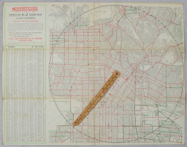
Lot 205
Subject: Los Angeles, California
Clason Map Company
Improved E-Z Guide Map of Los Angeles, 1927
Size: 16.6 x 12.8 inches (42.2 x 32.5 cm)
Estimate: $160 - $190
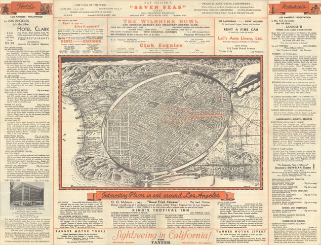
Lot 206
Subject: Los Angeles, California
Interesting Places In and Around Los Angeles [on verso] California Pacific International Exposition, 1935
Size: 23.9 x 18.3 inches (60.7 x 46.5 cm)
Estimate: $160 - $190

Lot 207
Subject: Los Angeles, California, Literary Map
The Literary Map of Los Angeles, 1987
Size: 26.5 x 20.3 inches (67.3 x 51.6 cm)
Estimate: $140 - $170
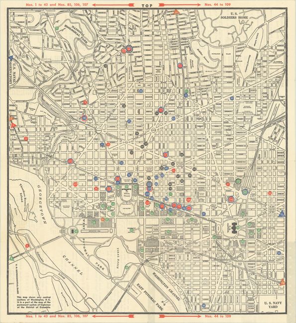
Lot 218
Subject: Washington, D.C.
Service Men’s Map of Washington - Full Information on Service Clubs, Entertainment Sightseeing and Lodging, 1945
Size: 14.1 x 15.4 inches (35.8 x 39.1 cm)
Estimate: $200 - $230
Service Men's Map Documents World War II Segregation in Washington, D.C.
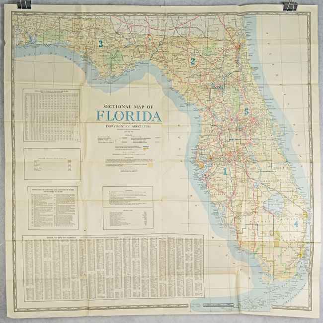
Lot 219
Subject: Florida
Matthews-Northrup Co
Sectional Map of Florida Issued by Department of Agriculture, 1938
Size: 44.8 x 44.5 inches (113.8 x 113 cm)
Estimate: $140 - $170
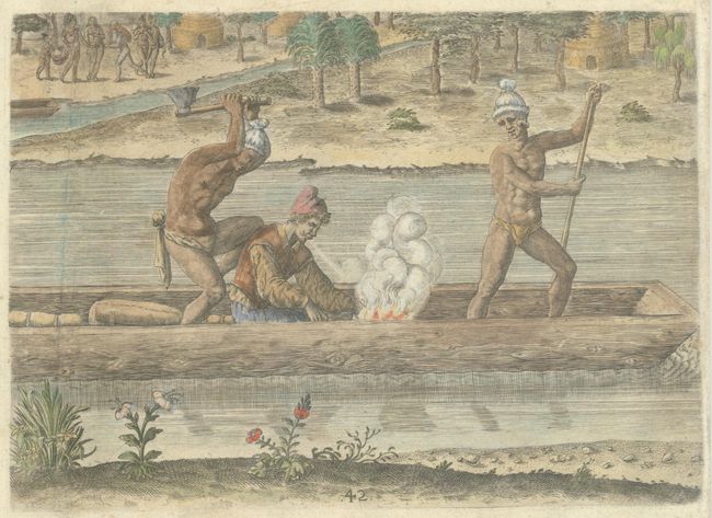
Lot 223
Subject: Florida, Natives
Bry, Theodore de
[The Murder of the Frenchman, Pierre Gambie] Welcher Gestalt Petrus Cambie / ein Frantzosz / umb Sein Leben Kommen, 1591
Size: 8.5 x 6.1 inches (21.6 x 15.5 cm)
Estimate: $275 - $350
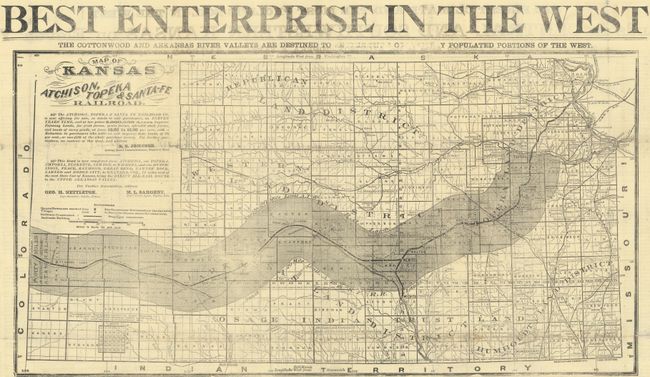
Lot 235
Subject: Kansas
Railroad Companies, (Various)
[Promotional Broadside for the Atchison, Topeka & Santa-Fe Railroad] Best Enterprise in the West, 1874
Size: 23.4 x 12.3 inches (59.4 x 31.2 cm)
Estimate: $275 - $350
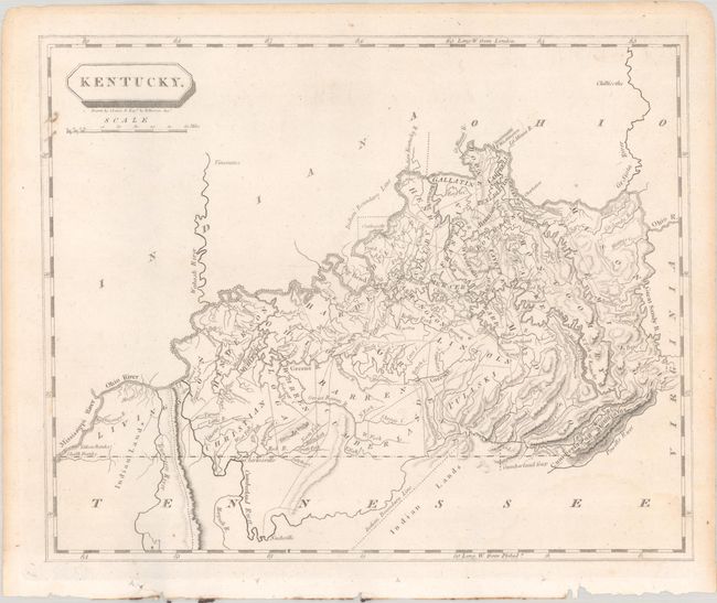
Lot 239
Subject: Kentucky
Arrowsmith & Lewis
Kentucky, 1804
Size: 9.8 x 8 inches (24.9 x 20.3 cm)
Estimate: $200 - $230
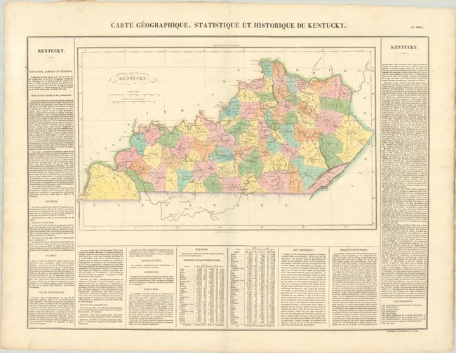
Lot 240
Subject: Kentucky
Buchon, Jean Alexandre
Carte Geographique, Statistique et Historique du Kentucky, 1825
Size: 18.3 x 11.2 inches (46.5 x 28.4 cm)
Estimate: $140 - $170
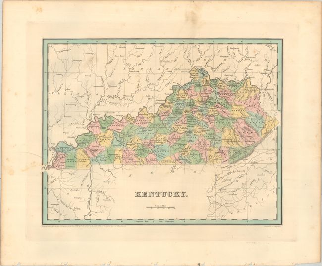
Lot 241
Subject: Kentucky
Bradford, Thomas Gamaliel
Kentucky, 1838
Size: 14.4 x 11.3 inches (36.6 x 28.7 cm)
Estimate: $140 - $170
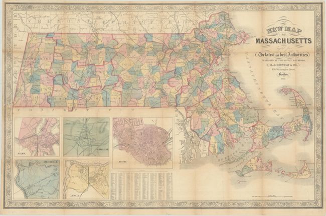
Lot 249
Subject: Massachusetts
Dutton, E. P.
New Map of Massachusetts Compiled from the Latest and Best Authorities, 1863
Size: 30.1 x 19.5 inches (76.5 x 49.5 cm)
Estimate: $160 - $190
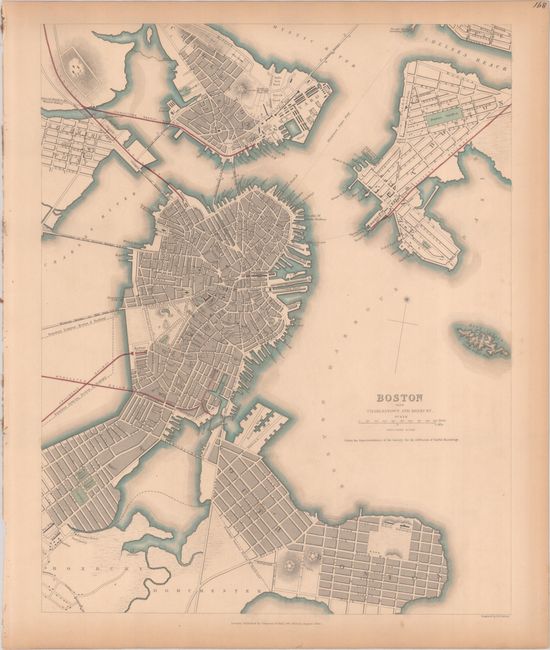
Lot 251
Subject: Boston, Massachusetts
SDUK Society for the Diffusion of Useful Knowledge
Boston with Charlestown and Roxbury, 1842
Size: 11.8 x 14.8 inches (30 x 37.6 cm)
Estimate: $200 - $230
158 lots
Page 1 of 4