Current Auction
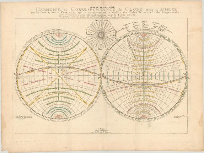
"Harmonie ou Correspondance du Globe auecq la Sphere par les Points, Lignes, Cercles, &c...", Sanson, Nicolas
Subject: Cartographic Miscellany, World
Period: 1699 (dated)
Publication:
Color: Hand Color
Size:
21.3 x 14 inches
54.1 x 35.6 cm
Download High Resolution Image
(or just click on image to launch the Zoom viewer)
(or just click on image to launch the Zoom viewer)
This very unusual double hemisphere map was engraved by Jean Somer Pruthensus. It displays simple outlines of the continents, shows California as an island, and illustrates meridians and climatic zones. There are no place names, and the interior of the continents are completely blank. The map was included in Sanson's atlases from 1659 onwards. This is a later edition with the addition of a wind rose in between the hemispheres, and the outlines of the continents only faintly visible.
See also lot 714 for Rodney Shirley's The Mapping of the World - Early Printed World Maps 1472-1700 that describes this map.
References: cf. Pastoureau, SANSON V A [3]; Shirley #408.
Condition: B+
Contemporary outline color with minor soiling, some extraneous creasing, and dampstains along the sides of the sheet.
Estimate: $275 - $350
Price: $200
Bid Increments
$100 - $249$10
$250 - $499$25
$500 - $999$50
$1,000 - $2,499$100
Terms & Conditions