Current Auction
"Carte Geographique, Statistique et Historique du Kentucky", Buchon, Jean Alexandre
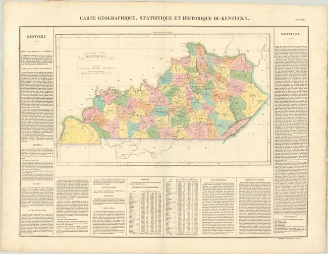
Subject: Kentucky
Period: 1825 (published)
Publication: Atlas Geographique, Statistique, Historique ... des Deux Ameriques
Color: Hand Color
Size:
18.3 x 11.2 inches
46.5 x 28.4 cm
Download High Resolution Image
(or just click on image to launch the Zoom viewer)
(or just click on image to launch the Zoom viewer)
This attractive copper engraved map delineates counties in full hand coloring, roads and towns. County configuration is current to circa 1821, with a large newly formed Hickman County in the southwestern corner. It is surrounded on three sides with French text describing Kentucky - its history, religions, etc. The size given is for the map only; it is on a large folio sheet measuring 27.6 x 21.3". Buchon produced the French edition of Carey & Lea's American Atlas. He used a better quality paper and today his maps are generally found in better condition than their American counterparts.
References:
Condition: A
Contemporary color on a clean bright sheet.
Estimate: $140 - $170
Price: $100
Bid Increments
$50 - $99$5
$100 - $249$10
$250 - $499$25
$500 - $999$50
Terms & Conditions