Current Auction
"Kentucky", Bradford, Thomas Gamaliel
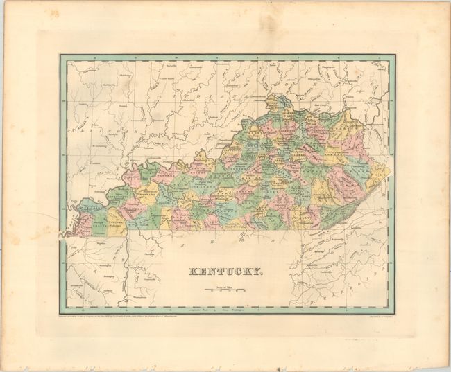
Subject: Kentucky
Period: 1838 (dated)
Publication: An Illustrated Atlas, Geographical, Statistical, and Historical, of the United States...
Color: Hand Color
Size:
14.4 x 11.3 inches
36.6 x 28.7 cm
Download High Resolution Image
(or just click on image to launch the Zoom viewer)
(or just click on image to launch the Zoom viewer)
An attractive, early map of the state that details county seats, towns and settlements, and river systems. County development is current to 1836 with the addition of Clinton County along the Tennessee border. Locates Fort Jefferson, Mammoth Cave, and several springs. Not to be confused with the maps from the Comprehensive Atlas, this map is several inches larger and carries much more information. Engraved by G. W. Boynton.
References: Phillips (Atlases) #1381; Ristow pp. 270-271.
Condition: B+
Contemporary color with minor foxing and soiling mostly in the blank margins.
Estimate: $140 - $170
Price: $100
Bid Increments
$50 - $99$5
$100 - $249$10
$250 - $499$25
$500 - $999$50
Terms & Conditions