Current Auction
"Kentucky", Arrowsmith & Lewis
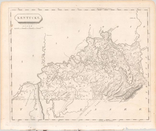
Subject: Kentucky
Period: 1804 (circa)
Publication: A New and Elegant General Atlas
Color: Black & White
Size:
9.8 x 8 inches
24.9 x 20.3 cm
Download High Resolution Image
(or just click on image to launch the Zoom viewer)
(or just click on image to launch the Zoom viewer)
This county map shows towns, early roads, rivers, and topography. Indian Lands are noted within Livingston and Madison counties and within Indiana. The county configuration is quite unique with some notable counties missing, such as Jefferson and Nelson, which were two of the first counties established in the state. Drawn by Samuel Lewis and engraved by William Harrison Jr.
See also lot 705 for Phillips & LeGear's A List of Geographical Atlases in the Library of Congress with Bibliographical Notes that notes this map.
References: Phillips (Atlases) #702-51; Rumsey #2436.051.
Condition: B+
A bright sheet of wove paper with a faint dampstain at bottom right, show-through at top left of map number (51) written in old manuscript ink on verso, and binding holes in the bottom margin.
Estimate: $200 - $230
Price: $150
Bid Increments
$100 - $249$10
$250 - $499$25
$500 - $999$50
$1,000 - $2,499$100
Terms & Conditions