Subject: Ancient World
Period: 1676 (published)
Publication: Introductionis in Universam Geographiam
Color: Hand Color
Size:
8.1 x 6.3 inches
20.6 x 16 cm
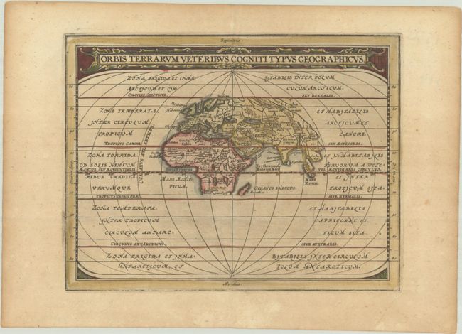
This is a reduced version of the classic map of the ancient world based on Ortelius. Europe, Asia, and Africa (as far south as Madagascar) are placed at the center of a much larger oval frame that continues to the Antarctic. The climatic zones are identified. The title is enclosed in a lovely strapwork panel at top.
Cluver's Introductio in Universam Geographicam was a popular atlas, appearing in over 45 editions during a 100-year period. The first edition was published without maps in the 1620s, and the first edition to include maps was published circa 1641. The various editions were published in different cities throughout Europe, including Amsterdam, Nuremberg, and London, often with new sets of maps engraved. This map is from an Amsterdam edition published by Jansson's heirs, which included some maps from the Jansson and Cloppenburgh editions of Atlas Minor.
References: Shirley (BL Atlases) T.CLUV-6a #1.
Condition: B+
A generally dark impression that is weak along the bottom neatline, on a lightly toned sheet.