Subject: Western Hemisphere - America
Period: 1818 (dated)
Publication: Geographisk Handatlas
Color: Hand Color
Size:
13.7 x 17.2 inches
34.8 x 43.7 cm
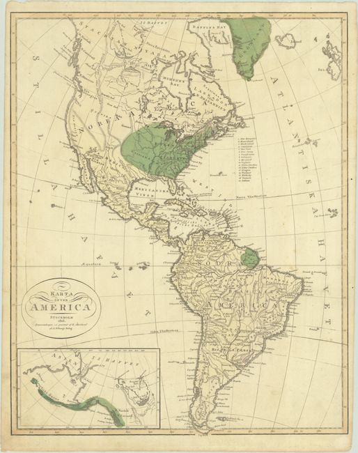
This uncommon Swedish map shows interesting state boundaries within the United States. Seventeen states are listed, including Indiana but omitting Ohio. Indiana is placed north of the Ohio River but is not delineated, while Tennessee is located between Georgia and the Mississippi River. West of the Mississippi River is Louisiana Territory, however it only extends to a dotted border around the middle of the United States. There are several spurious mountain ranges that extend north-south through the western half of the United States, which is otherwise devoid of information. In South America, there is an area around Lagoa dos Patos that is noted as "neutral land." Compiled and engraved by Erik Akerland and published by A. Wiborg in Stockholm.
References:
Condition: B+
Original color on a sheet with a fleur-de-lis watermark, a tiny paper flaw at the eastern tip of Maine, and light soiling. An edge tear that enters 1/2" into the image at left has been closed on verso with archival tape.