Filtered by Category:Books, Atlases, Travel Guides, Geography & Reference Books(Show All Categories)
Showing results for:Auction 175
Catalog Archive
50 lots
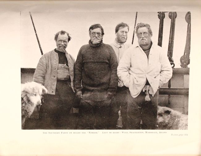
Auction 175, Lot 29
Subject: South Pole
[2 Volumes] The Heart of the Antarctic Being the Story of the British Antarctic Expedition 1907-1909, 1909
Size: 7.4 x 10 inches (18.8 x 25.4 cm)
Estimate: $600 - $750
Sold for: $550
Closed on 11/13/2019
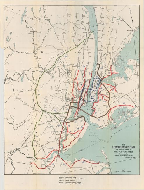
Auction 175, Lot 220
Subject: New York City, New York
Report with Plan for the Comprehensive Development of the Port of New York, 1921
Size: 7.3 x 10.3 inches (18.5 x 26.2 cm)
Estimate: $180 - $220
Sold for: $120
Closed on 11/13/2019
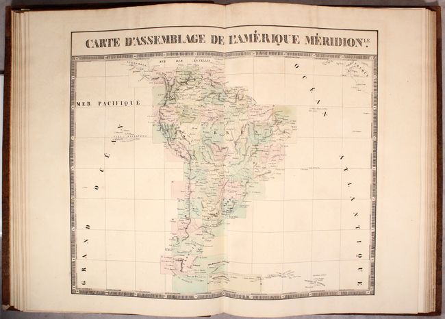
Auction 175, Lot 306
Subject: South America, Atlases
Vandermaelen, Philippe Marie Guillaume
Atlas Universel de Geographie Physique, Politique, Statistique et Mineralogique ... Cinquieme Partie. - Amer. Merid., 1827
Size: 15 x 21.6 inches (38.1 x 54.9 cm)
Estimate: $5,000 - $6,500
Vandermaelen's Remarkable Atlas of South America
Unsold
Closed on 11/13/2019
Auction 175, Lot 554
Subject: Holy Land
Mortier, Pierre
[2 Volumes] Historie des Ouden en Nieuwen Testaments, Verrykt met meer dan Vierhonderd Printverbeeldingen in Koper Gesneeden..., 1700
Size: 11.8 x 18 inches (30 x 45.7 cm)
Estimate: $1,800 - $2,100
Mortier's Dutch History of the Old and New Testaments with Five Maps
Sold for: $1,000
Closed on 11/13/2019
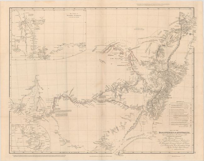
Auction 175, Lot 639
Subject: Australia
Arrowsmith, John
Map of the Discoveries in Australia, Copied from the Latest M.S. Surveys in the Colonial Office... [with] Two Expeditions Into the Interior of Southern Australia, During the Years 1828, 1829, 1830, and 1831...Volume I, 1833
Size: 24.2 x 19.2 inches (61.5 x 48.8 cm)
Estimate: $550 - $700
Sold for: $375
Closed on 11/13/2019
Auction 175, Lot 673
Subject: Atlases
Lattre, Jean
Atlas Moderne ou Collection de Cartes sur Toutes les Parties du Globe Terrestre..., 1787
Size: 11.6 x 15.4 inches (29.5 x 39.1 cm)
Estimate: $2,750 - $3,500
Complete Atlas with 62 Maps in Contemporary Color
Sold for: $3,250
Closed on 11/13/2019
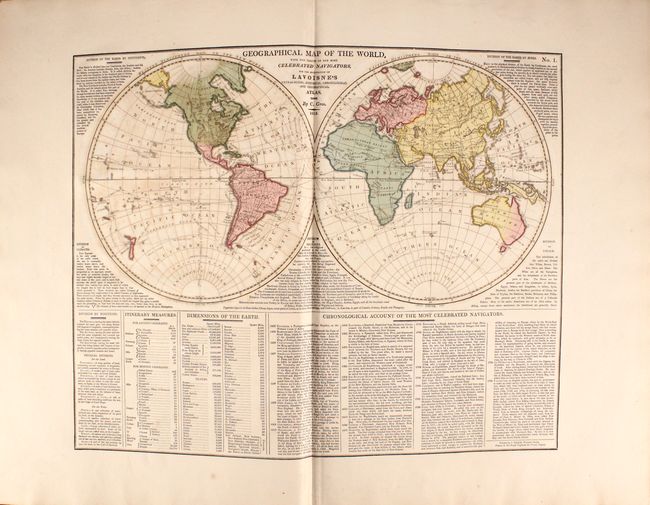
Auction 175, Lot 674
Subject: Atlases
Lavoisne/Aspin
Lavoisne's Complete Genealogical, Historical, Chronological, and Geographical Atlas; Being a General Guide to History, Both Ancient and Modern..., 1814
Size: 15.3 x 21.3 inches (38.9 x 54.1 cm)
Estimate: $800 - $950
With 30 Maps in Full Contemporary Color
Unsold
Closed on 11/13/2019
Auction 175, Lot 675
Subject: Atlases
Dirwaldt, Joseph
Allgemeiner Hand-Atlas zum Gebrauch fur die Jugend in Hoehern und Niedern Schulen..., 1818
Size: 20.5 x 15.7 inches (52.1 x 39.9 cm)
Estimate: $1,500 - $1,800
Rare Austrian School Atlas in Original Color
Unsold
Closed on 11/13/2019
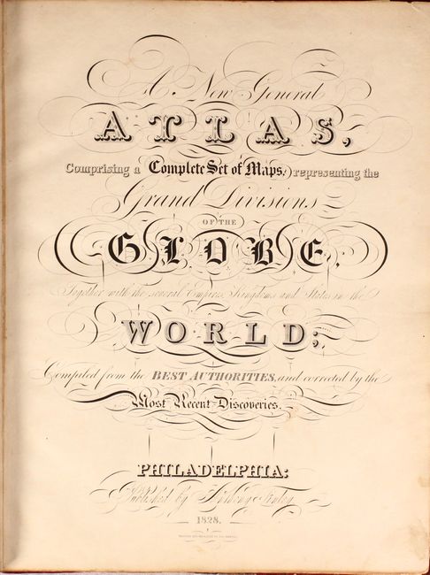
Auction 175, Lot 676
Subject: Atlases
Finley, Anthony
A New General Atlas, Comprising a Complete Set of Maps, Representing the Grand Divisions of the Globe..., 1828
Size: 11.4 x 14.2 inches (29 x 36.1 cm)
Estimate: $4,500 - $5,500
An Early and Important American Atlas
Sold for: $3,750
Closed on 11/13/2019
Auction 175, Lot 677
Subject: Atlases
Lothian, John
New Edinburg General Atlas. Exhibiting the Relative Extent & Divisions the Boundaries and Other Geographical Details of the Various Empires, States & Quarters of the World..., 1846
Size: 13.7 x 16.6 inches (34.8 x 42.2 cm)
Estimate: $900 - $1,100
Unsold
Closed on 11/13/2019
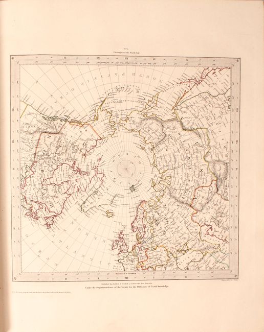
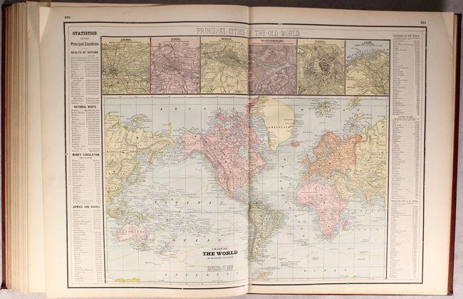
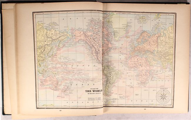
Auction 175, Lot 678
Subject: Atlases
SDUK Society for the Diffusion of Useful Knowledge
General Atlas Published Under the Superintendence of the Society for the Diffusion of Useful Knowledge ... Vol. I, 1852
Size: 13.6 x 16.3 inches (34.5 x 41.4 cm)
Estimate: $750 - $900
NO RESERVE
Sold for: $350
Closed on 11/13/2019
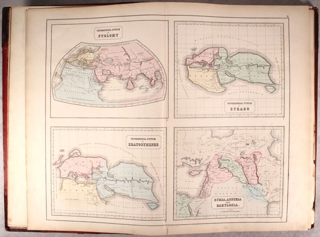
Auction 175, Lot 679
Subject: Atlases, Ancient World
Philip, George
Philips' Atlas of Classical, Historical, and Scriptural Geography, Containing Fifty-One Maps and Plans..., 1855
Size: 15.7 x 22.9 inches (39.9 x 58.2 cm)
Estimate: $400 - $500
Sold for: $250
Closed on 11/13/2019
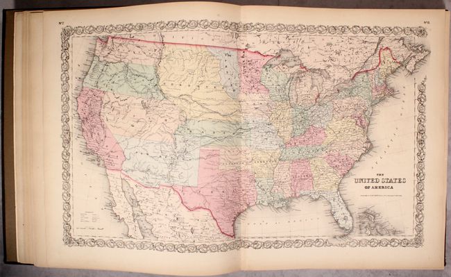
Auction 175, Lot 680
Subject: Atlases
Colton, Joseph Hutchins
Colton's Atlas of America, Illustrating the Physical and Political Geography of North and South America and the West India Islands..., 1857
Size: 15.8 x 18.4 inches (40.1 x 46.7 cm)
Estimate: $3,250 - $4,000
Uncommon Colton Atlas Focused on the Americas
Unsold
Closed on 11/13/2019
Auction 175, Lot 681
Subject: Atlases
Mitchell, Samuel Augustus
Mitchell's New General Atlas, Containing Maps of the Various Countries of the World, Plans of Cities, Etc..., 1862
Size: 12.9 x 15.9 inches (32.8 x 40.4 cm)
Estimate: $1,000 - $1,300
Sold for: $750
Closed on 11/13/2019
Auction 175, Lot 682
Subject: Atlases
Johnson & Browning
Johnson's New Illustrated (Steel Plate) Family Atlas, with Descriptions, Geographical, Statistical, and Historical, 1862
Size: 15.1 x 18.6 inches (38.4 x 47.2 cm)
Estimate: $1,000 - $1,300
Sold for: $750
Closed on 11/13/2019
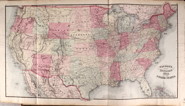
Auction 175, Lot 683
Subject: Atlases, Railroads
Watson, Gaylord
Watson's New Commercial County and Railroad Atlas of the United States and Territories, and British Provinces..., 1875
Size: 14.8 x 18.4 inches (37.6 x 46.7 cm)
Estimate: $700 - $850
A Rare American Atlas - Inscribed by the Author
Sold for: $550
Closed on 11/13/2019
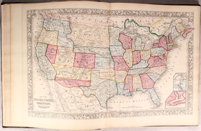
Auction 175, Lot 684
Subject: Atlases
Walker, Henry B.
Walker's International Atlas Containing Over One Hundred and Twenty New Maps, Showing the Geographical Location of Railroads, Cities, Towns, Post Offices, of Every State..., 1889
Size: 13.6 x 17.9 inches (34.5 x 45.5 cm)
Estimate: $550 - $700
Unusual Atlas Featuring Both Hand-Colored and Printed Maps
Sold for: $400
Closed on 11/13/2019
Auction 175, Lot 685
Subject: Atlases
Gaskell, C. A.
The C.A. Gaskell Family and Business Atlas of the World New and Complete..., 1894
Size: 11.9 x 14.1 inches (30.2 x 35.8 cm)
Estimate: $220 - $250
Sold for: $160
Closed on 11/13/2019
Auction 175, Lot 686
Subject: Geography Books
Buffier, Claude
Geographie Universelle, Exposee dans les Diferentes Metodes qui Peuvent Abreger l'Etude & Faciliter l'Usage de Cette Sience..., 1749
Size: 3.9 x 6.9 inches (9.9 x 17.5 cm)
Estimate: $475 - $600
Sold for: $325
Closed on 11/13/2019
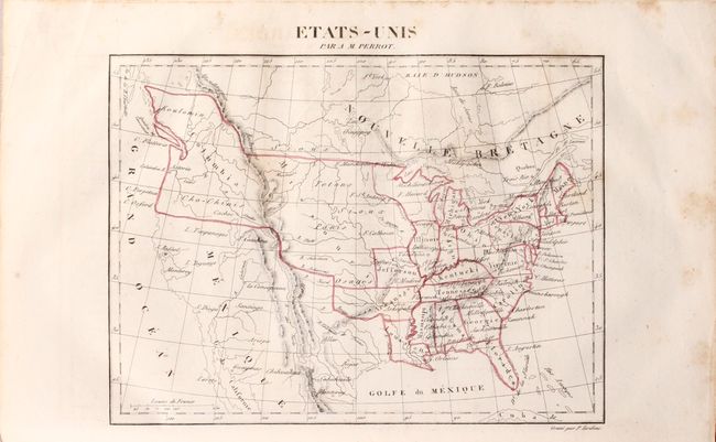
Auction 175, Lot 687
Subject: Geography Books
Perrot, Aristide Michel
[2 Volumes] Dictionnaire Universel de Geographie Moderne, ou Description Physique, Politique et Historique..., 1836
Size: 7.5 x 11.1 inches (19.1 x 28.2 cm)
Estimate: $250 - $325
Sold for: $180
Closed on 11/13/2019
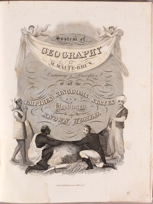
Auction 175, Lot 688
Subject: Geography Books
Malte-Brun, Conrad
[3 Volumes] A System of Universal Geography, or a Description of All the Parts of the World..., 1847
Size: 9.6 x 11.8 inches (24.4 x 30 cm)
Estimate: $400 - $475
Sold for: $220
Closed on 11/13/2019
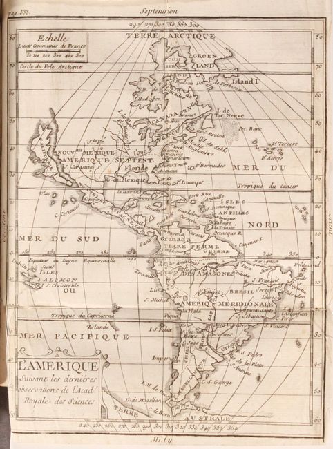
Auction 175, Lot 689
Subject: Exploration & Surveys
Anson, George
A Voyage Round the World, in the Years MDCCXL, I, II, III, IV..., 1748
Size: 5.1 x 8.1 inches (13 x 20.6 cm)
Estimate: $550 - $700
Sold for: $275
Closed on 11/13/2019
Auction 175, Lot 690
Subject: History Books, Revolutionary War
Tarleton, Banastre (Sir)
A History of the Campaigns of 1780 and 1781, in the Southern Provinces of North America, 1787
Size: 8.8 x 11.2 inches (22.4 x 28.4 cm)
Estimate: $7,000 - $8,500
Complete First Edition of Tarleton's Work on the Southern Campaigns of the American Revolution
Sold for: $4,000
Closed on 11/13/2019
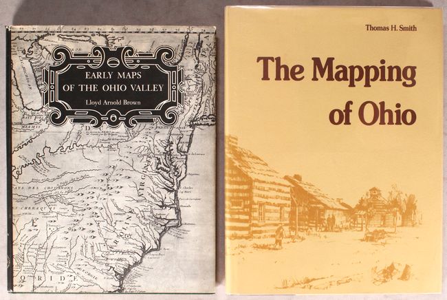
Auction 175, Lot 691
Subject: References, Ohio & Ohio River Valley
[Lot of 2] Early Maps of the Ohio Valley - A Selection of Maps, Plans, and Views Made by Indians and Colonials from 1673 to 1783 [and] The Mapping of Ohio - The Delineation of the State of Ohio..., 1959-77
Size: See Description
Estimate: $200 - $230
Sold for: $150
Closed on 11/13/2019
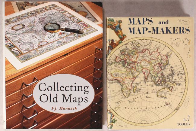
Auction 175, Lot 692
Subject: References
[Lot of 2] Collecting Old Maps [and] Maps and Map-Makers, 1961-98
Size: See Description
Estimate: $110 - $140
NO RESERVE
Sold for: $26
Closed on 11/13/2019
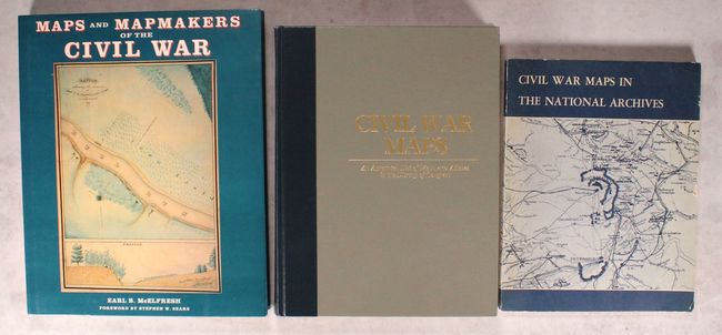
Auction 175, Lot 693
Subject: References, Civil War
[Lot of 3] Maps and Mapmakers of the Civil War [and] Civil War Maps - An Annotated List of Maps and Atlases in the Library of Congress [and] Civil War Maps in the National Archives, 1964-99
Size: See Description
Estimate: $70 - $90
NO RESERVE
Sold for: $275
Closed on 11/13/2019
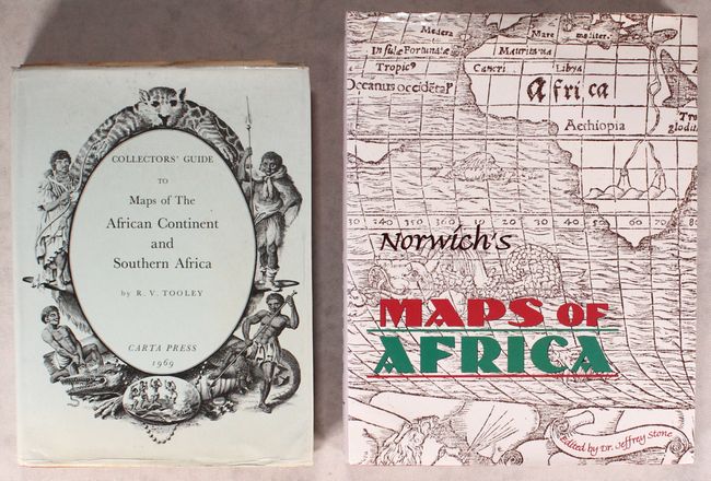
Auction 175, Lot 694
Subject: References, Africa
[Lot of 2] Collectors' Guide to Maps of the African Continent and Southern Africa [and] Norwich's Maps of Africa - An Illustrated and Annotated Carto-Bibliography, 1969-97
Size: See Description
Estimate: $200 - $230
Sold for: $100
Closed on 11/13/2019
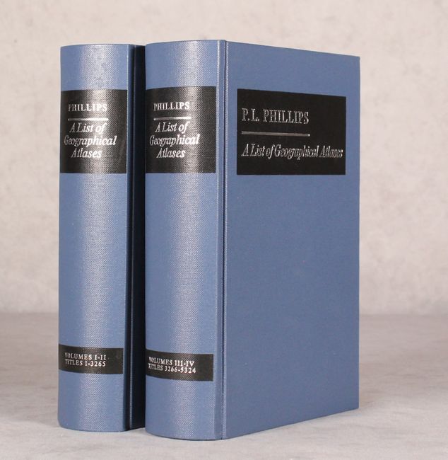
Auction 175, Lot 695
Subject: References
Phillips, P. Lee
[4 Volumes in 2 Books] A List of Geographical Atlases in the Library of Congress, 1971
Size: 6 x 9 inches (15.2 x 22.9 cm)
Estimate: $250 - $325
Sold for: $125
Closed on 11/13/2019
Auction 175, Lot 696
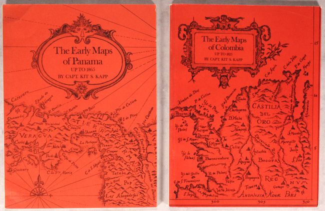
Subject: References, Panama, Colombia
Kapp, Kit S.
[Lot of 2] The Early Maps of Panama Up to 1865 [and] The Early Maps of Colombia Up to 1825, 1971
Size: 7.3 x 9.7 inches (18.5 x 24.6 cm)
Estimate: $90 - $120
NO RESERVE - An Indispensable Reference on the Mapping of Panama & Columbia
Sold for: $75
Closed on 11/13/2019
Auction 175, Lot 697
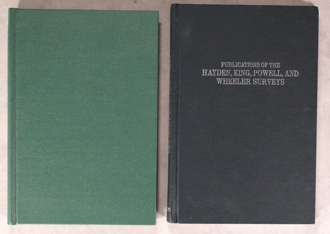
Subject: References, Geology
[Lot of 2] Mapoteca Geologica Americana - A Catalogue of Geological Maps of America (North and South) 1752-1881... [and] Catalogue and Index of the Publications of the Hayden, King, Powell, and Wheeler Surveys..., 1971-98
Size: 6.2 x 9.3 inches (15.7 x 23.6 cm)
Estimate: $80 - $100
NO RESERVE
Sold for: $375
Closed on 11/13/2019

Auction 175, Lot 698
Subject: References, Southeast United States
Cumming, William P.
The Southeast in Early Maps with an Annotated Check List of Printed and Manuscript Regional and Local Maps of Southeastern North America During the Colonial Period, 1973
Size: 8.8 x 11.3 inches (22.4 x 28.7 cm)
Estimate: $140 - $170
NO RESERVE
Unsold
Closed on 11/13/2019
Auction 175, Lot 699
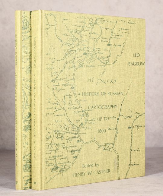
Subject: References, Russia
Bagrow, Leo
[2 Volumes] A History of the Cartography of Russia Up to 1600 [and] ... Up to 1800, 1975
Size: 9.2 x 11.8 inches (23.4 x 30 cm)
Estimate: $140 - $170
Sold for: $130
Closed on 11/13/2019
Auction 175, Lot 700
Subject: References
Mercator, Gerard
[Facsimile] Atlas sive Cosmographicae Meditationes de Fabrica Mundi et Fabricati Figura, 1979
Size: 13.3 x 17.8 inches (33.8 x 45.2 cm)
Estimate: $200 - $230
Sold for: $425
Closed on 11/13/2019

Auction 175, Lot 701
Subject: References, Western United States
Wagner & Camp
The Plains & the Rockies - A Critical Bibliography of Exploration, Adventure and Travel in the American West 1800-1865 Fourth Edition, 1982
Size: 7.1 x 10.4 inches (18 x 26.4 cm)
Estimate: $90 - $120
NO RESERVE
Sold for: $10
Closed on 11/13/2019
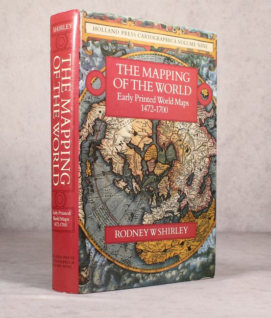
Auction 175, Lot 702
Subject: References, World
Shirley, Rodney W.
The Mapping of the World - Early Printed World Maps 1472-1700, 1983
Size: 9.5 x 13.6 inches (24.1 x 34.5 cm)
Estimate: $475 - $600
Sold for: $325
Closed on 11/13/2019
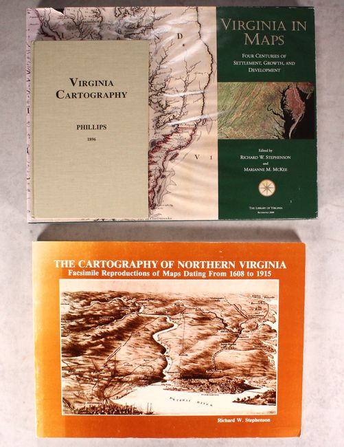
Auction 175, Lot 703
Subject: References, Virginia
[Lot of 3] Virginia in Maps - Four Centuries of Settlement, Growth, and Development [and] Virginia Cartography - A Bibliographical Description [and] The Cartography of Northern Virginia - Facsimile Reproductions of Maps Dating from 1608 to 1915, 1983-2000
Size: See Description
Estimate: $120 - $150
Sold for: $95
Closed on 11/13/2019
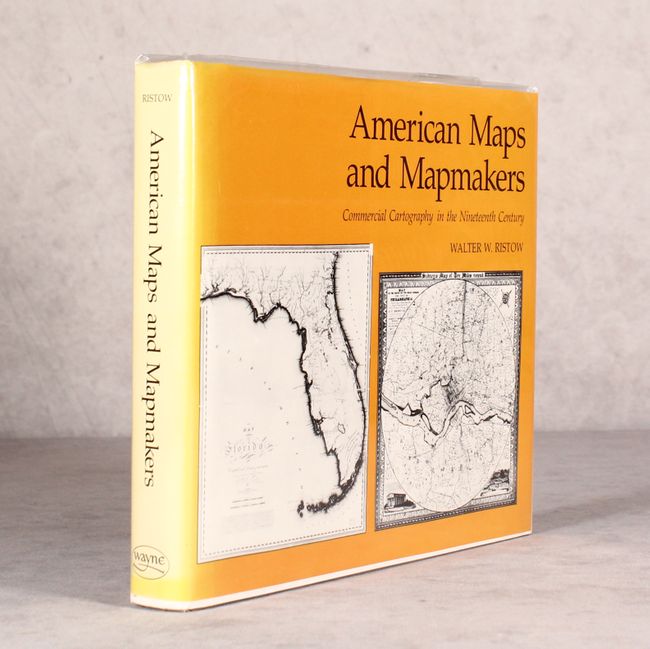
Auction 175, Lot 704
Subject: References, United States of America
Ristow, Walter W.
American Maps and Mapmakers - Commercial Cartography in the Nineteenth Century, 1986
Size: 10.4 x 9 inches (26.4 x 22.9 cm)
Estimate: $140 - $170
Sold for: $100
Closed on 11/13/2019
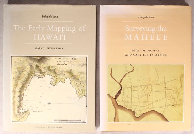
Auction 175, Lot 705
Subject: References, Hawaii
[Lot of 2] The Early Mapping of Hawai'i [and] Surveying the Mahele, 1986-95
Size: 10.4 x 14.3 inches (26.4 x 36.3 cm)
Estimate: $110 - $140
Sold for: $80
Closed on 11/13/2019
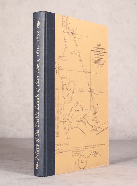
Auction 175, Lot 706
Subject: References, San Diego
Harlow, Neal
Maps of the Pueblo Lands of San Diego 1602-1874, 1987
Size: 8.8 x 12.6 inches (22.4 x 32 cm)
Estimate: $80 - $100
NO RESERVE
Sold for: $23
Closed on 11/13/2019
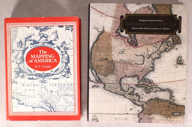
Auction 175, Lot 707
Subject: References, North America
[Lot of 2] The Mapping of America [and] Degrees of Latitude - Mapping Colonial America, 1988-2002
Size: See Description
Estimate: $100 - $130
NO RESERVE
Sold for: $350
Closed on 11/13/2019
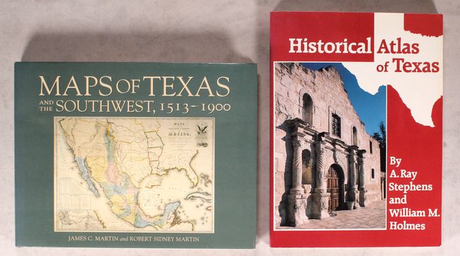
Auction 175, Lot 708
Subject: References, Texas
[Lot of 2] Maps of Texas and the Southwest, 1513-1900 [and] Historical Atlas of Texas, 1989-99
Size: See Description
Estimate: $80 - $100
NO RESERVE
Sold for: $90
Closed on 11/13/2019

Auction 175, Lot 709
Subject: References
Jolly, David C.
[2 Volumes] Maps in British Periodicals Part I [and] Part II, 1990-91
Size: 6.1 x 9.3 inches (15.5 x 23.6 cm)
Estimate: $160 - $190
Sold for: $160
Closed on 11/13/2019
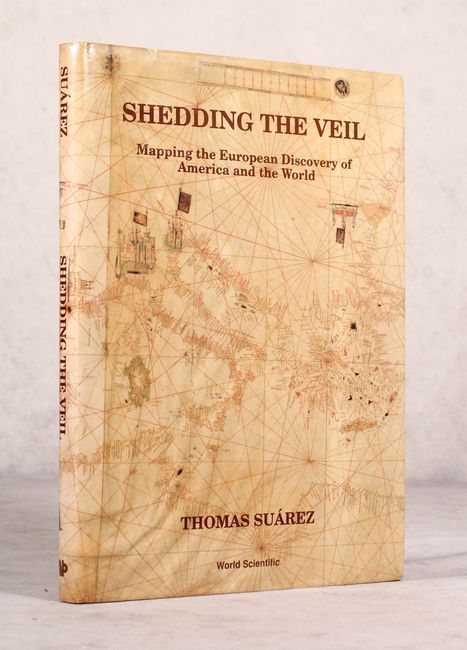
Auction 175, Lot 710
Subject: References
Suarez, Thomas
Shedding the Veil - Mapping the European Discovery of America and the World, 1992
Size: 8.7 x 11.8 inches (22.1 x 30 cm)
Estimate: $80 - $100
NO RESERVE
Sold for: $37
Closed on 11/13/2019
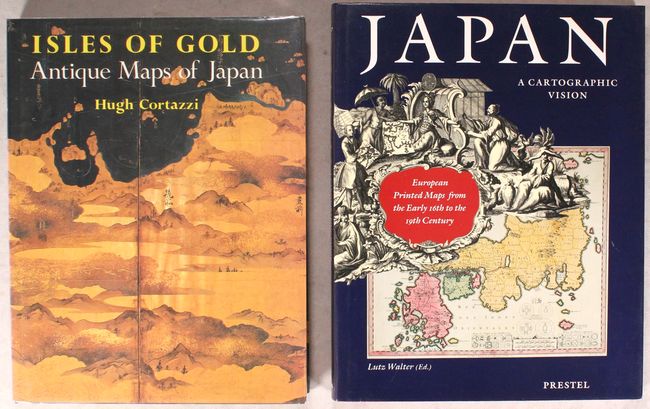
Auction 175, Lot 711
Subject: References, Japan
[Lot of 2] Isles of Gold - Antique Maps of Japan [and] Japan - A Cartographic Vision - European Printed Maps from the Early 16th to the 19th Century, 1992-94
Size: See Description
Estimate: $160 - $190
Sold for: $80
Closed on 11/13/2019
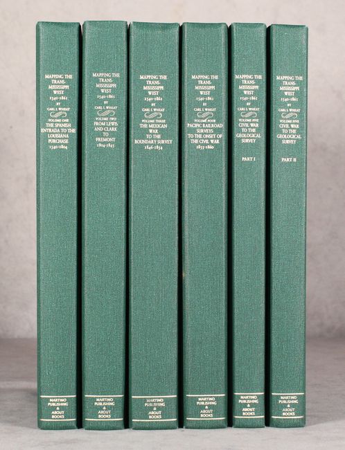
Auction 175, Lot 712
Subject: References, Western United States
Wheat, Carl I.
[5 Volumes in 6 Books] 1540-1861 Mapping the Transmississippi West, 1995
Size: 9.3 x 12.3 inches (23.6 x 31.2 cm)
Estimate: $600 - $750
Unsold
Closed on 11/13/2019
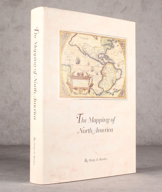
Auction 175, Lot 713
Subject: References, North America
Burden, Philip D.
The Mapping of North America - A List of Printed Maps 1511-1670, 1996
Size: 10.5 x 14.3 inches (26.7 x 36.3 cm)
Estimate: $220 - $250
Unsold
Closed on 11/13/2019
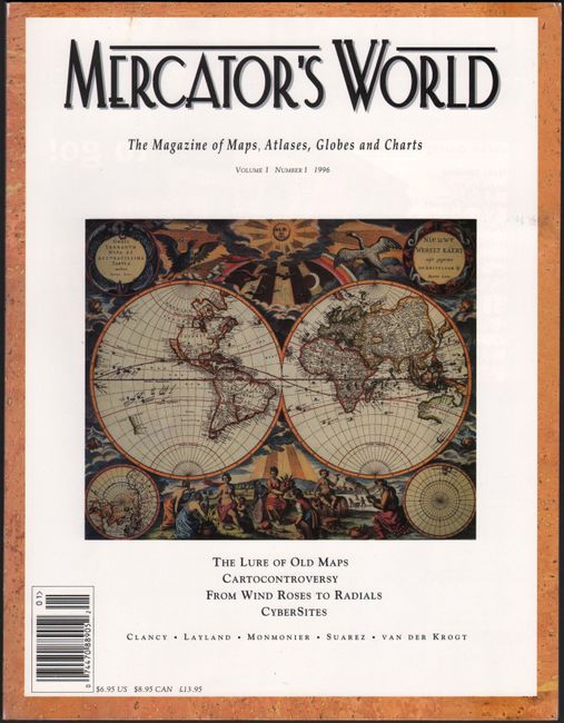
Auction 175, Lot 714
Subject: References
Mercator's World - The Magazine of Maps, Atlases, Globes and Charts Volume I Number I, 1996
Size: 8.4 x 10.9 inches (21.3 x 27.7 cm)
Estimate: $20 - $30
NO RESERVE
Sold for: $16
Closed on 11/13/2019
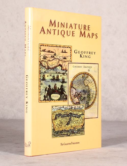
Auction 175, Lot 715
Subject: References
King, Geoffrey L.
Miniature Antique Maps - An Illustrated Guide for the Collector, 1996
Size: 7.5 x 11 inches (19.1 x 27.9 cm)
Estimate: $100 - $130
NO RESERVE
Sold for: $28
Closed on 11/13/2019
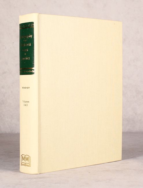
Auction 175, Lot 716
Subject: References, Northwestern United States & Canada
Wagner, Henry R.
The Cartography of the Northwest Coast of America to the Year 1800, 1999
Size: 8.6 x 11.1 inches (21.8 x 28.2 cm)
Estimate: $200 - $230
Sold for: $100
Closed on 11/13/2019

Auction 175, Lot 717
Subject: References
Tooley, R. V.
[4 Volumes] Tooley's Dictionary of Mapmakers - Revised Edition, 1999-2004
Size: 7.1 x 10.2 inches (18 x 25.9 cm)
Estimate: $500 - $650
Sold for: $550
Closed on 11/13/2019
50 lots