Subject: References, Hawaii
Period: 1986-95 (published)
Publication:
Color: Printed Color
Size:
10.4 x 14.3 inches
26.4 x 36.3 cm
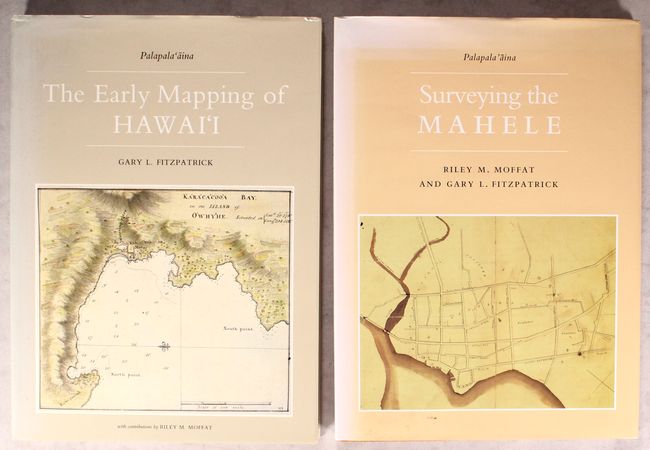
Gary L. Fitzpatrick and Riley M. Moffat's fine references on the history of the cartography of Hawaii are essential volumes for the Hawaiian collector. The first volume tells the story of the mapping of Hawaii starting with its discovery by Captain Cook, emphasizing the impact of the West on the indigenous society. It contains nearly 70 maps plus more than 20 views, portraits, and illustrations. The second volume continues the story, showing how Hawaii developed after the Western concept of private land ownership arrived on its shores. This volume is also illustrated with survey maps, portraits, photographs, documents, and more, many of them in color. Published by Editions Limited, Honolulu, HI. Both volumes folio. Volume 1: 160 pp., hardbound in beige cloth with black stamped titles and an illustrated dust jacket. Volume II: 120 pp., hardbound in orange cloth with black stamped titles and an illustrated dust jacket.
References:
Condition: A
Contents are tight on both volumes. The dust jackets are lightly sunned and soiled. Volume II's front free-endpaper is slightly creased.