Filtered by Category:United States(Show All Categories)
Showing results for:Auction 175
Catalog Archive
171 lots
Page 1 of 4
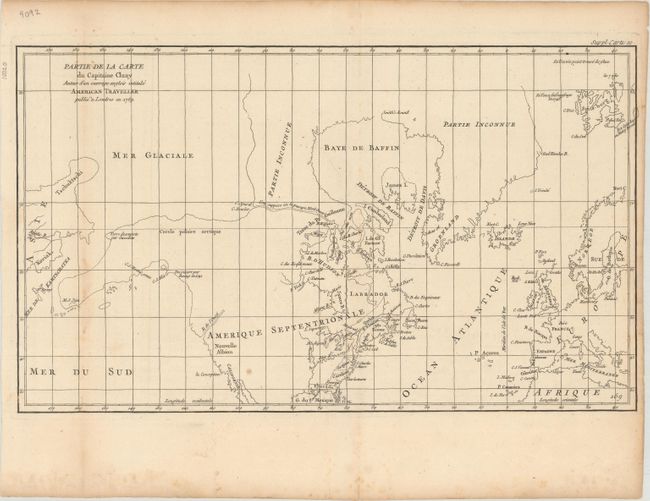
Auction 175, Lot 86
Subject: Colonial United States & Canada, Arctic
Robert de Vaugondy, Didier
Partie de la Carte du Capitaine Cluny Auteur d'un Ouvrage Anglois Intitule American Traveller Publie a Londres en 1769, 1773
Size: 19.6 x 11.5 inches (49.8 x 29.2 cm)
Estimate: $120 - $150
Sold for: $90
Closed on 11/13/2019
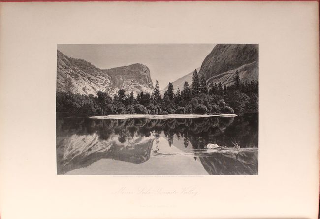
Auction 175, Lot 87
Subject: United States & Canada
Bryant, William C.
[2 Volumes] Picturesque America; or, the Land We Live In. A Delineation by Pen and Pencil..., 1872-74
Size: 10.1 x 13.4 inches (25.7 x 34 cm)
Estimate: $350 - $425
Sold for: $250
Closed on 11/13/2019
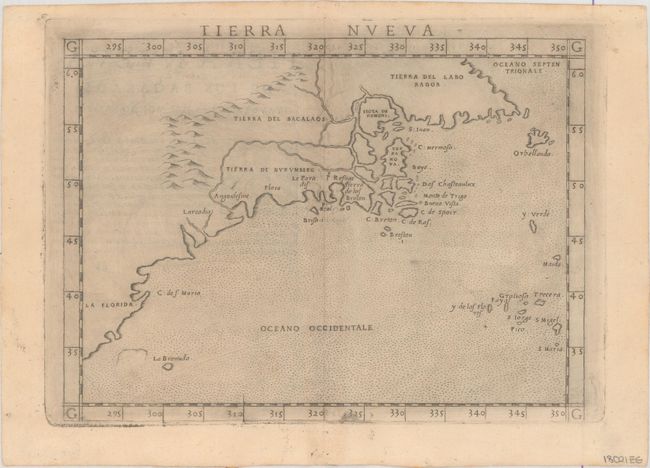
Auction 175, Lot 88
Subject: Eastern United States & Canada
Ruscelli, Girolamo
Tierra Nueva, 1574
Size: 9.6 x 7.1 inches (24.4 x 18 cm)
Estimate: $1,100 - $1,400
Ruscelli's Map of the East Coast
Sold for: $800
Closed on 11/13/2019
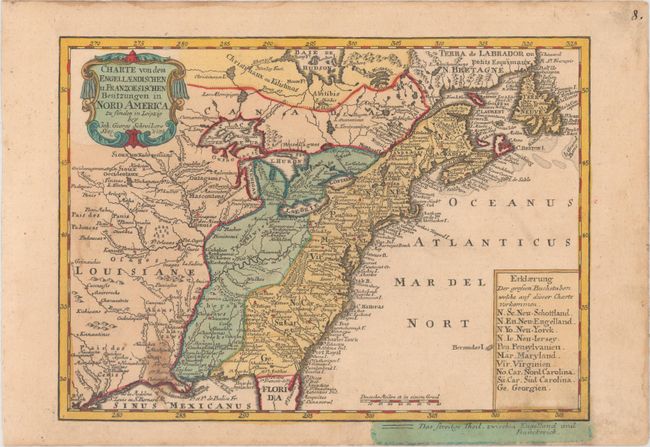
Auction 175, Lot 89
Subject: Colonial Eastern United States & Canada
Schreiber, Johann Georg
Charte von dem Engellaendischen u. Franzoesischen Besitzungen in Nord America..., 1753
Size: 9.5 x 6.9 inches (24.1 x 17.5 cm)
Estimate: $300 - $375
Sold for: $325
Closed on 11/13/2019
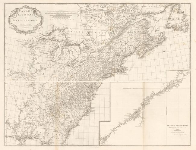
Auction 175, Lot 90
Subject: Colonial Eastern United States & Canada
Anville, Jean Baptiste Bourguignon d'
[On 4 Sheets] Canada Louisiane et Terres Angloises, 1755
Size: 21.8 x 18.6 inches (55.4 x 47.2 cm)
Estimate: $1,300 - $1,600
D'Anville's Spectacular Map of Eastern Seaboard
Sold for: $900
Closed on 11/13/2019
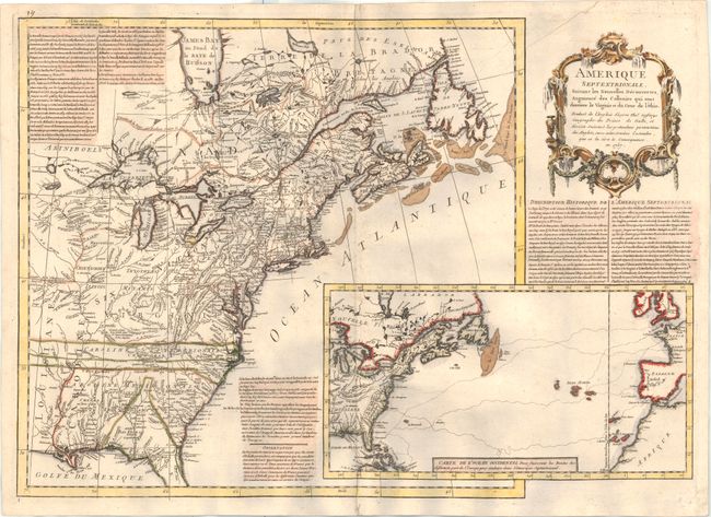
Auction 175, Lot 91
Subject: Colonial Eastern United States & Canada
Anon.
Amerique Septentrionale, Suivant les Nouvelles Decouvertes, Augmente des Collonies qui sont Derriere la Virginie et du Cour de l'Ohio..., 1757
Size: 27.1 x 19.1 inches (68.8 x 48.5 cm)
Estimate: $2,750 - $3,500
A Rare French Map Countering Jefferys' French & Indian War Map
Sold for: $2,500
Closed on 11/13/2019
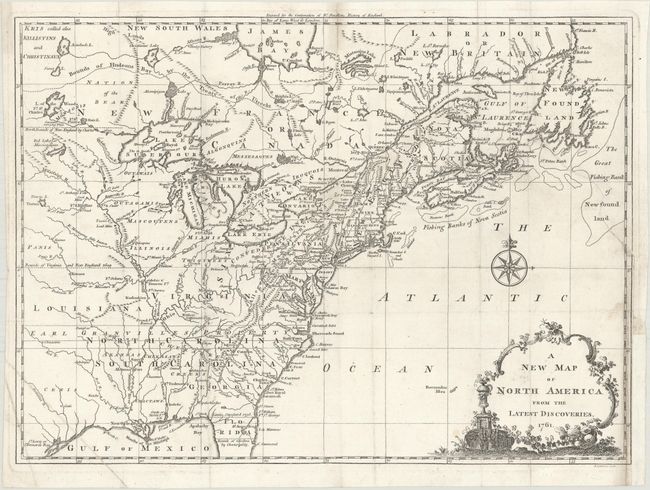
Auction 175, Lot 92
Subject: Colonial Eastern United States & Canada
Spilsbury, J.
A New Map of North America from the Latest Discoveries, 1761
Size: 14.9 x 10.8 inches (37.8 x 27.4 cm)
Estimate: $450 - $550
Sold for: $275
Closed on 11/13/2019
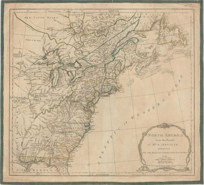
Auction 175, Lot 93
Subject: Colonial Eastern United States & Canada
Jefferys/Sayer & Bennett
North America from the French of Mr. D'Anville Improved with the English Surveys Made Since the Peace, 1775
Size: 20.1 x 18.1 inches (51.1 x 46 cm)
Estimate: $475 - $600
Sold for: $350
Closed on 11/13/2019
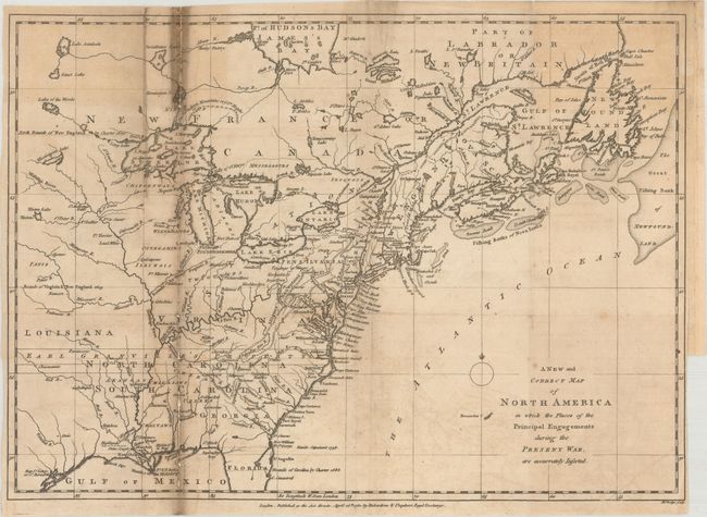
Auction 175, Lot 94
Subject: Colonial Eastern United States & Canada
Lodge, John
A New and Correct Map of North America in Which the Places of the Principal Engagements During the Present War, Are Accurately Inserted, 1780
Size: 15.1 x 10.8 inches (38.4 x 27.4 cm)
Estimate: $300 - $375
Sold for: $190
Closed on 11/13/2019
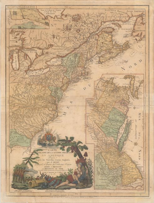
Auction 175, Lot 95
Subject: Colonial Eastern United States & Canada
Denis, Louis
Carte du Theatre de la Guerre Presente en Amerique Dressee d'Apres les Nouvelles Cartes Anglaises, 1782
Size: 19.6 x 26.3 inches (49.8 x 66.8 cm)
Estimate: $3,000 - $3,750
Scarce American Revolutionary War Map
Sold for: $1,800
Closed on 11/13/2019
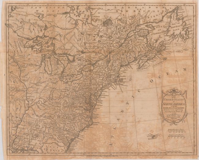
Auction 175, Lot 96
Subject: Eastern United States & Canada
Kitchin, Thomas
Map of the United States in North America: with the British, French and Spanish Dominions Adjoining, According to the Treaty of 1783, 1783
Size: 20.1 x 16.1 inches (51.1 x 40.9 cm)
Estimate: $500 - $650
One of the Earliest English-Produced Maps to Acknowledge the United States
Sold for: $250
Closed on 11/13/2019
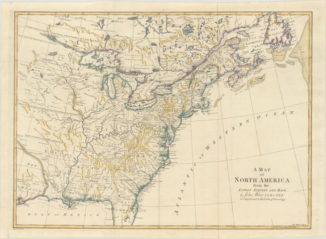
Auction 175, Lot 97
Subject: Colonial Eastern United States & Canada
Blair, Rev. John
A Map of North America from the Latest Surveys and Maps, 1802
Size: 22.5 x 16.5 inches (57.2 x 41.9 cm)
Estimate: $600 - $750
Sold for: $450
Closed on 11/13/2019
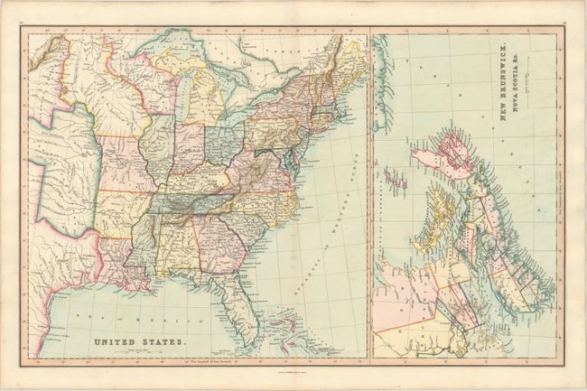
Auction 175, Lot 98
Subject: Eastern United States & Canada
Smith & Son
United States [on sheet with] New Brunswick, Nova Scotia &c., 1846
Size: 22.6 x 14.1 inches (57.4 x 35.8 cm)
Estimate: $150 - $180
Sold for: $110
Closed on 11/13/2019
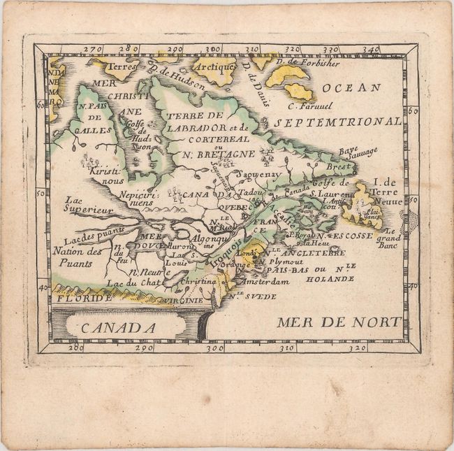
Auction 175, Lot 99
Subject: Colonial Northeast United States & Canada
Duval/Beer
Canada, 1661
Size: 4.8 x 3.8 inches (12.2 x 9.7 cm)
Estimate: $475 - $600
Sold for: $400
Closed on 11/13/2019
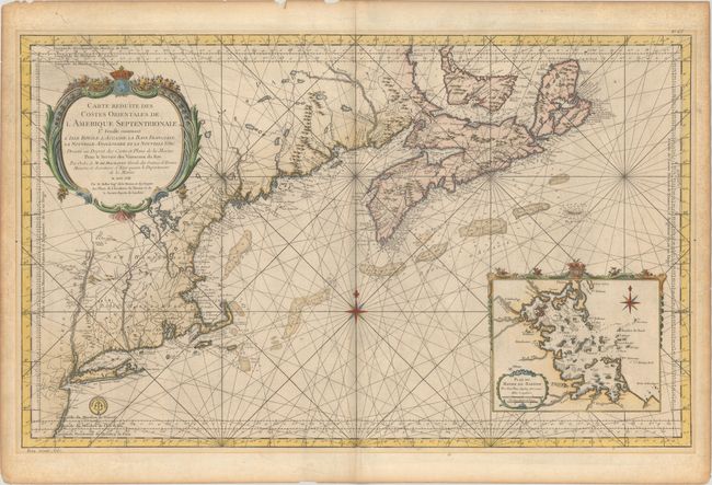
Auction 175, Lot 100
Subject: Colonial Northeastern United States & Canada
Bellin, Jacques Nicolas
Carte Reduite des Costes Orientales de l'Amerique Septentrionale 1re Feuille Contenant l'Isle Royale, l'Accadie, la Baye Francoise, la Nouvelle Angleterre et la Nouvelle Yorc..., 1757
Size: 34.9 x 21.5 inches (88.6 x 54.6 cm)
Estimate: $1,900 - $2,200
Scarce Large-Scale Chart of the Coast of New England
Unsold
Closed on 11/13/2019
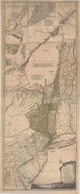
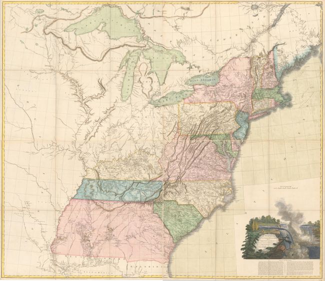
Auction 175, Lot 101
Subject: Colonial Northeast United States & Quebec
Holland/Pownal
The Provinces of New York, and New Jersey; with Part of Pensilvania, and the Province of Quebec..., 1777
Size: 20.3 x 52 inches (51.6 x 132.1 cm)
Estimate: $3,500 - $4,500
Rare German Edition of an Important Revolutionary War Period Map
Sold for: $2,300
Closed on 11/13/2019
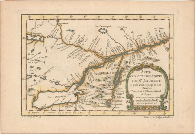
Auction 175, Lot 102
Subject: Colonial Lake Ontario & St. Lawrence River
Bellin, Jacques Nicolas
Suite du Cours du Fleuve de St. Laurent, Depuis Quebec Jusqu au Lac Ontario. Pour Servir a l'Histoire Generale des Voyages, 1757
Size: 11.3 x 7.5 inches (28.7 x 19.1 cm)
Estimate: $110 - $140
Sold for: $80
Closed on 11/13/2019
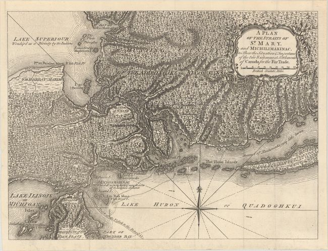
Auction 175, Lot 103
Subject: Colonial Great Lakes
Anon.
A Plan of the Straits of St. Mary, and Michilimakinac, to Shew the Situation & Importance of the Two Westernmost Settlements of Canada for the Fur Trade, 1761
Size: 12.8 x 9.4 inches (32.5 x 23.9 cm)
Estimate: $450 - $550
Sold for: $475
Closed on 11/13/2019
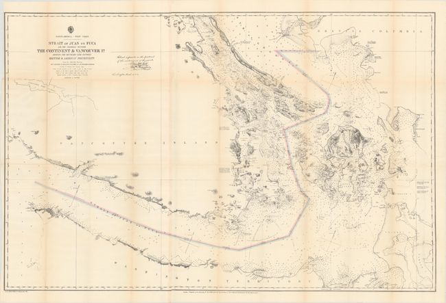
Auction 175, Lot 104
Subject: Washington & British Columbia
U.S. Hydrographic Office
Strait of Juan de Fuca and the Channels Between the Continent & Vancouver Id. Showing the Boundary Line Between British & American Possessions, 1872
Size: 44.3 x 28.8 inches (112.5 x 73.2 cm)
Estimate: $400 - $475
Sold for: $325
Closed on 11/13/2019
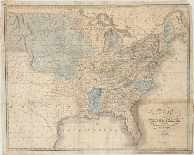
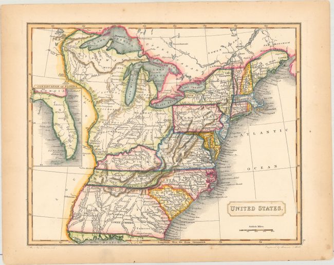
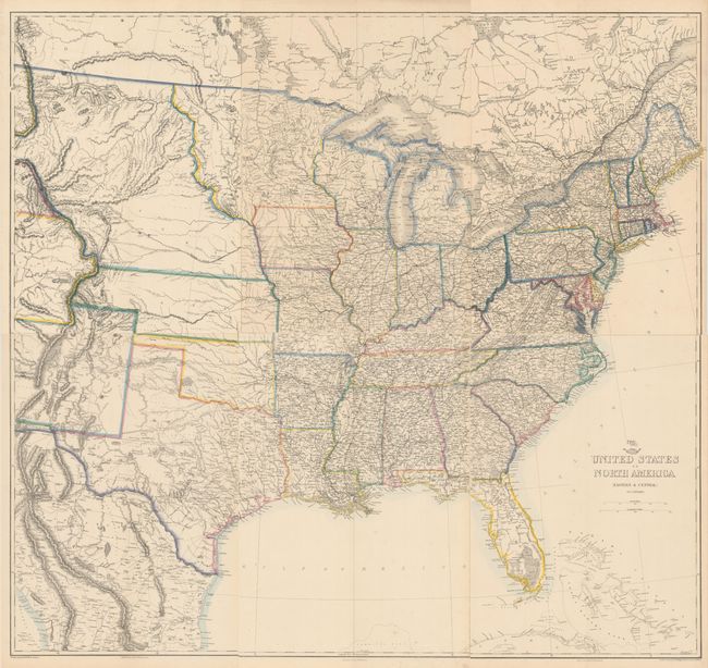
Auction 175, Lot 105
Subject: United States
Map of the United States Drawn from the Most Approved Surveys, 1826
Size: 20.4 x 16.3 inches (51.8 x 41.4 cm)
Estimate: $600 - $750
Sold for: $375
Closed on 11/13/2019
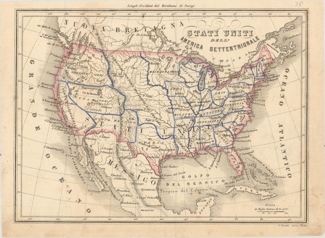
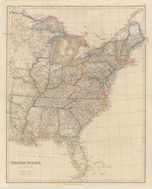
Auction 175, Lot 106
Subject: United States
Stati Uniti dell' America Settentrionale, 1858
Size: 9.9 x 7.2 inches (25.1 x 18.3 cm)
Estimate: $90 - $120
NO RESERVE
Sold for: $110
Closed on 11/13/2019
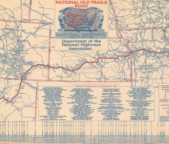
Auction 175, Lot 107
Subject: United States
Map of the National Old Trails Road Grand Canyon Route Open 365 Days in the Year Thru the Heart of America..., 1924
Size: 32.9 x 8.9 inches (83.6 x 22.6 cm)
Estimate: $160 - $190
Sold for: $100
Closed on 11/13/2019
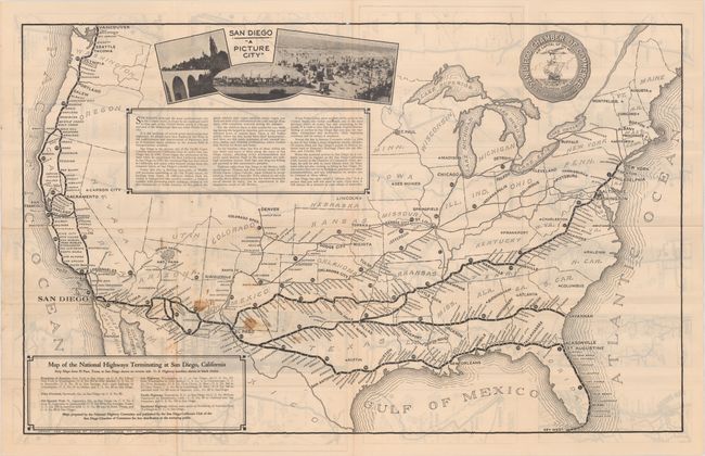
Auction 175, Lot 108
Subject: United States; San Diego, California
Map of the National Highways Terminating at San Diego, California - Strip Maps from El Paso, Texas, to San Diego Shown on Reverse Side..., 1929
Size: 31.9 x 19.9 inches (81 x 50.5 cm)
Estimate: $100 - $130
Sold for: $130
Closed on 11/13/2019
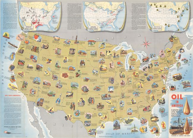
Auction 175, Lot 109
Subject: United States, Oil
Oil in America - A Pictorial Story of the Petroleum Industry in the United States, 1957
Size: 33.5 x 24 inches (85.1 x 61 cm)
Estimate: $180 - $220
Sold for: $500
Closed on 11/13/2019
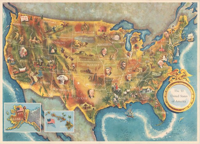
Auction 175, Lot 110
Subject: United States, Presidential Elections
The 50 United States of America, 1960
Size: 24.9 x 17.9 inches (63.2 x 45.5 cm)
Estimate: $250 - $325
1960 Election Map of the United States
Sold for: $180
Closed on 11/13/2019
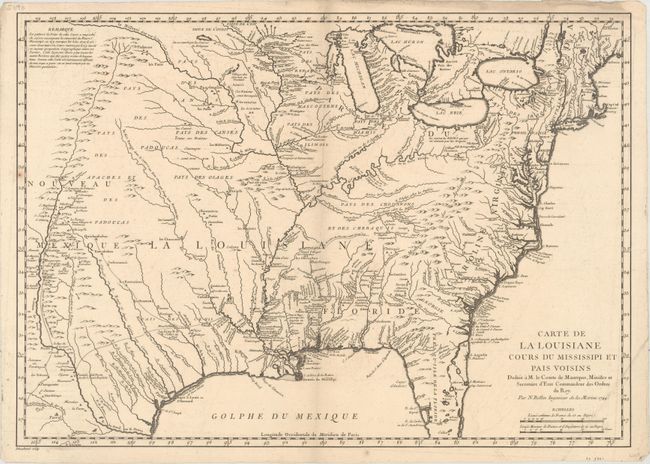
Auction 175, Lot 111
Subject: Colonial Eastern United States
Bellin, Jacques Nicolas
Carte de la Louisiane Cours du Mississipi et Pais Voisins..., 1744
Size: 21.9 x 15.4 inches (55.6 x 39.1 cm)
Estimate: $900 - $1,100
Sold for: $500
Closed on 11/13/2019
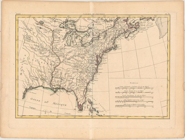
Auction 175, Lot 112
Subject: Colonial Eastern United States
Bonne/Lattre
[Partie de l'Amerique Septentrionale, Qui Comprend le Canada, la Louisiane, le Labrador…] Canada IIe. Feuille, 1770
Size: 17.1 x 11.6 inches (43.4 x 29.5 cm)
Estimate: $250 - $325
Sold for: $150
Closed on 11/13/2019
Auction 175, Lot 113
Subject: Eastern United States
Conder, Thomas
The United States of America, 1788
Size: 11.8 x 11.3 inches (30 x 28.7 cm)
Estimate: $400 - $475
Sold for: $250
Closed on 11/13/2019
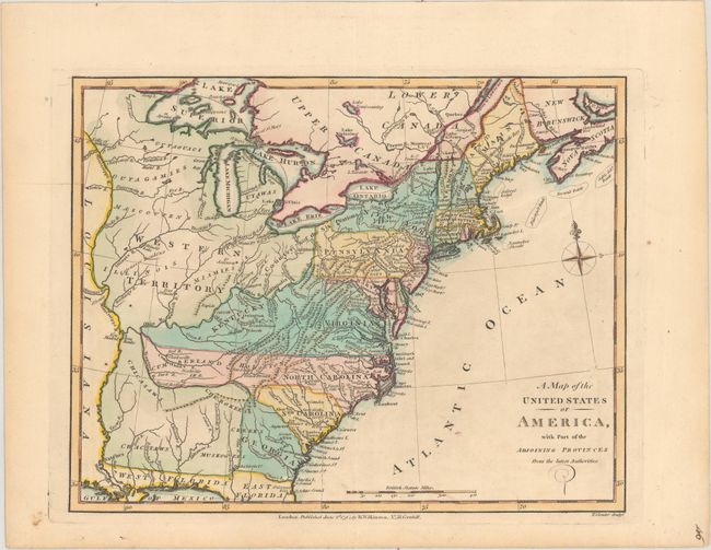
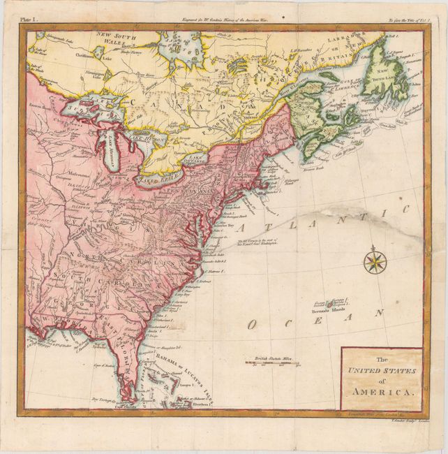
Auction 175, Lot 114
Subject: Eastern United States
Wilkinson, Robert
A Map of the United States of America, with Part of the Adjoining Provinces from the Latest Authorities, 1794
Size: 10.8 x 8.4 inches (27.4 x 21.3 cm)
Estimate: $220 - $250
Sold for: $275
Closed on 11/13/2019
Auction 175, Lot 115
Subject: Eastern United States
Arrowsmith, Aaron, Sr.
[On 4 Sheets] A Map of the United States of North America Drawn from a Number of Critical Researches, 1802
Size: 27.8 x 24.3 inches (70.6 x 61.7 cm)
Estimate: $8,000 - $10,000
Arrowsmith's Large-Format Map Used by Lewis & Clark
Sold for: $5,500
Closed on 11/13/2019
Auction 175, Lot 116
Subject: Eastern United States
Arrowsmith, Aaron, Sr.
United States, 1823
Size: 10.1 x 8.2 inches (25.7 x 20.8 cm)
Estimate: $250 - $325
Sold for: $220
Closed on 11/13/2019
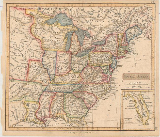
Auction 175, Lot 117
Subject: Eastern United States
Arrowsmith, Samuel
United States, 1835
Size: 9.4 x 8 inches (23.9 x 20.3 cm)
Estimate: $200 - $230
Sold for: $180
Closed on 11/13/2019
Auction 175, Lot 118
Subject: Eastern United States
Arrowsmith, John
United States, 1858
Size: 19.7 x 23.6 inches (50 x 59.9 cm)
Estimate: $140 - $170
Sold for: $100
Closed on 11/13/2019
Auction 175, Lot 119
Subject: Eastern United States
Ettling, Theodor
[On 6 Sheets] United States of North America (Eastern & Central), 1863
Size: 12 x 16.8 inches (30.5 x 42.7 cm)
Estimate: $275 - $350
Sold for: $400
Closed on 11/13/2019
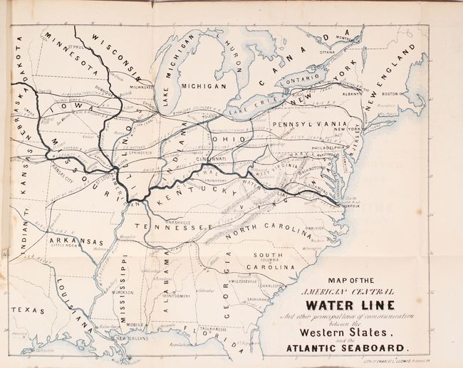
Auction 175, Lot 120
Subject: Eastern United States
Map of the American Central Water Line and Other Principal Lines of Communication Between the Western States, and the Atlantic Seaboard [bound in] The Central Water-Line from the Ohio River to the Virginia Capes..., 1869
Size: 13.5 x 10.9 inches (34.3 x 27.7 cm)
Estimate: $200 - $230
Sold for: $100
Closed on 11/13/2019
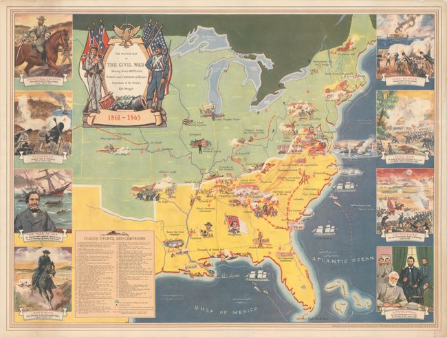
Auction 175, Lot 121
Subject: Eastern United States, Civil War
The Picture Map of the Civil War Showing Nearly 100 Places, Events and Campaigns of Decisive Importance in the Nation's Epic Struggle, 1956
Size: 29.7 x 22 inches (75.4 x 55.9 cm)
Estimate: $140 - $170
Sold for: $100
Closed on 11/13/2019
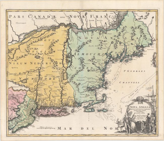
Auction 175, Lot 122
Subject: Colonial New England & Mid-Atlantic United States
Homann, Johann Baptist
Nova Anglia Septentrionali Americae Implantata Anglorumque Coloniis Florentissima Geographice Exhibita, 1730
Size: 22.9 x 19.2 inches (58.2 x 48.8 cm)
Estimate: $950 - $1,200
Sold for: $800
Closed on 11/13/2019
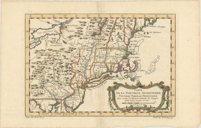
Auction 175, Lot 123
Subject: Colonial New England & Mid-Atlantic United States
Bellin, Jacques Nicolas
Carte de la Nouvelle Angleterre, Nouvelle Yorck, et Pensilvanie. Pour Servir a l'Histoire Generale des Voyages, 1757
Size: 11.8 x 8.1 inches (30 x 20.6 cm)
Estimate: $200 - $230
Sold for: $230
Closed on 11/13/2019
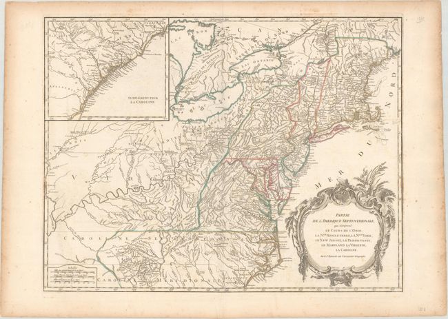
Auction 175, Lot 124
Subject: Colonial New England & Mid-Atlantic United States
Robert de Vaugondy
Partie de l'Amerique Septentrionale, qui Comprend le Cours de l'Ohio, la Nlle. Angleterre, la Nlle York, le New Jersey, la Pensylvanie, le Maryland la Virginie, la Caroline, 1788
Size: 24.4 x 18.8 inches (62 x 47.8 cm)
Estimate: $475 - $600
Sold for: $350
Closed on 11/13/2019
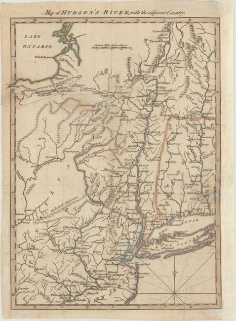
Auction 175, Lot 125
Subject: Colonial New England United States, Revolutionary War
Anon.
Map of Hudson's River, with the Adjacent Country, 1778
Size: 8.5 x 11.5 inches (21.6 x 29.2 cm)
Estimate: $200 - $230
Unsold
Closed on 11/13/2019
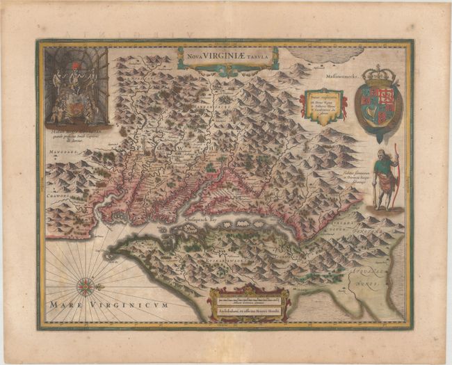
Auction 175, Lot 126
Subject: Colonial Mid-Atlantic United States
Hondius, Henricus
Nova Virginiae Tabula, 1647
Size: 19.4 x 15 inches (49.3 x 38.1 cm)
Estimate: $1,400 - $1,700
One of the Most Important 17th Century Maps of the Chesapeake Bay in Full Contemporary Color
Sold for: $900
Closed on 11/13/2019
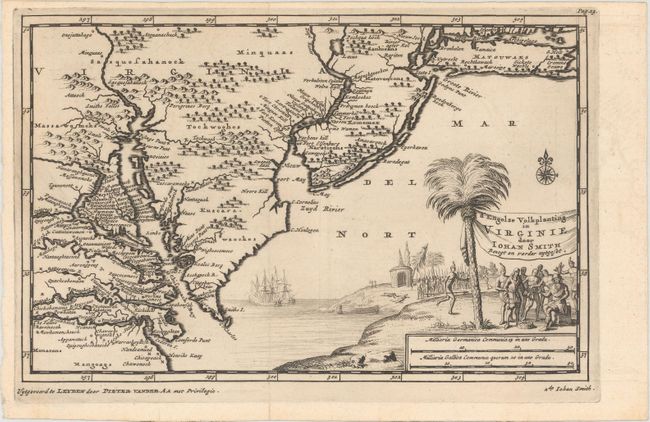
Auction 175, Lot 127
Subject: Colonial Mid-Atlantic United States
Aa, Pieter van der
D' Engelze Volkplanting in Virginie door Iohan Smith Bezogt en Verder Uytgeset, 1706
Size: 9.2 x 5.9 inches (23.4 x 15 cm)
Estimate: $600 - $750
Sold for: $500
Closed on 11/13/2019
Auction 175, Lot 128
Subject: Colonial Mid-Atlantic United States
Bellin, Jacques Nicolas
Carte de la Virginie, de la Baye Chesapeack, et Pays Voisins pour Servir a l'Histoire Generale des Voyages..., 1758
Size: 11.3 x 7.5 inches (28.7 x 19.1 cm)
Estimate: $275 - $350
Sold for: $230
Closed on 11/13/2019
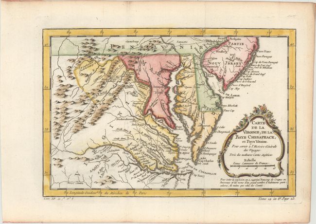
Auction 175, Lot 129
Subject: Colonial Mid-Atlantic United States
Laporte, Joseph de
Carte de la Virginie et du Mariland, 1770
Size: 8.6 x 7 inches (21.8 x 17.8 cm)
Estimate: $200 - $230
Sold for: $100
Closed on 11/13/2019
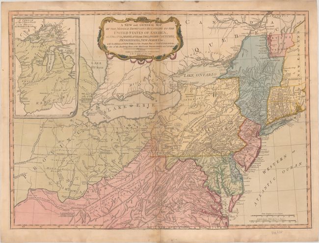
Auction 175, Lot 130
Subject: Mid-Atlantic United States
Laurie & Whittle
A New and General Map of the Middle Dominions Belonging to the United States of America, viz. Virginia, Maryland, the Delaware-Counties, Pennsylvania, New Jersey &c. with the Addition of New York, & of the Greatest Part of New England…, 1794
Size: 26 x 18.8 inches (66 x 47.8 cm)
Estimate: $900 - $1,100
Laurie & Whittle's Popular Map Depicting the "New" United States
Sold for: $650
Closed on 11/13/2019
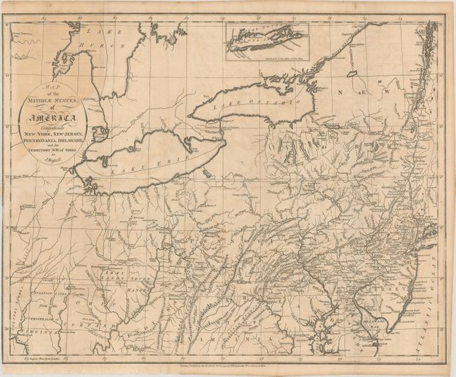
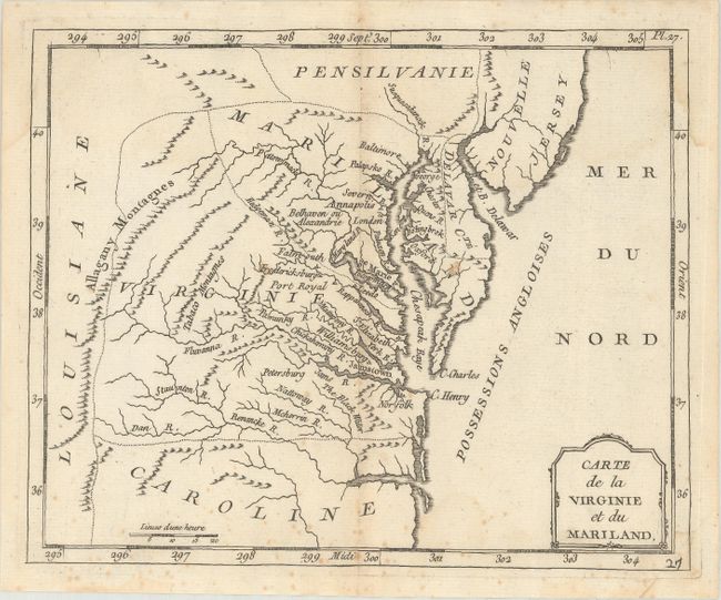
Auction 175, Lot 131
Subject: Mid-Atlantic United States
Russell, John C.
Map of the Middle States, of America. Comprehends New-York, New-Jersey, Pennsylvania, Delaware, and the Territory N:W: of Ohio, 1794
Size: 18.1 x 14.3 inches (46 x 36.3 cm)
Estimate: $200 - $240
Sold for: $180
Closed on 11/13/2019
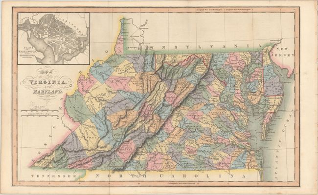
Auction 175, Lot 132
Subject: Mid-Atlantic United States
Hinton, Simpkin & Marshall
Map of the States of Virginia, and Maryland, 1831
Size: 15.5 x 9.8 inches (39.4 x 24.9 cm)
Estimate: $150 - $180
Sold for: $140
Closed on 11/13/2019
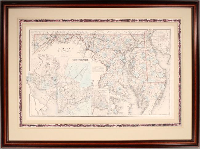
Auction 175, Lot 133
Subject: Mid-Atlantic United States
Gray, Frank
Maryland Delaware and the District of Columbia, 1876
Size: 26.3 x 15.7 inches (66.8 x 39.9 cm)
Estimate: $140 - $170
Unsold
Closed on 11/13/2019
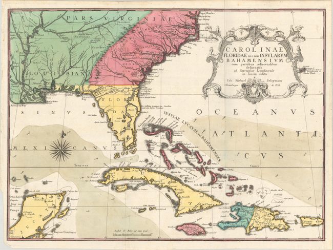
Auction 175, Lot 134
Subject: Colonial Southeast United States, Bahamas & Greater Antilles
Seligmann, Johann Michael
Carolinae Floridae nec non Insularum Bahamensium cum Partibus Adjacendibus Delineatio ad Exemplar Londinense in Lucem Edita, 1755
Size: 23.1 x 16.8 inches (58.7 x 42.7 cm)
Estimate: $4,000 - $5,000
German Edition of Catesby's Scarce and Important Map of the Southeastern United States
Sold for: $2,600
Closed on 11/13/2019
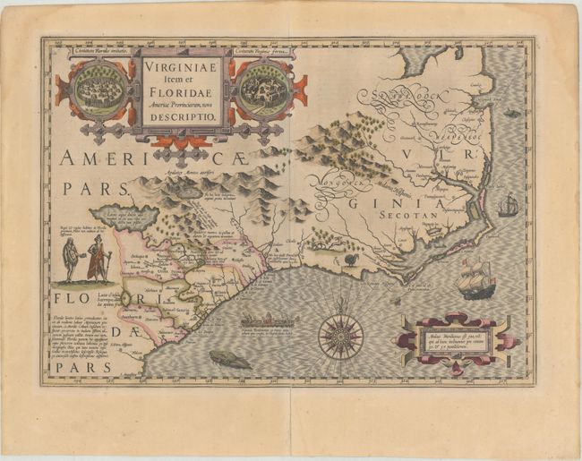
Auction 175, Lot 135
Subject: Colonial Southeast United States
Hondius, Jodocus
Virginiae Item et Floridae Americae Provinciarum, Nova Descriptio, 1623
Size: 19 x 13.4 inches (48.3 x 34 cm)
Estimate: $1,700 - $2,000
A Seminal Map of the Southeast and Early American Cartography
Sold for: $1,200
Closed on 11/13/2019
171 lots
Page 1 of 4