Subject: New York City, New York
Period: 1921 (published)
Publication:
Color: Printed Color
Size:
7.3 x 10.3 inches
18.5 x 26.2 cm
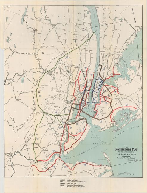
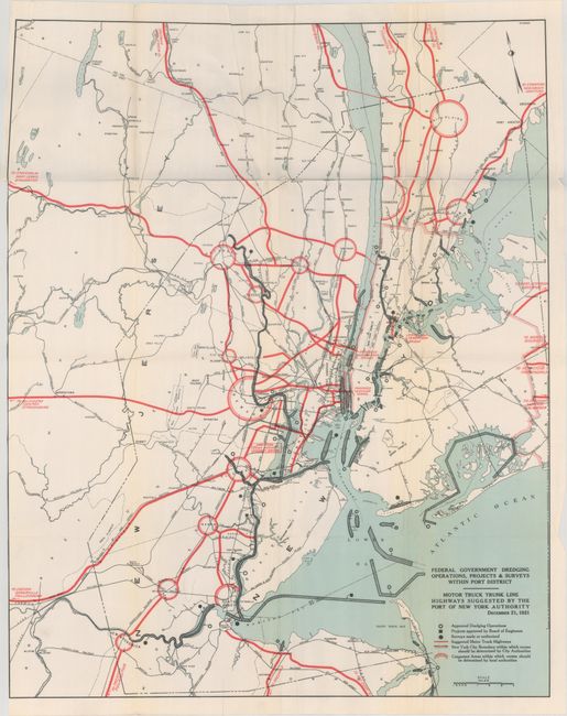
This is the original report and plan of the Port of New York Authority printed by J.B. Lyon in Albany. Difficulty in embarking troops from the congested New York City ports during World War I led to the establishment of the Port of New York Authority with early support from the federal government and the states of New York and New Jersey. This ambitious model under the Interstate Compact provisions of the Constitution was the first such agency established in the U.S. By most accounts the Port Authority succeeded in rationalizing the complex transportation infrastructure of the nation’s largest city and much of this original plan was carried out. Included within the 56 pages of text are 9 folding maps including the following large maps:
The Comprehensive Plan for the Development of the Port District (28.0 x 22.3"). Map of the greater New York City region that is color-coded to show the various types of transportation projects under the Port Authority.
Federal Government Dredging Operations, Projects & Surveys Within Port District (28.0 x 22.3"). Shows the “proposed” Triboro and Hudson River bridges and a proposed vehicular tunnel that became the Holland Tunnel.
Quarto, original printed paper wrappers now bound in library boards.
References:
Condition: B+
The large folding maps (loose) have a few minor fold separations, otherwise near fine. Text and other folding maps are also very good with a hint of light toning. The rear endpaper is loose and the rear wrapper is not present. Deaccession stamp on the front pastedown. Binding is a little loose and the covers have light wear.