Subject: Holy Land
Period: 1700 (published)
Publication:
Color: Hand Color
Size:
11.8 x 18 inches
30 x 45.7 cm
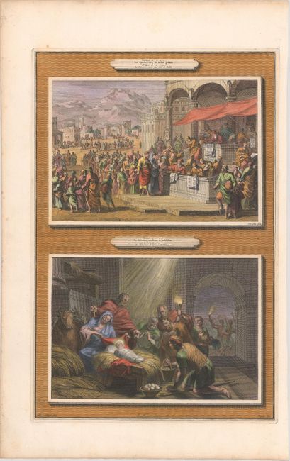
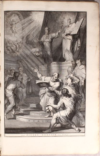
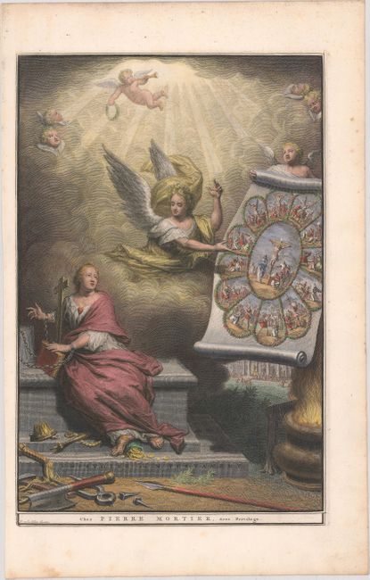
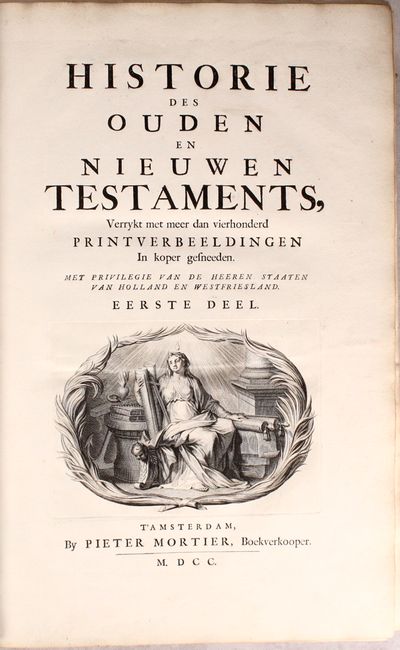
This is a two-volume Dutch history of the Bible covering the Old and New Testament, published by Pierre Mortier. There are 216 plates interspersed within the text, including elaborate frontispieces for each volume, hundreds of biblical scenes (as each plate includes two), and portraits of Matthew, Mark, Luke and John with engraved frames. Accompanying the text in Volume II are five maps depicting the regions described in the text, including:
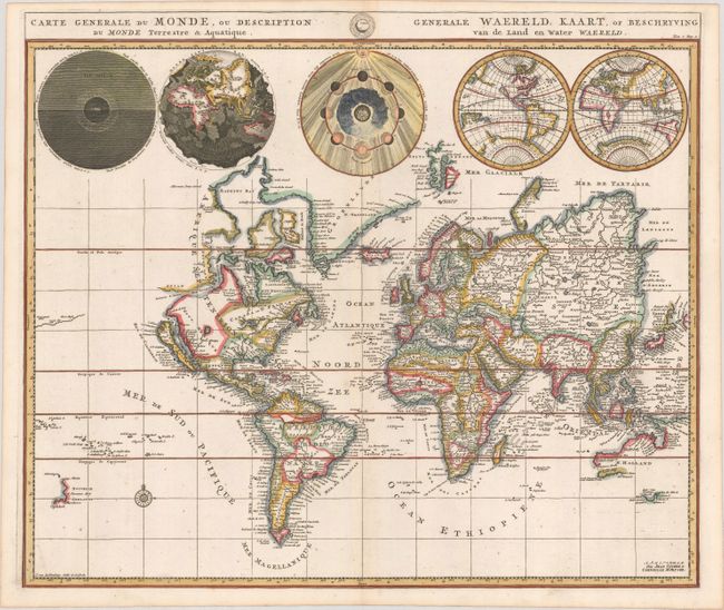
Carte Generale du Monde, ou Description du Monde Terrestre & Aquatique. This unique world map drawn on Mercator's projection depicts California as an island and the Detroit d'Anian connected by dotted lines through the Northwest Passage to Button's Bay located to the west of Hudson Bay. There is an erroneous large lake shown as the source for the Rio Norte (Rio Grande River) located in the Southwest, as well as an early, open-ended version of the Great Lakes named Mer Douce. A small coastline of New Zealand appears in the Pacific. The northeast coast of Asia is severely truncated and shows Witsen's Cap de Glaces. Australia's northern coast is shown connected to New Guinea, and two disjointed coastlines appear to the south, including Van Diemen's Land. The most interesting features of the map are the five spheres presented along the top depicting day and night, the flood, the phases of the moon, and the Western and Eastern Hemispheres. The map was precisely engraved by Jan van Luchenburg (imprint at lower left).
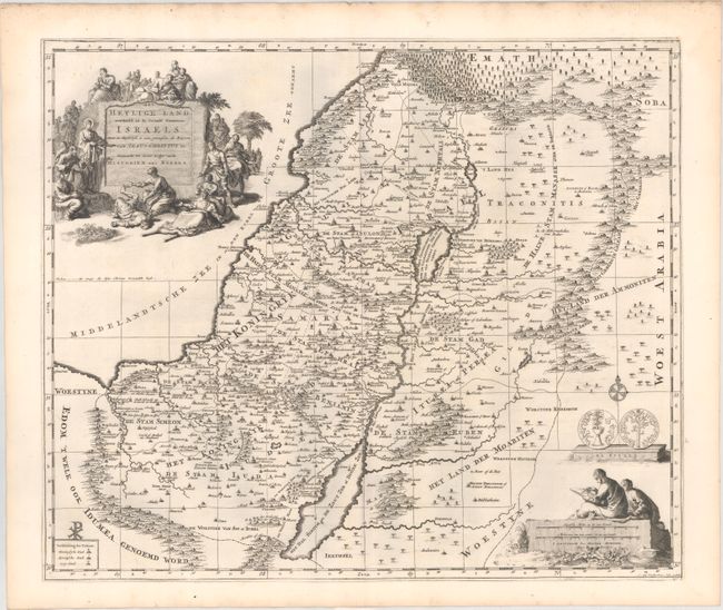
Het Heylige Land Verdeeld in de Twaalf Stammen Israels. This decorative map of present-day Israel, Lebanon and Jordan is fully engraved with mountains, towns, forests and notations of important Biblical sites. It shows both the divisions in the Twelve Tribes of Israel and the regions in Christ's time. The pictorial title cartouche depicts Jesus healing the sick and a scale of miles cartouche portrays two scholars. Also included is a depiction of a Jerusalem Shekel from the First Jewish Revolt against Rome. Engraved by Jan van Luchetenburg.
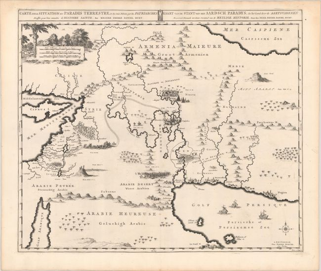
Carte de la Situation du Paradis Terrestre, Et des Pais Habitez par les Patriarches Dressee pour bien entendre l'Histoire Sainte, Par Messire Pierre Daniel Huet. This interesting map covers the region from the Mediterranean through the Persian Gulf. Detail is omitted in favor of Biblical depictions including the Sermon on the Mount, Babylon, the Garden of Eden, Noah's Ark, Abraham's journey from Ur, and others. Pictorial scale of miles with a lion, lamb, and a serpent in an apple tree. Three tiny ships sail in the Persian gulf with a compass rose. Title is in both French and Dutch in panel at top.
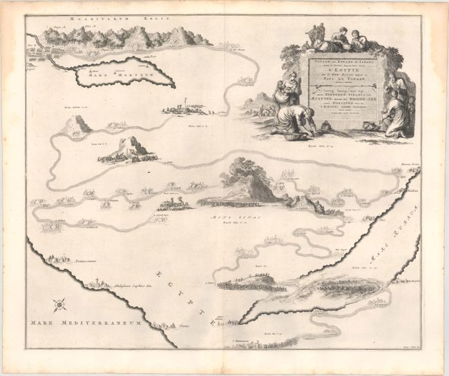
Voyage des Enfans d'Israel dans le Desert Depuis leur Sortie d'Egypte par la Mer Rouge. This interesting pictorial map focuses on the Exodus of the Children of Israel from Egypt to the Promised Land and their wandering in the desert. Mount Sinai is prominent at the center of the map. At top left are the Jordan River and the Mare Mortuum (Dead Sea) and at bottom right is a graphic scene of the pursuing Egyptians being swallowed in the Red Sea following the successful escape of the Hebrews. Numerous place names and biblical references fill the map which is decorated with a large title cartouche depicting women gathering the Manna.
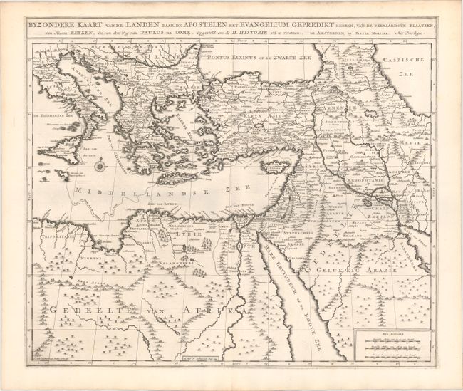
Byzondere Kaart van de Landen Daar de Apostelen Het Evangelium Gepredikt Hebben.... This expansive engraved map of the eastern Mediterranean and the Middle East features the tract of St. Paul from Jerusalem to Rome. The map is filled with mountains, forests, and oases, and is decorated with a compass rose.
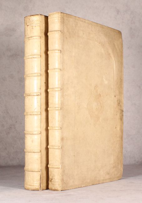
Vol. I: 282 pp.; Vol. II: 163 pp. Hardbound in full vellum with embossed decorations on covers and raised bands on spine.
References: Shirley #622; Laor #507, #508 and cf. #224.
Condition: A
Condition code is for the maps and engravings, which are clean and bright with sharp impressions. Although the majority of the maps and engravings remain in black and white, the world map, the frontispiece to Volume II, and 21 plates have been removed and hand colored. As a result, these leaves, in addition to the remaining four maps and a dozen or so other leaves are loosely inserted in the volumes in their correct places. The world map appears to be from a different example. The text is also clean and bright, with only minor occasional soiling and a couple of pages with short marginal tears that have been closed with cello tape. The bindings are sound and the covers show light wear and soiling. A lovely set with beautiful plates ready to be framed.