Subject: Exploration & Surveys
Period: 1748 (published)
Publication:
Color: Black & White
Size:
5.1 x 8.1 inches
13 x 20.6 cm
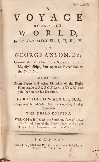
This is the third edition of Anson's famous work describing his voyage around the world. The narrative was very popular and went through at least fifteen editions through the 1780s. This ocatvo edition includes the same folding maps as the quarto edition, but lacks the additional engraved plates.
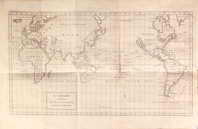
In 1740, George Anson set sail in command of a squadron sent to attack Spanish possessions and interests in South America. The expedition was ill-equipped and failed to carry out its original ambitious mission. By June 1741 when Anson reached Juan Fernandes, his force had been reduced to only three of the original six ships, while the strength of his crews had fallen from 961 to 335. After launching several attacks on the west coast of South America and recuperating on the island he collected the remaining survivors on his flagship, the Centurion, and set sail in search of one of the richly laden galleons that conducted the trade between Mexico and the Philippines. The indomitable perseverance he had shown during one of the most arduous voyages in the history of sea adventure gained the reward of the capture of an immensely rich prize, the Nuestra Señora de Covadonga, which he encountered off Cape Espiritu Santo on June 20, 1743. From here he sailed back to Canton before traveling through Southeast Asia and around the southern tip of Africa. He made his way back to England, arriving in Spithead in June 1744. Included in the work are the following three folding maps depicting his voyage, all engraved by Richard Seale:
A Chart Shewing The Track of the Centurion Round the World (15.7 x 9"). This chart delineates Anson's world circumnavigation, one of the last great buccaneering voyages. Details in the chart are limited to the immediate region of the voyage leaving continental interiors blank save for large rivers and important cities. California is depicted as an island, a very late depiction of this cartographic error, while Australia is only partially mapped with New Guinea appearing to be connected to the mainland.
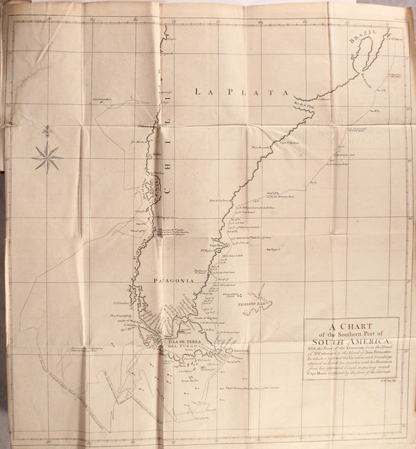
A Chart of the Southern Part of South America... (18.4 x 20"). This handsome chart shows the route of Capt. George Anson's expedition from St. Catherine's Island off the coast of Brazil, around Cape Horn and up to Juan Fernandes Island (now known as Robinson Crusoe Island) off the coast of Chili. The chart shows numerous calculations of water depth, ocean currents, and includes navigational notes. A decorative compass rose with fleur-de-lys is positioned in the sea.
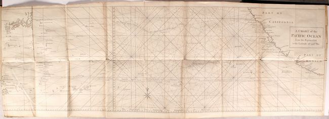
A Chart of the Pacific Ocean from the Equinoctial to the Latitude of 39 ½d. No. (33.5 x 10.7"). This unusual chart joined on two sheets details the route of Spanish galleons between the Philippines and Acapulco. The tracks of British Navy Commodore George Anson and Spanish Nostra Seigniora de Cabadonga are shown. A somewhat speculative depiction of the islands of Japan is shown at top left.
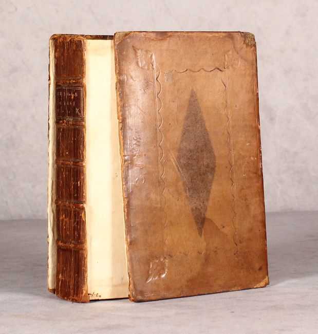
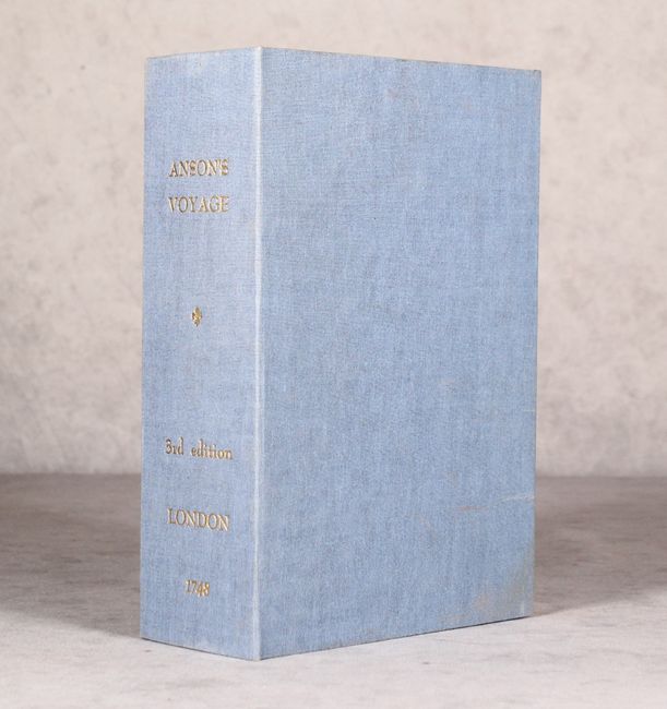
548 pages. Printed for John and Paul Knapton in London. Hardbound in full contemporary leather with raised bands and title label on spine. Housed in a modern blue clamshell case.
References: Shirley (BL Atlases) G.ANS-1a; Mercator's World Nov/Dec 1998 pp. 45-51.
Condition: B
The maps are good to very good with some light offsetting. The map of southern South America has a 3" archivally repaired binding tear at left, and the chart of the Pacific Ocean has a 3" fold separation at bottom and a 5" archivally repaired binding tear at left. Text is very good. Covers are moderately worn and detached, and the spine is cracking. Modern clamshell case is near fine with some minor soiling.