Subject: Atlases
Period: 1787 (dated)
Publication:
Color: Hand Color
Size:
11.6 x 15.4 inches
29.5 x 39.1 cm
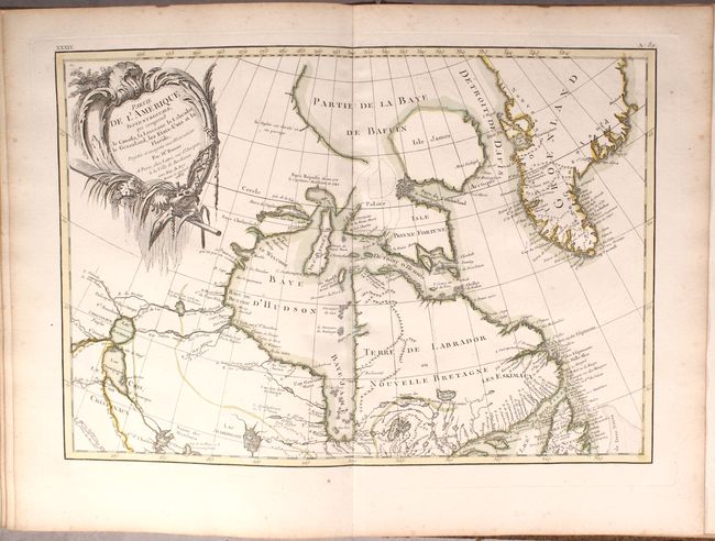
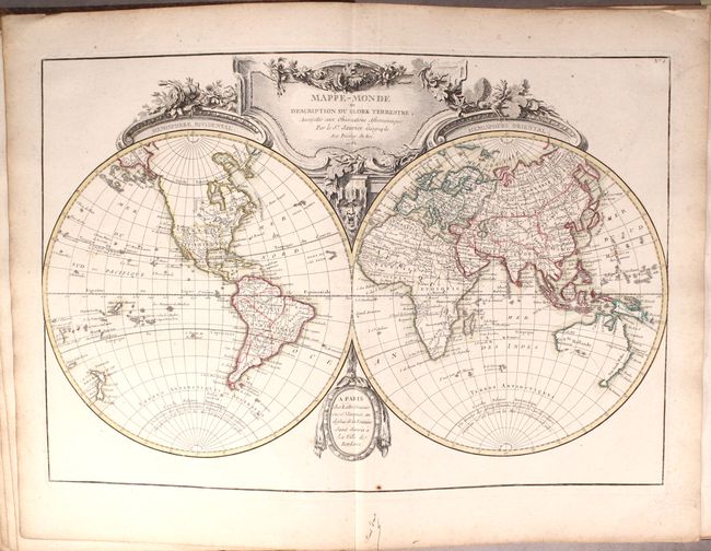
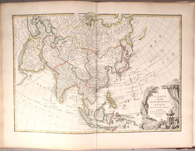
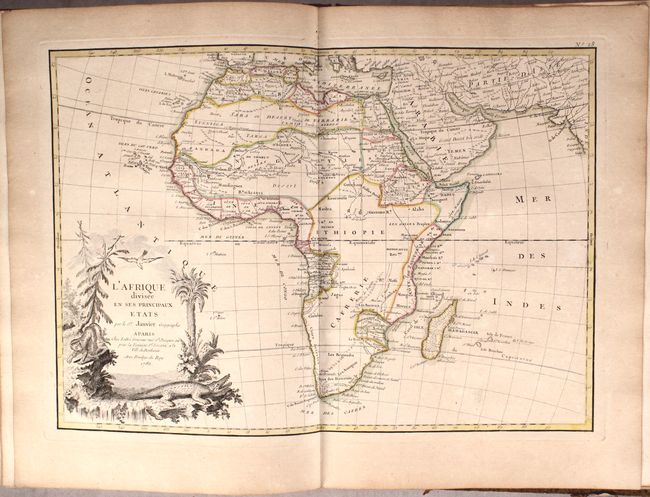
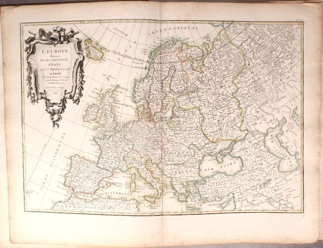
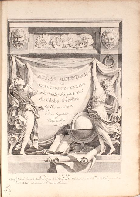
This complete atlas contains 62 maps of all regions around the world on 74 double-page sheets, including several multi-sheet maps. Also included are three additional engravings: a lovely title page; an engraving of terrestrial and celestial globes with armillary spheres based on Copernicus and Ptolemy; and an engraving with several wind roses. The multi-sheet maps are of Portugal, Italy, Germany, Russia, Southern & Southeast Asia, Western Africa, United States & Canada, and the Holy Land. The maps include a world map, 32 maps related to Europe, 13 maps related to Asia, 6 maps related to Africa, 9 maps related to the Americas, and a map of the regions of the New Testament. Most of the maps include an elaborate and superbly engraved title cartouche featuring emblems of the region. Some of the noteworthy maps in this atlas include:
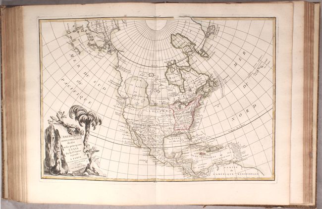
L'Amerique Septentrionale Divisee en ses Principaux Etats. This fascinating map, dated 1782, has been updated from the original edition published in 1762. It still shows the imaginary Sea of the West, however the Northwest Passage from Baffin Bay to the Pacific coast has been eliminated. The gigantic Sea the West, near modern-day Seattle, is connected to the Pacific by the straits of Juan de Fuca and Martin d' Aguilar. New Albion is on the southwest shore of this great inland sea, which inundates virtually all of present-day British Columbia and Alberta. There is not any sign of a recognizable Alaska, however the coastline in the Pacific Northwest has been extended in this edition with a new notation on Vitus Bering's discovery along the coast in 1741. Despite being dated 1782, the map has also been updated to reflect the newly formed United States east of the Mississippi River, with French Louisiana stretching to the Pacific Northwest. Florida is controlled by Spain. Ft. Cenis and Santa Fe are visible within the Spanish territories in the southwest, labeled Nouveau Mexique here. The large, decorative title cartouche, incorporating a palm tree and grape vines, was engraved by Berthault.
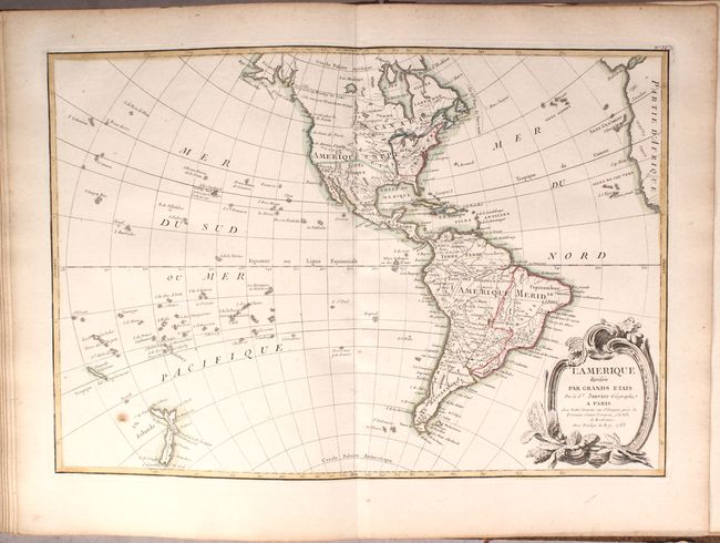
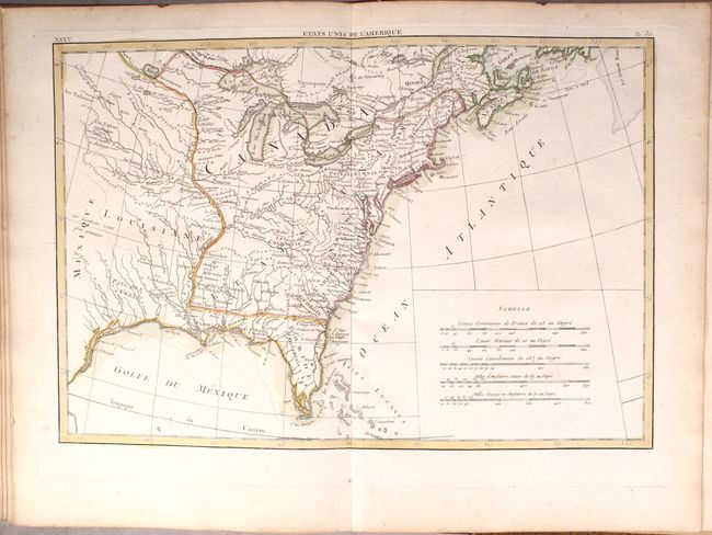
Interestingly, the map of the western hemisphere, L'Amerique Divisee par Grands Etats, is dated 1783 and has been updated to incorporate the new United States, eliminate the Sea of the West, and add a rudimentary outline of Alaska. The multi-sheet map of the United States & Canada also shows the new nation of Etats Unis.
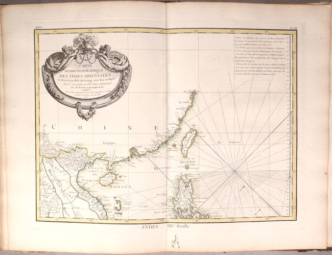
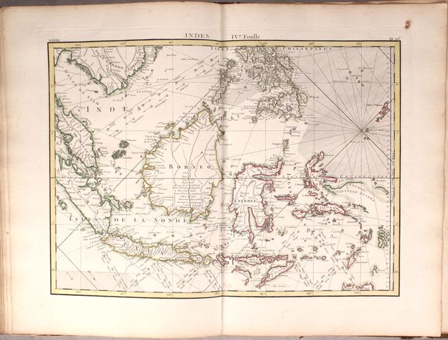
The four-sheet map of Southern and Southeast Asia, Carte Hydro-Geo-Graphique des Indes Orientales en Deca et au Dela du Gange avec leur Archipel, was created by Rigobert Bonne and is dated 1771. This map gives excellent detail from Pakistan to China and as far south as the northern tip of Australia. In particular, this map shows the increase in knowledge of the East Indies, although several islands are still only partially outlined, including New Guinea, Sumba, and Sumbawa.
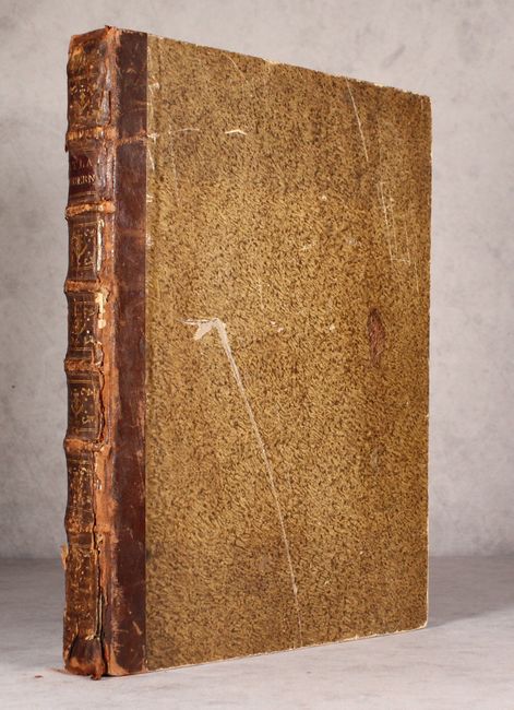
Hardbound in quarter brown leather over paper-covered boards with gilt tooling, titling, and raised bands on spine.
References:
Condition:
The maps all have contemporary color, with the majority in near fine (A) condition. About a third of the maps are in very good (B+) condition with occasional toning, foxing, and soiling. There are faint damp stains confined to the blank margins on the last 8 maps. The hinges are starting and the front cover is beginning to come loose at bottom. The covers are moderately soiled and scuffed and the spine has numerous cracks and chips.