Subject: Atlases, Railroads
Period: 1875 (published)
Publication:
Color: Hand Color
Size:
14.8 x 18.4 inches
37.6 x 46.7 cm
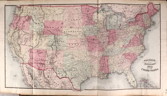
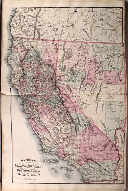
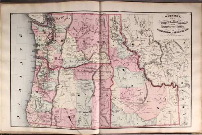
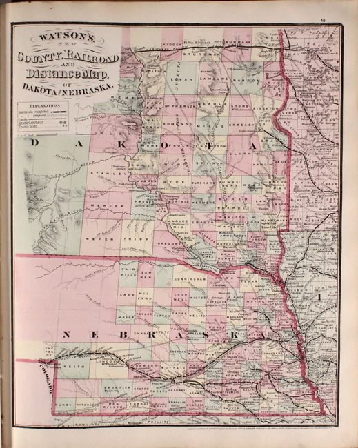
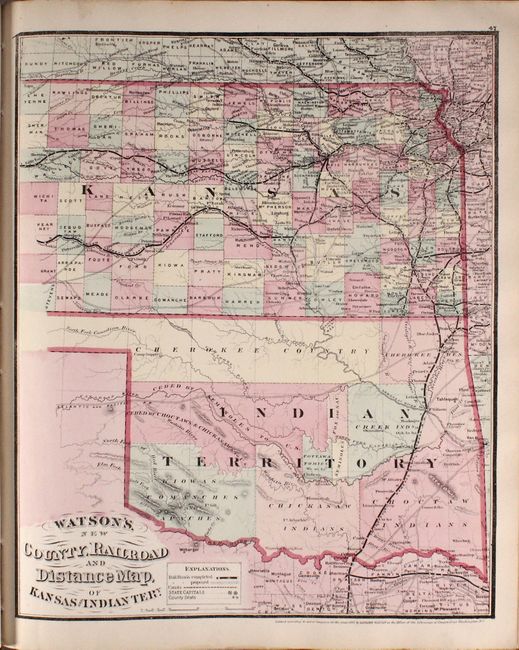
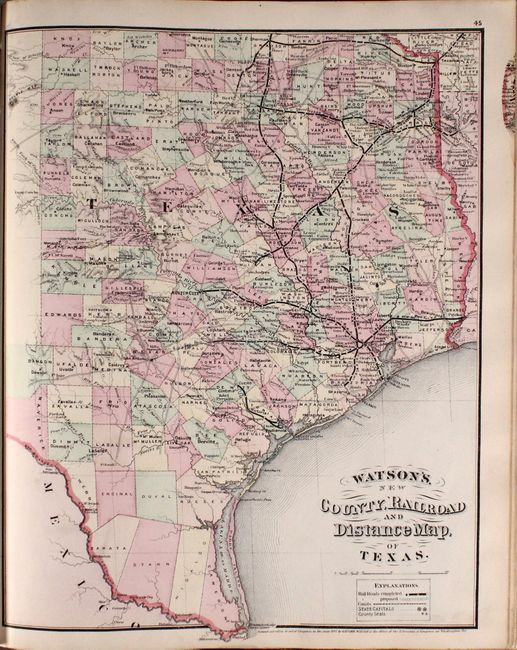
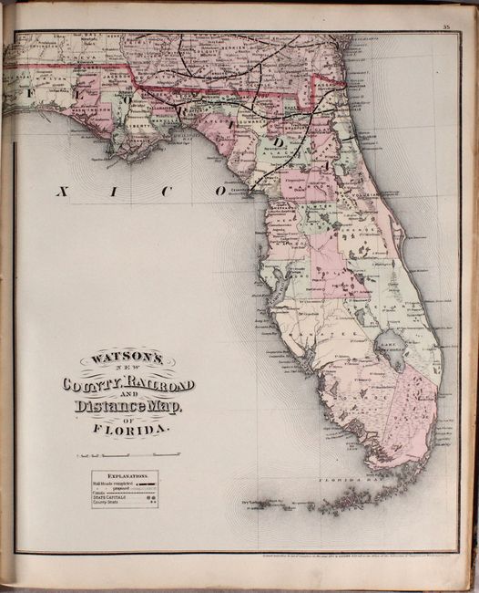
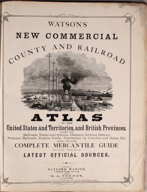
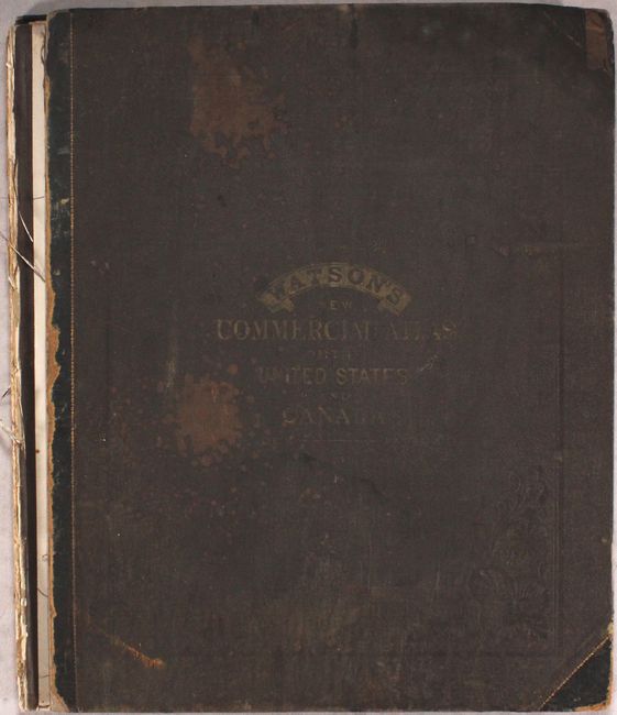
This atlas is complete with 17 single-page, 10 double-page, and one large folding map of the United States. The emphasis on the maps is the transportation network, with existing railroads, proposed railroads, and canals filling the maps. The large U.S. map (30 x 17") was produced just six years after the first transcontinental railroad was opened. It delineates the Oregon Route, the Proposed Pacific Rail Road Route through the Southwest from Indian Territory to California, numerous military and exploration routes, and much more. The atlas also includes a nice double-page map of California, and single-page maps of Texas, Indian Territory, and Dakota/Nebraska. The atlas is inscribed “G.H. Foster Esq Compliments of G. Watson.” The G.H. Foster may have been George H. Foster, a prominent shoe merchant in Chicago at the time this atlas was published. 106 pages. Hardbound (disbound) in quarter leather with tips over gilt-stamped brown cloth. No dealer prices or auction records found for this New York edition in the last 30 years.
References: cf. Phillips (A) #1392.
Condition: B+
The maps are clean, bright, and near fine with some minor dampstains in the margins. The two exceptions are the folding U.S. map that has a long fold separation archivally repaired on verso, and the map of SC/GA/AL that has a long edge tear repaired with old tape. The spine has perished and the boards have detached, which are also stained and worn. Given the favorable condition of the maps, this is an excellent candidate for professional rebinding.