Subject: References, Texas
Period: 1989-99 (published)
Publication:
Color:
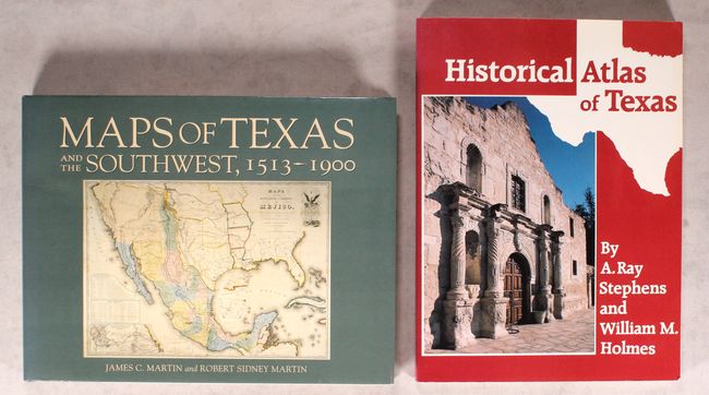
A. Maps of Texas and the Southwest, 1513-1900, by James C. Martin and Robert Sidney Martin, published 1999, printed color (12.1 x 9.4"). The fifty maps collected for this volume represent many of the historically significant maps of Texas and the Southwest from 1513 to 1900. The book is beautifully illustrated with 67 plates, 17 of them in color, many with detailed descriptions. 174pp., 4to, hardbound in beige cloth with leather spine, with illustrated dust jacket in protective sleeve. Condition: Like new with negligible wear to the dust jacket. (A+)
B. Historical Atlas of Texas, by A. Ray Stephens and William M. Holmes, published 1989, black & white (8.9 x 12.0"). This interesting book illustrates the history of Texas with a variety of original maps. Texas Indians, La Salle in Texas, the Zebulon Pike expedition, the Fredonian Republic, the Alamo, the American-Mexican War, the Secession Movement, cattle trails, Texas railroads, and modern Texas are among the 64 topics covered in this historical atlas. Published by the University of Oklahoma Press. Soft illustrated covers. Condition: Minor shelf wear to the covers, otherwise near fine. (A)
References:
Condition:
See description above.