Filtered by Category:Canada(Show All Categories)
Showing results for:Auction 175
Catalog Archive
26 lots
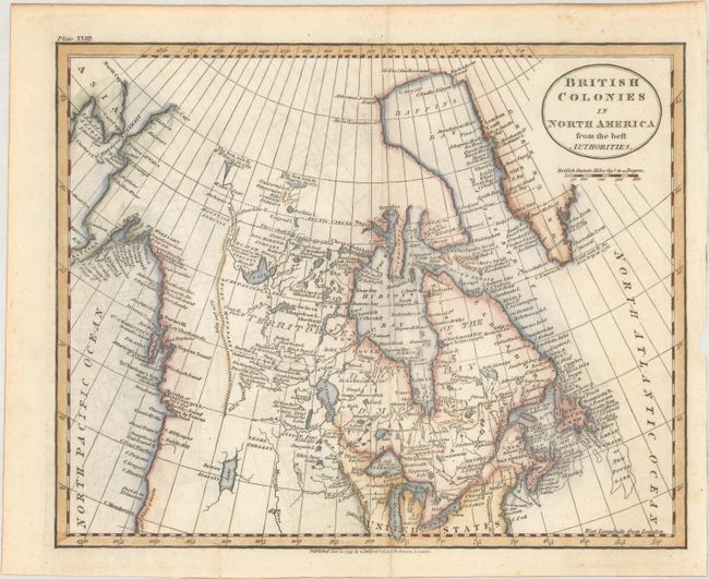
Auction 175, Lot 79
Subject: Canada & Alaska
Guthrie, William
British Colonies in North America from the Best Authorities, 1797
Size: 8.9 x 7.2 inches (22.6 x 18.3 cm)
Estimate: $140 - $170
Sold for: $100
Closed on 11/13/2019
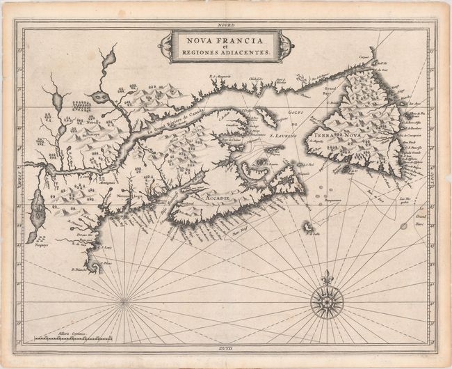
Auction 175, Lot 80
Subject: Eastern Canada
de Laet, Joannes
Nova Francia et Regiones Adiacentes, 1630
Size: 14 x 11 inches (35.6 x 27.9 cm)
Estimate: $1,200 - $1,500
First Accurate Depiction of Prince Edward Island
Sold for: $900
Closed on 11/13/2019
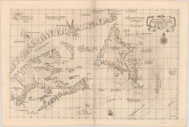
Auction 175, Lot 81
Subject: Eastern Canada
Dudley, Robert (Sir)
Carta Particolare della Terra Nuova con la Gran Baia et il Fiume Grande della Canida ... D'America Car.a Prima, 1647
Size: 29.3 x 19.1 inches (74.4 x 48.5 cm)
Estimate: $3,500 - $4,500
First Printed Sea Chart of the Gulf of St. Lawrence
Sold for: $2,500
Closed on 11/13/2019
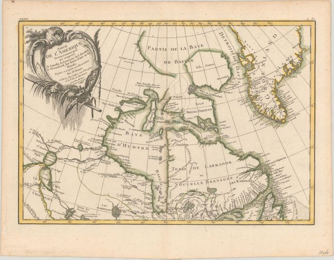
Auction 175, Lot 82
Subject: Eastern Canada, Greenland
Bonne/Lattre
Partie de l'Amerique Septentrionale, qui Comprend le Canada, la Louisiane le Labrador, le Groenland, les Etats-Unis et la Floride. Projettee et Assujettie aux Observations, 1783
Size: 17.1 x 11.8 inches (43.4 x 30 cm)
Estimate: $160 - $190
Sold for: $120
Closed on 11/13/2019
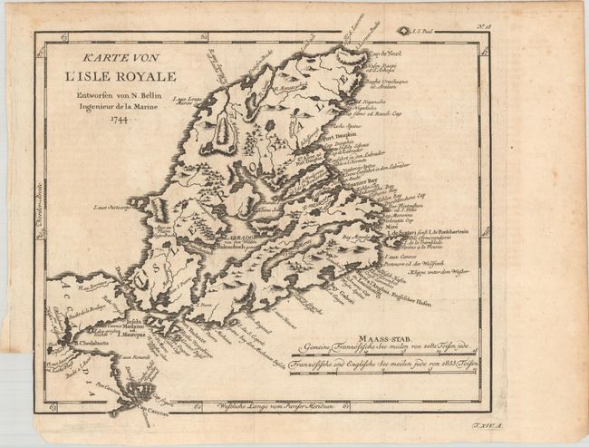
Auction 175, Lot 83
Subject: Cape Breton Island, Canada
Bellin, Jacques Nicolas
Karte von l'Isle Royale..., 1744
Size: 10.6 x 9.6 inches (26.9 x 24.4 cm)
Estimate: $100 - $130
Sold for: $75
Closed on 11/13/2019
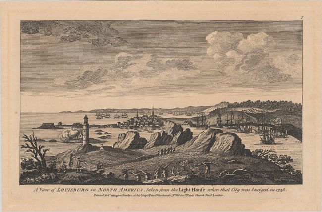
Auction 175, Lot 84
Subject: Cape Breton Island, Canada
Bowles, Carrington
A View of Louisburg in North America, Taken from the Light House When That City Was Beseiged in 1758, 1772
Size: 10.4 x 6 inches (26.4 x 15.2 cm)
Estimate: $450 - $550
Sold for: $275
Closed on 11/13/2019
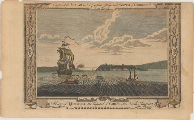
Auction 175, Lot 85
Subject: Quebec City, Canada
Millar, George H.
A View of Quebec the Capital of Canada, in North America, 1782
Size: 11.9 x 8.1 inches (30.2 x 20.6 cm)
Estimate: $60 - $80
NO RESERVE
Sold for: $55
Closed on 11/13/2019
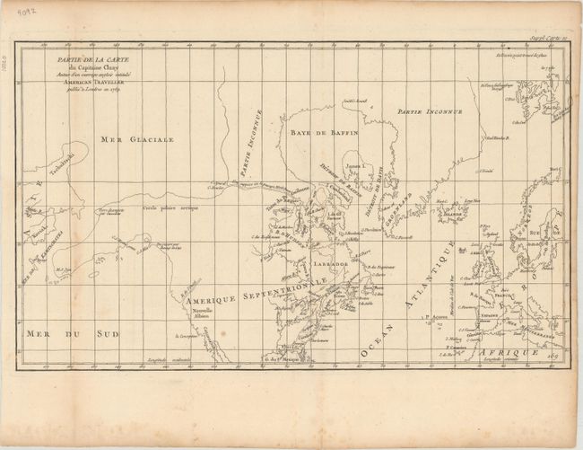
Auction 175, Lot 86
Subject: Colonial United States & Canada, Arctic
Robert de Vaugondy, Didier
Partie de la Carte du Capitaine Cluny Auteur d'un Ouvrage Anglois Intitule American Traveller Publie a Londres en 1769, 1773
Size: 19.6 x 11.5 inches (49.8 x 29.2 cm)
Estimate: $120 - $150
Sold for: $90
Closed on 11/13/2019
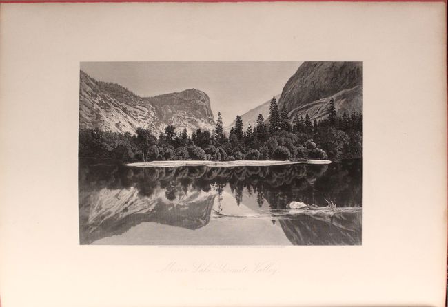
Auction 175, Lot 87
Subject: United States & Canada
Bryant, William C.
[2 Volumes] Picturesque America; or, the Land We Live In. A Delineation by Pen and Pencil..., 1872-74
Size: 10.1 x 13.4 inches (25.7 x 34 cm)
Estimate: $350 - $425
Sold for: $250
Closed on 11/13/2019
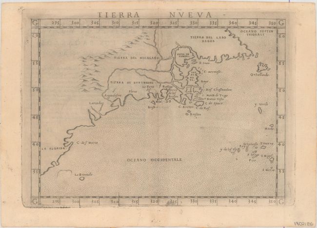
Auction 175, Lot 88
Subject: Eastern United States & Canada
Ruscelli, Girolamo
Tierra Nueva, 1574
Size: 9.6 x 7.1 inches (24.4 x 18 cm)
Estimate: $1,100 - $1,400
Ruscelli's Map of the East Coast
Sold for: $800
Closed on 11/13/2019
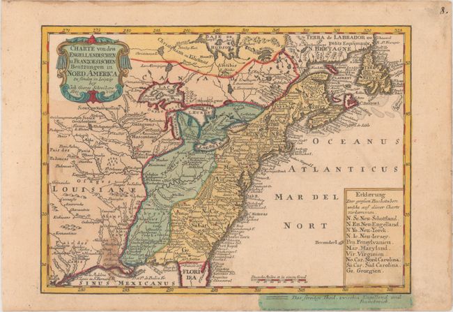
Auction 175, Lot 89
Subject: Colonial Eastern United States & Canada
Schreiber, Johann Georg
Charte von dem Engellaendischen u. Franzoesischen Besitzungen in Nord America..., 1753
Size: 9.5 x 6.9 inches (24.1 x 17.5 cm)
Estimate: $300 - $375
Sold for: $325
Closed on 11/13/2019
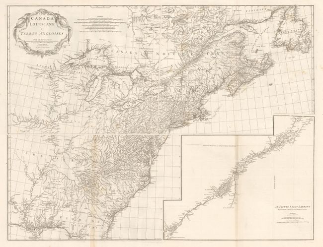
Auction 175, Lot 90
Subject: Colonial Eastern United States & Canada
Anville, Jean Baptiste Bourguignon d'
[On 4 Sheets] Canada Louisiane et Terres Angloises, 1755
Size: 21.8 x 18.6 inches (55.4 x 47.2 cm)
Estimate: $1,300 - $1,600
D'Anville's Spectacular Map of Eastern Seaboard
Sold for: $900
Closed on 11/13/2019
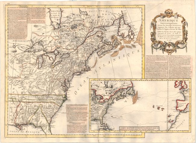
Auction 175, Lot 91
Subject: Colonial Eastern United States & Canada
Anon.
Amerique Septentrionale, Suivant les Nouvelles Decouvertes, Augmente des Collonies qui sont Derriere la Virginie et du Cour de l'Ohio..., 1757
Size: 27.1 x 19.1 inches (68.8 x 48.5 cm)
Estimate: $2,750 - $3,500
A Rare French Map Countering Jefferys' French & Indian War Map
Sold for: $2,500
Closed on 11/13/2019
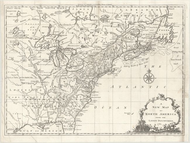
Auction 175, Lot 92
Subject: Colonial Eastern United States & Canada
Spilsbury, J.
A New Map of North America from the Latest Discoveries, 1761
Size: 14.9 x 10.8 inches (37.8 x 27.4 cm)
Estimate: $450 - $550
Sold for: $275
Closed on 11/13/2019
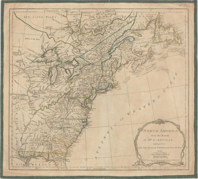
Auction 175, Lot 93
Subject: Colonial Eastern United States & Canada
Jefferys/Sayer & Bennett
North America from the French of Mr. D'Anville Improved with the English Surveys Made Since the Peace, 1775
Size: 20.1 x 18.1 inches (51.1 x 46 cm)
Estimate: $475 - $600
Sold for: $350
Closed on 11/13/2019
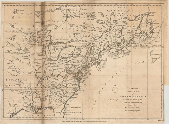
Auction 175, Lot 94
Subject: Colonial Eastern United States & Canada
Lodge, John
A New and Correct Map of North America in Which the Places of the Principal Engagements During the Present War, Are Accurately Inserted, 1780
Size: 15.1 x 10.8 inches (38.4 x 27.4 cm)
Estimate: $300 - $375
Sold for: $190
Closed on 11/13/2019
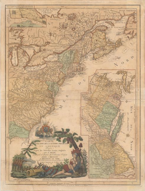
Auction 175, Lot 95
Subject: Colonial Eastern United States & Canada
Denis, Louis
Carte du Theatre de la Guerre Presente en Amerique Dressee d'Apres les Nouvelles Cartes Anglaises, 1782
Size: 19.6 x 26.3 inches (49.8 x 66.8 cm)
Estimate: $3,000 - $3,750
Scarce American Revolutionary War Map
Sold for: $1,800
Closed on 11/13/2019
Auction 175, Lot 96
Subject: Eastern United States & Canada
Kitchin, Thomas
Map of the United States in North America: with the British, French and Spanish Dominions Adjoining, According to the Treaty of 1783, 1783
Size: 20.1 x 16.1 inches (51.1 x 40.9 cm)
Estimate: $500 - $650
One of the Earliest English-Produced Maps to Acknowledge the United States
Sold for: $250
Closed on 11/13/2019
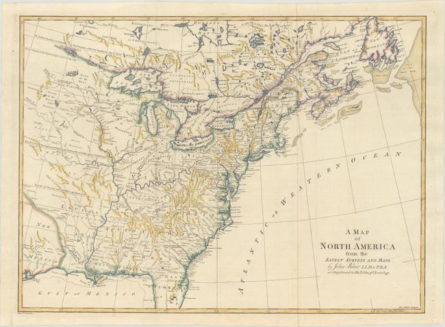
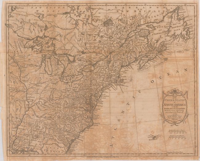
Auction 175, Lot 97
Subject: Colonial Eastern United States & Canada
Blair, Rev. John
A Map of North America from the Latest Surveys and Maps, 1802
Size: 22.5 x 16.5 inches (57.2 x 41.9 cm)
Estimate: $600 - $750
Sold for: $450
Closed on 11/13/2019
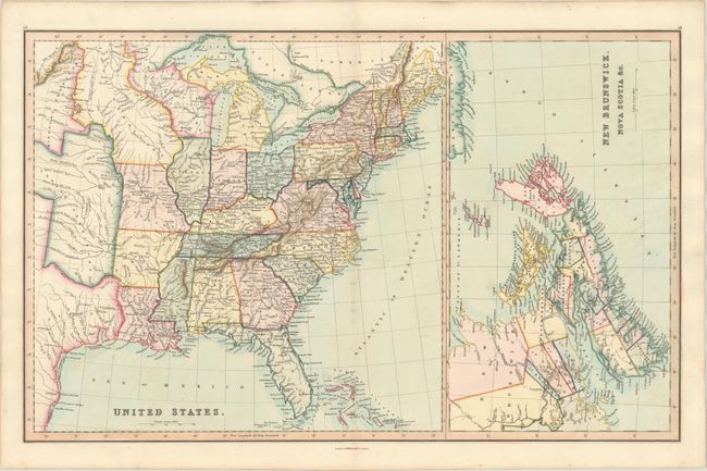
Auction 175, Lot 98
Subject: Eastern United States & Canada
Smith & Son
United States [on sheet with] New Brunswick, Nova Scotia &c., 1846
Size: 22.6 x 14.1 inches (57.4 x 35.8 cm)
Estimate: $150 - $180
Sold for: $110
Closed on 11/13/2019
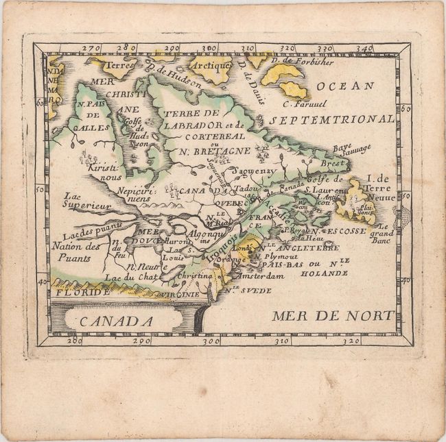
Auction 175, Lot 99
Subject: Colonial Northeast United States & Canada
Duval/Beer
Canada, 1661
Size: 4.8 x 3.8 inches (12.2 x 9.7 cm)
Estimate: $475 - $600
Sold for: $400
Closed on 11/13/2019
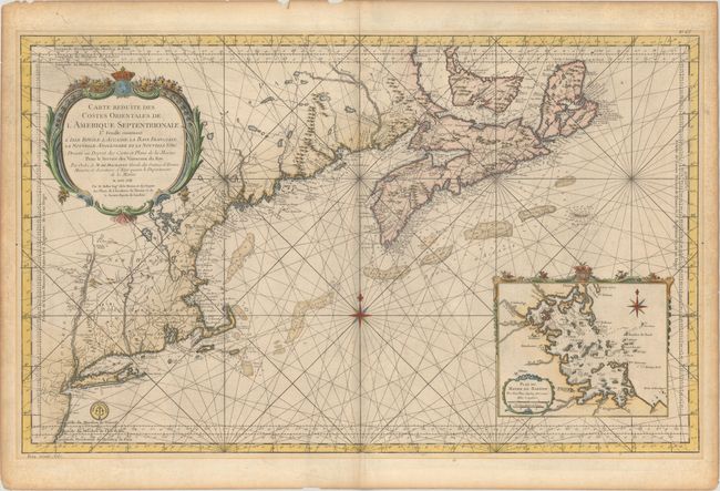
Auction 175, Lot 100
Subject: Colonial Northeastern United States & Canada
Bellin, Jacques Nicolas
Carte Reduite des Costes Orientales de l'Amerique Septentrionale 1re Feuille Contenant l'Isle Royale, l'Accadie, la Baye Francoise, la Nouvelle Angleterre et la Nouvelle Yorc..., 1757
Size: 34.9 x 21.5 inches (88.6 x 54.6 cm)
Estimate: $1,900 - $2,200
Scarce Large-Scale Chart of the Coast of New England
Unsold
Closed on 11/13/2019
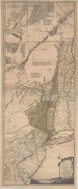
Auction 175, Lot 101
Subject: Colonial Northeast United States & Quebec
Holland/Pownal
The Provinces of New York, and New Jersey; with Part of Pensilvania, and the Province of Quebec..., 1777
Size: 20.3 x 52 inches (51.6 x 132.1 cm)
Estimate: $3,500 - $4,500
Rare German Edition of an Important Revolutionary War Period Map
Sold for: $2,300
Closed on 11/13/2019
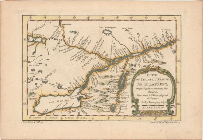
Auction 175, Lot 102
Subject: Colonial Lake Ontario & St. Lawrence River
Bellin, Jacques Nicolas
Suite du Cours du Fleuve de St. Laurent, Depuis Quebec Jusqu au Lac Ontario. Pour Servir a l'Histoire Generale des Voyages, 1757
Size: 11.3 x 7.5 inches (28.7 x 19.1 cm)
Estimate: $110 - $140
Sold for: $80
Closed on 11/13/2019
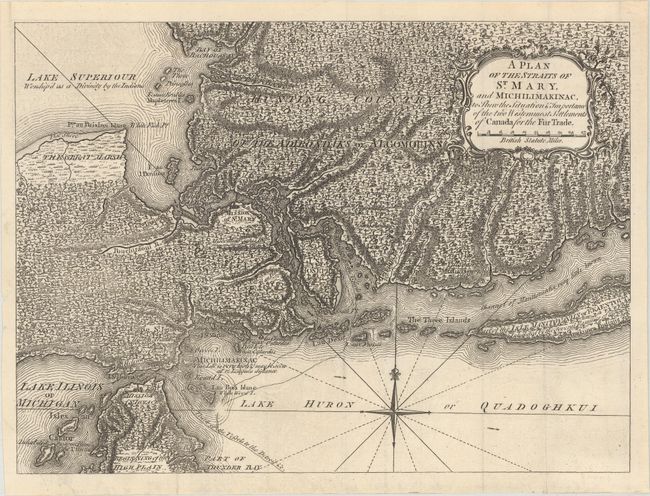
Auction 175, Lot 103
Subject: Colonial Great Lakes
Anon.
A Plan of the Straits of St. Mary, and Michilimakinac, to Shew the Situation & Importance of the Two Westernmost Settlements of Canada for the Fur Trade, 1761
Size: 12.8 x 9.4 inches (32.5 x 23.9 cm)
Estimate: $450 - $550
Sold for: $475
Closed on 11/13/2019
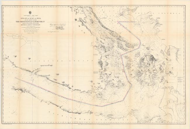
Auction 175, Lot 104
Subject: Washington & British Columbia
U.S. Hydrographic Office
Strait of Juan de Fuca and the Channels Between the Continent & Vancouver Id. Showing the Boundary Line Between British & American Possessions, 1872
Size: 44.3 x 28.8 inches (112.5 x 73.2 cm)
Estimate: $400 - $475
Sold for: $325
Closed on 11/13/2019
26 lots