Filtered by Category:Atlantic & Arctic(Show All Categories)
Showing results for:Auction 175
Catalog Archive
12 lots
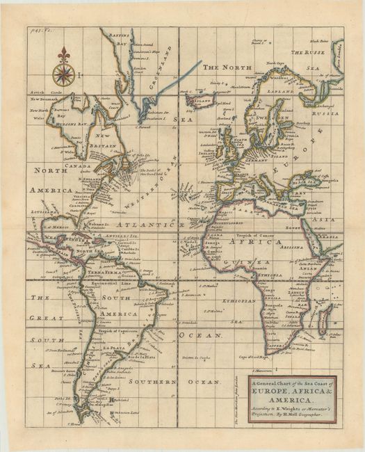
Auction 175, Lot 338
Subject: Atlantic Ocean
Moll, Herman
A General Chart of the Sea Coast of Europe, Africa & America. According to E. Wrights or Mercator's Projection, 1720
Size: 11.1 x 13.9 inches (28.2 x 35.3 cm)
Estimate: $200 - $230
Sold for: $150
Closed on 11/13/2019
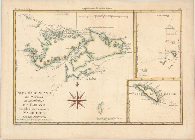
Auction 175, Lot 339
Subject: South Atlantic Islands
Bonne, Rigobert
Isles Maidenland, de Hawkins, et le Detroit de Fakland. Ces Isles sont Nommees Malouines, par les Francois, 1787
Size: 13.6 x 9.2 inches (34.5 x 23.4 cm)
Estimate: $50 - $70
NO RESERVE
Sold for: $160
Closed on 11/13/2019
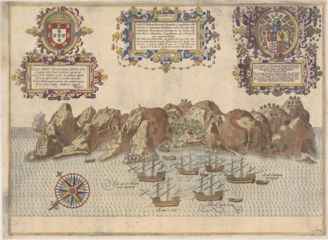
Auction 175, Lot 340
Subject: St. Helena
Linschoten, Jan Juygen van
Insula D. Helenae Sacra Coeli Clementia et Aequabilitate..., 1589
Size: 19.9 x 14.6 inches (50.5 x 37.1 cm)
Estimate: $550 - $700
Sold for: $550
Closed on 11/13/2019
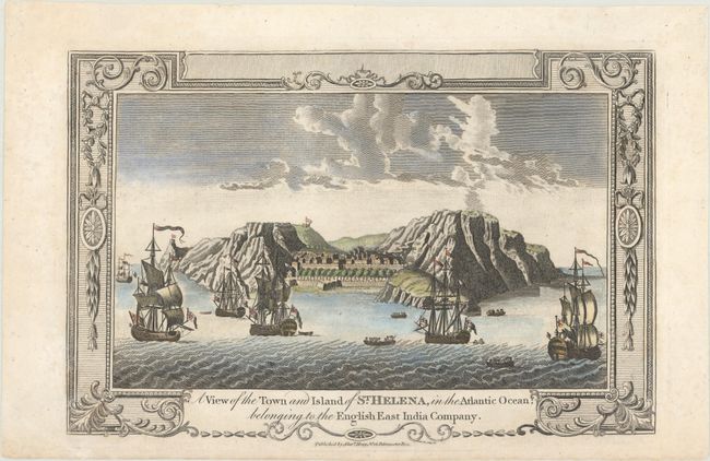
Auction 175, Lot 341
Subject: St. Helena
Hogg, Alexander
A View of the Town and Island of St. Helena, in the Atlantic Ocean; Belonging to the English East India Company, 1779
Size: 11.8 x 7.8 inches (30 x 19.8 cm)
Estimate: $95 - $120
Sold for: $70
Closed on 11/13/2019
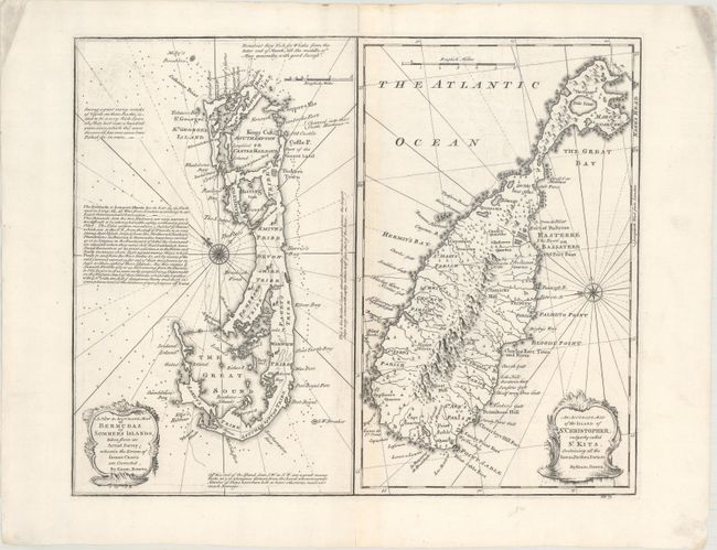
Auction 175, Lot 342
Subject: Bermuda & St. Kitts
Bowen, Emanuel
A New & Accurate Map of Bermudas or Sommer's Islands... [on sheet with] An Accurate Map of the Island of St. Christopher, Vulgarly Called St. Kits..., 1747
Size: 17 x 13.8 inches (43.2 x 35.1 cm)
Estimate: $600 - $750
Unsold
Closed on 11/13/2019
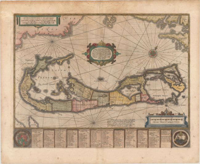
Auction 175, Lot 343
Subject: Bermuda
Hondius/Jansson
Mappa Aestivarum Insularum, Alias Barmudas Dictarum, ad Ostia Mexicani..., 1647
Size: 20.3 x 15.4 inches (51.6 x 39.1 cm)
Estimate: $800 - $950
Unsold
Closed on 11/13/2019
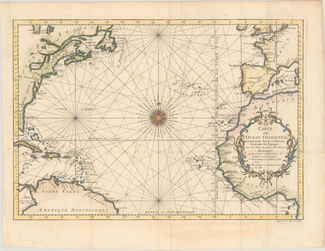
Auction 175, Lot 344
Subject: North Atlantic
Bellin, Jacques Nicolas
Carte de l'Ocean Occidental Dressee pour Servir a l'Histoire Generale des Voyages..., 1746
Size: 18.2 x 12.6 inches (46.2 x 32 cm)
Estimate: $170 - $200
Sold for: $240
Closed on 11/13/2019
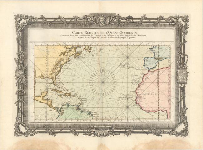
Auction 175, Lot 345
Subject: North Atlantic
Desnos, Louis Charles
Carte Reduite de l'Ocean Occidental, Contenant les Cotes Occidentales de l'Europe et de l'Afrique, et les Cotes Orientales de l'Amerique..., 1761
Size: 21.3 x 15.3 inches (54.1 x 38.9 cm)
Estimate: $350 - $425
Sold for: $200
Closed on 11/13/2019
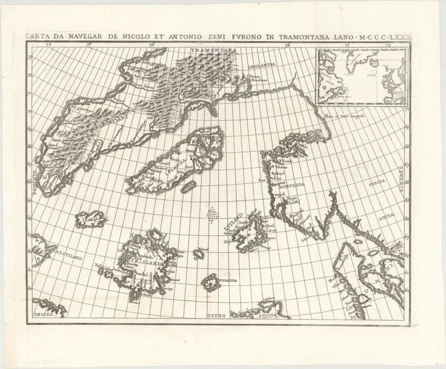
Auction 175, Lot 346
Subject: North Atlantic
Carta da Navegar de Nicolo et Antonio Zeni Furono in Tramontana Lano MCCCLXXX, 1818
Size: 14.3 x 10.6 inches (36.3 x 26.9 cm)
Estimate: $400 - $500
Sold for: $250
Closed on 11/13/2019
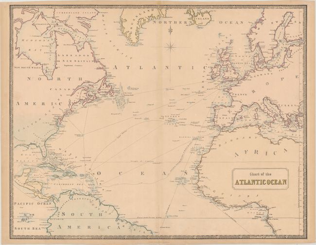
Auction 175, Lot 347
Subject: North Atlantic
Philip, George
Chart of the Atlantic Ocean, 1851
Size: 25.4 x 19.9 inches (64.5 x 50.5 cm)
Estimate: $160 - $190
Sold for: $90
Closed on 11/13/2019
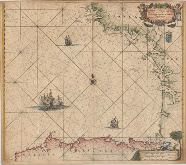
Auction 175, Lot 348
Subject: Bay of Biscay
Keulen, Johannes van
Pas Caart van de Bocht van Vranckryck Biscaien en Galissen Tusschen Heyssant en C. de Finisterre, 1680
Size: 23.3 x 20.2 inches (59.2 x 51.3 cm)
Estimate: $275 - $350
Sold for: $200
Closed on 11/13/2019
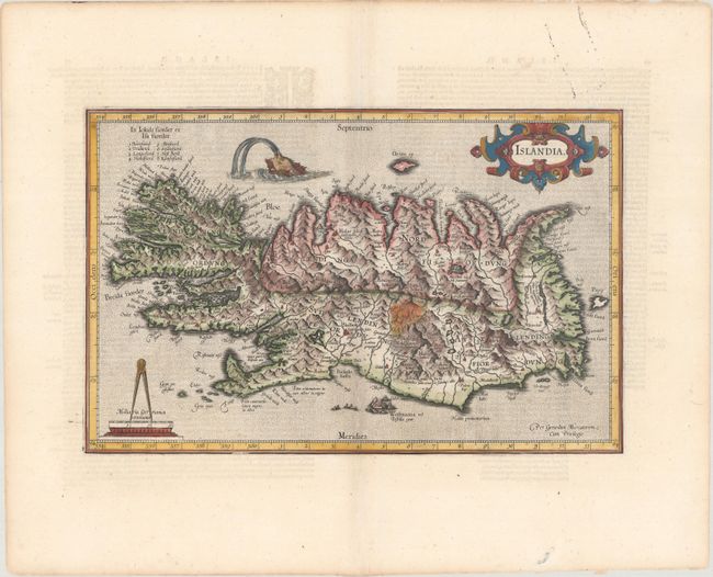
Auction 175, Lot 349
Subject: Iceland
Mercator/Hondius
Islandia, 1619
Size: 17.4 x 11.1 inches (44.2 x 28.2 cm)
Estimate: $600 - $750
Sold for: $450
Closed on 11/13/2019
12 lots