Subject: References, Civil War
Period: 1964-99 (published)
Publication:
Color:
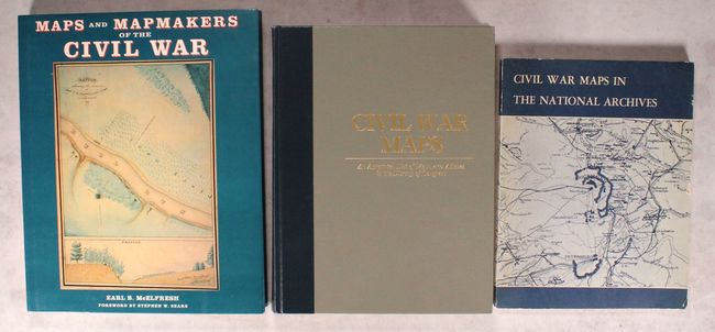
A. Maps and Mapmakers of the Civil War, by Earl B. McElfresh, published 1999, printed color (9.9 x 12.1"). This is a thorough examination of Civil War maps, mapmaking, and mapmakers and documents the techniques and travails of the mapmaker in the field. Lively anecdotes are retold alongside discussion of the practical effect of the cartographer's art on actual military operations. 272 pp., notes, bibliography, index, 180 illustrations, 150 in full-color, many never before reproduced. Hardbound with illustrated dust jacket. Condition: Contents and covers are clean and tight. (A)
B. Civil War Maps - An Annotated List of Maps and Atlases in the Library of Congress, by Richard W. Stephenson, published 1989, printed color (8.6 x 11.3"). This is the expanded second edition of this reference covering the maps and atlases of the American Civil War. The book includes 2240 maps and charts, 76 atlases and sketch books, 162 maps and 28 collections of paper from the Library of Congress's Manuscript Division, and a few additional atlases that accompany volumes in the Library's general book collections. It focuses not only on maps and atlases made during the war, but also those made in the aftermath. Entries include descriptive notes, and there are plenty of illustrations, some in color. 410 pp, hardbound with gilt titles on front cover and spine and a gilt Library of Congress stamp on the back cover. Condition: Contents are very good with minor damp stains along the top of the pages. There is a crack in the text block near the end of the volume. Covers are very good. (B+)
C. Civil War Maps in the National Archives, by the National Archives, published 1964, black & white (7.9 x 10.1"). This publication provides an overview of the 8,000 maps, charts, and plans held in the National Archive that relate to the American Civil War. Part I is a general guide to the maps and records in the Cartographic Branch, while Part II is a more specific account of individual items of interest. The book includes 7 black & white illustrations. 127 pp., with soft illustrated covers. Condition: Contents are very good with some faint toning and some minor unobtrusive chips near the front of the book. The covers have light shelf wear and soiling, with some small chips along the edge of the front cover. (B+)
References:
Condition:
See description above.