Filtered by Category:Cartographers(Show All Categories)
Articles
24 articles
Page 1 of 2
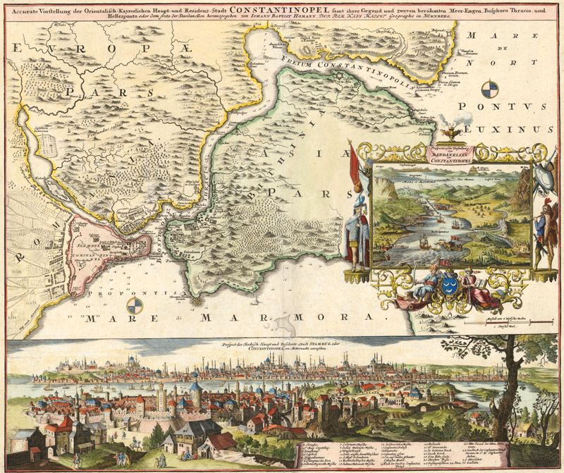
Homann, Seutter, Lotter and Their Heirs
This July 2025 article gives an overview of the major German map publishers of the 18th century and explains the interrelationships between them. The article focuses on Homann, Homann Heirs, Seutter, Lotter, Probst, Walch and their families.
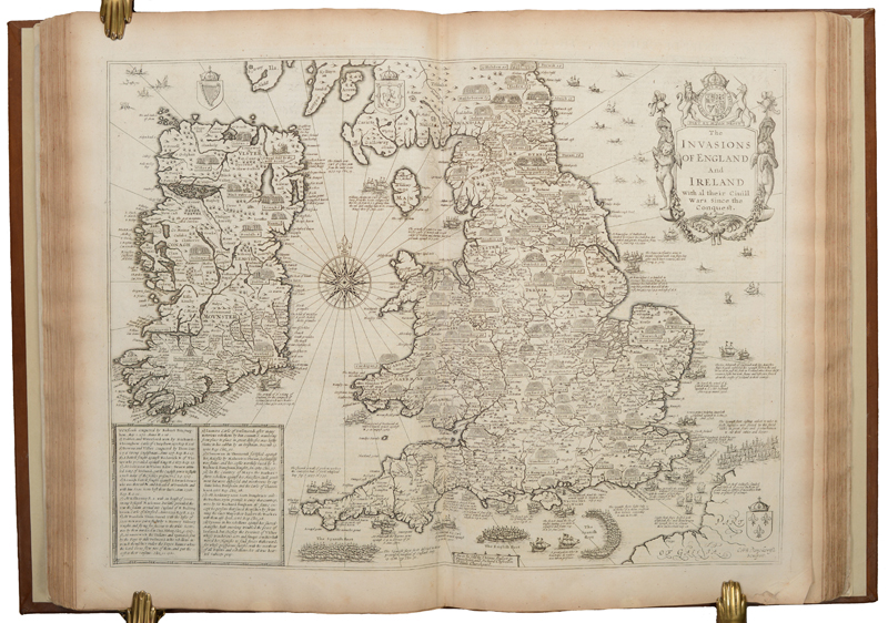
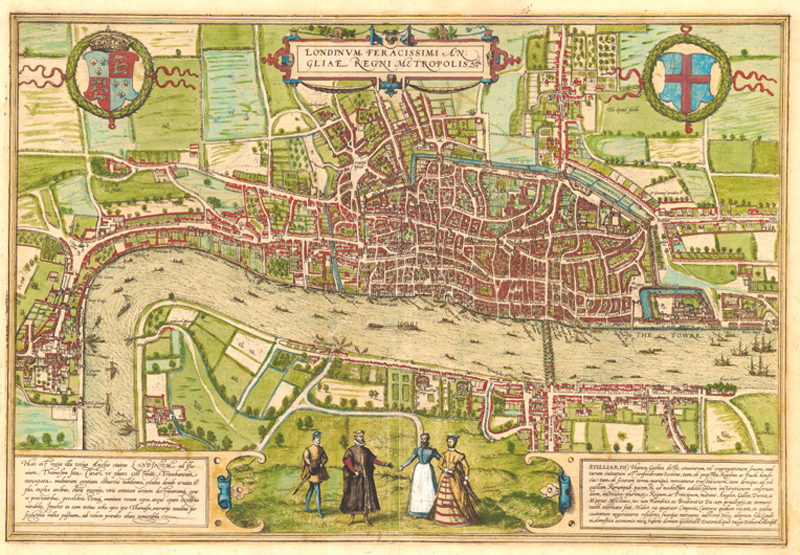
The Life and Works of John Speed
This January 2025 article gives a brief overview of John Speed, one of the most important and famous figures of all English mapmakers. The article explains how he became involved in the map trade and the history behind his two influential atlases, "The Theater of the Empire of Great Britaine" and "A Prospect of the Most Famous Parts of the World."
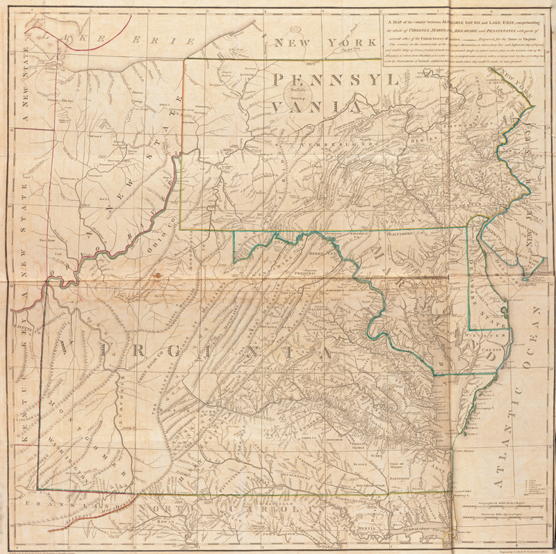
Jefferson and Maps
This March 2024 article gives an overview of the cartographic endeavors of Thomas Jefferson, with an in-depth discussion of his only published map, "A map of the Country Between Albemarle Sound, and Lake Erie."
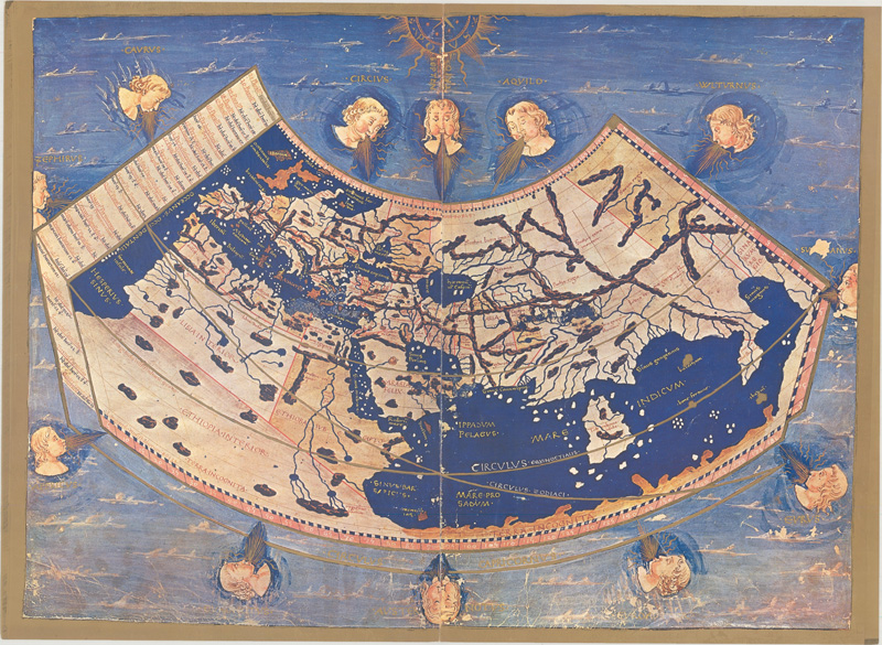
The Maps & Editions of Ptolemy
This January 2024 article reviews the major Ptolemaic works published between 1477 to 1730. Based on the work of the 2nd-century geographer Claudius Ptolemy, they provide a glimpse into an ancient understanding of the world. This primer provides clarity about Ptolemy, his ideas, and the most notable editions of his "Geographia."
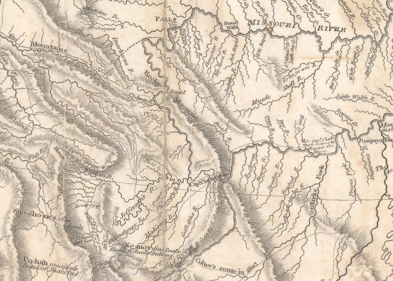
Lewis & Clark: Mapping the West
This May 2023 article gives an overview of the Lewis & Clark expedition through the western United States, with particular attention to the maps and cartographic tools they used on their journey.
Blaeu vs. Hondius/Jansson: The Battle for Cartographic Supremacy
This July 2022 article gives a brief history of the publishing houses of Willem Blaeu and Jan Jansson, and explains how the rivalry between these two firms unfolded. As two of the best-known figures during the Golden Age of Dutch cartography, Blaeu and Jansson were prolific publishers of maps and atlases, and their works are highly prized among collectors. But who won in the battle for cartographic supremacy? This article shines a light on several factors that should be considered when crowning the cartographic king.
Theodore de Bry's Grands Voyages Part I Inventory
This March 2021 article is by guest contributor Luke Vavra, former map dealer and specialist in Virginia material. This is the fourth in a four-part series about Part I of Theodore de Bry's "India Occidentalis" (America). This fourth article discusses the current inventory of existing volumes of "Grands Voyages."
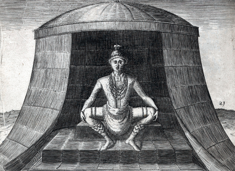
Theodore de Bry's Pict Plates from Grands Voyages Part I
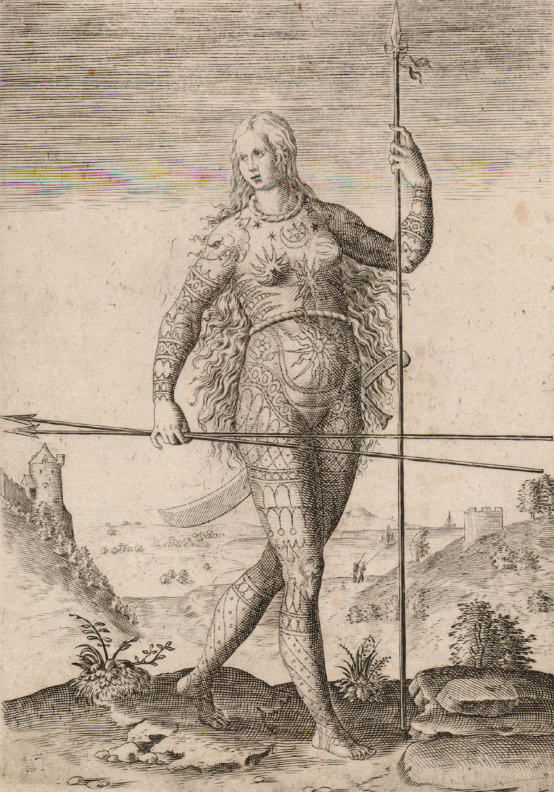
This March 2021 article is by guest contributor Luke Vavra, former map dealer and specialist in Virginia material. This is the third in a four-part series about the engravings in Part I of Theodore de Bry's "India Occidentalis" (America). This third article discusses the Pict plates in Part I, which depicted ancient Britons.
Theodore de Bry's Plates from Grands Voyages Part I
This February 2021 article is by guest contributor Luke Vavra, former map dealer and specialist in Virginia material. This is the second in a four-part series about the engravings in Part I of Theodore de Bry's "India Occidentalis" (America). This second article discusses the plates in Part I, including the title page, the dedication, the Virginia map, and the Algonquian series, with particular attention to the Kiwasa plate.
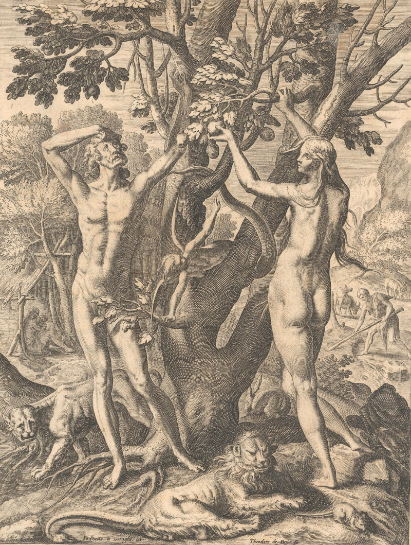
Theodore de Bry's Adam & Eve Engraving from Grands Voyages
This January 2021 article is by guest contributor Luke Vavra, former map dealer and specialist in Virginia material. This is the first in a four-part series about the engravings in Part I of Theodore de Bry's "India Occidentalis" (America). This first article concerns the first engraving in Part I - that of Adam and Eve in the Garden of Eden.
The Mapmakers Who Made the 20th Century
This is the final article in a series about mapmakers who played key roles in each century, and focuses on mapmakers in the 20th century, including Rand McNally Company, MacDonald Gill, and Jo Mora.
The Mapmakers Who Made the 19th Century
Read our July 2020 newsletter featuring an article about "The Mapmakers Who Made the 19th Century," which gives an overview of some of the most important cartographers of the 1800s and their most iconic maps, including Arrowsmith, Tallis, Mitchell, and the United States Government.
The Mapmakers Who Made the 18th Century
Read our June 2020 newsletter featuring an article about "The Mapmakers Who Made the 18th Century," which gives an overview of some of the most important cartographers of the 1700s and their most iconic maps, including Delisle, Moll, Homann, and Jefferys. Also in this newsletter is a list of free online resources that offer cartographic content to help you expand your worldview while staying safely at home.
The Mapmakers Who Made the 17th Century
This May 2020 newsletter features an article about "The Mapmakers Who Made the 17th Century," which gives an overview of some of the most important cartographers of the 1600s, including the Hondius family, the Blaeu family, John Speed, and Nicolas Sanson. Also in this newsletter is a list of free online resources that offer cartographic content to help you expand your worldview while staying safely at home.
The Mapmakers Who Made the 16th Century
Read our March 2020 newsletter featuring an article about "The Mapmakers Who Made the 16th Century," which gives an overview of some of the most important cartographers of the 1500s and their most iconic maps. Also in this newsletter is a list of free online resources that offer cartographic content to help you expand your worldview while staying safely at home.
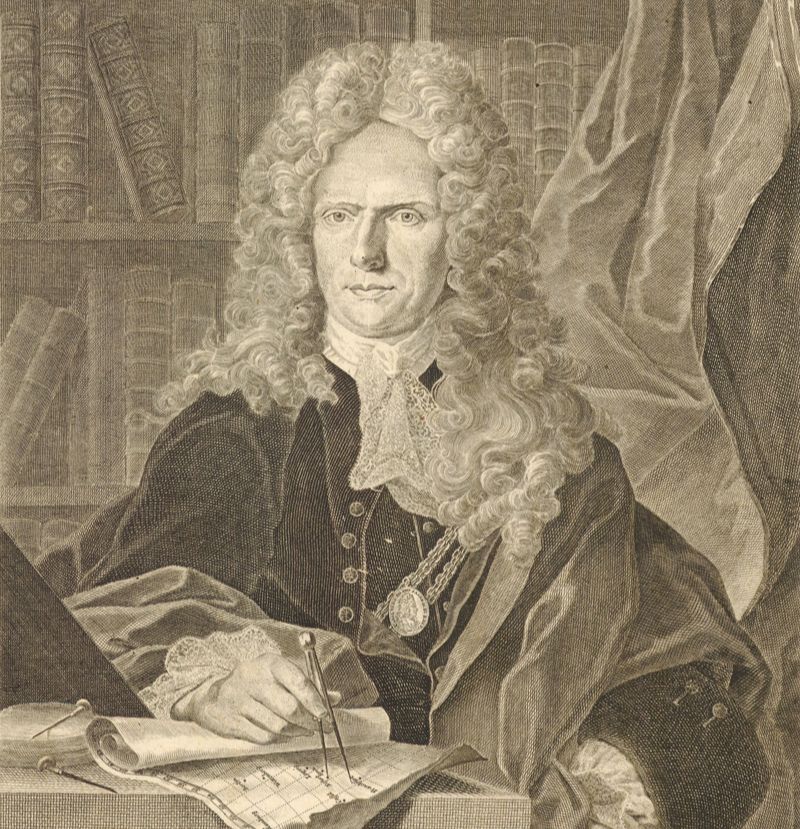
Precision & Exactitude: The Robert de Vaugondy Family
This October 2018 article gives an overview of the Robert de Vaugondy family, who published numerous maps, atlases, and globes during the 18th century, known as the golden age of French cartography.
Auction Trends in 2017 & Braun & Hogenberg
This December 2017 newsletter features two articles. The first gives an overview of the auction market for antique maps in 2017, with some interesting insights about the big winners and losers. The second article discusses Braun & Hogenberg and their incredible town book, "Civitates Orbis Terrarum."
The Society for the Diffusion of Useful Knowledge
This March 2017 article gives an overview of the Society for the Diffusion of Useful Knowledge, which published a series of maps between 1829-44.
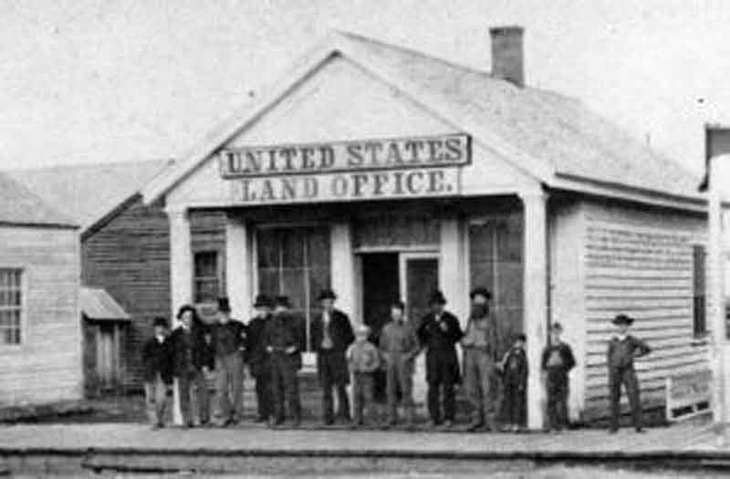
The Early United States Land System
This article from October 2016 gives a history of "The Early United States Land System."
Three "Old-School" Dealers & a Book Summary on Abraham Ortelius
This May 2016 newsletter features an article about 3 "old school" dealers: Luke Vavra of Cartographic Arts, Jonathan Potter of Jonathan Potter Ltd., and Steve Luck of Tooley Adams & Co.Find out how the map business has changed over the last 40 years and what their thoughts are on the future. Also included is a book summary of "Abraham Ortelius (1527-1598) Life, Works, Sources, and Friends" by Marcel van den Broecke.
24 articles
Page 1 of 2