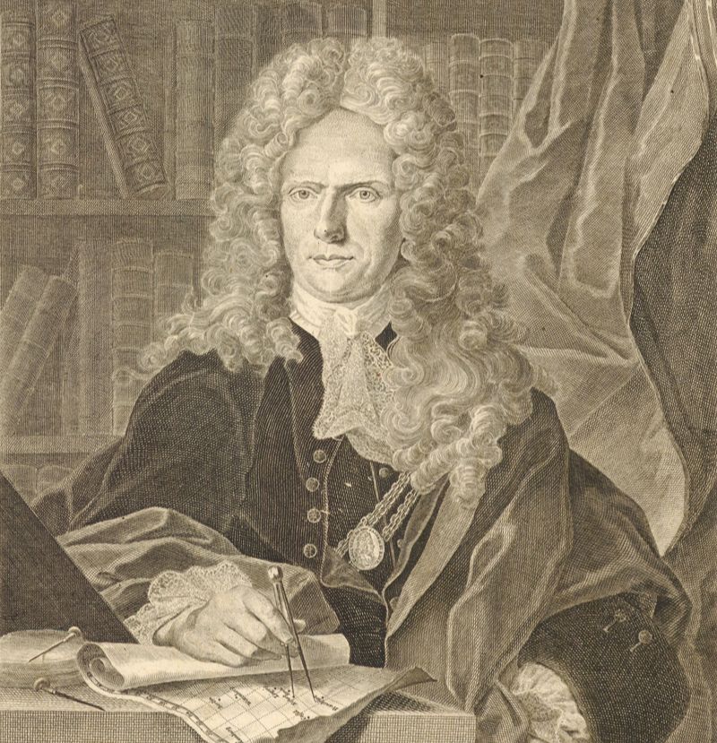
Johann Baptist Homann, engraved by Johann Wilhelm Winter, after a portrait by Johann Kenckel (circa 1740)
Homann, Seutter, Lotter, and Their Heirs: A Brief History of the Great German Map Publishers of the 18th Century
by Joe McAlhany
During the 18th century, Paris was the epicenter of European mapmaking. French cartographers were on the cutting edge, embracing the Enlightenment concept of “positive geography” and developing a more scientific approach to cartography. But other mapmaking hubs emerged as well. As the century progressed and the power and influence of the British Empire expanded, London cartographers like Herman Moll and Thomas Jefferys rose to new prominence. And in the German cities of Nuremberg and Augsburg, a cartographic tradition emerged that put a new spin on the decorative tradition of the Golden Age of Dutch cartography while keeping pace with the new scientific standards popularized by the French.
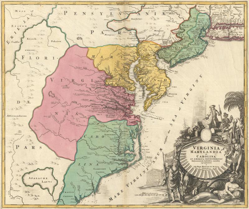
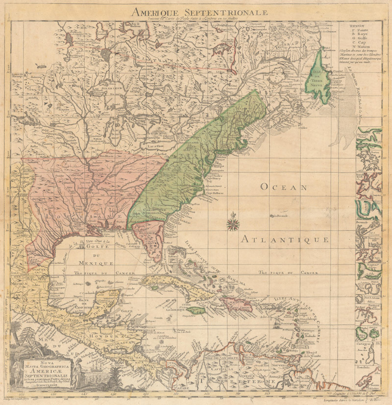
Johann Baptist Homann’s Virginia Marylandia et Carolina in America Septentrionali Britannorum… (ca. 1730), designed to promote German immigration to the colonies
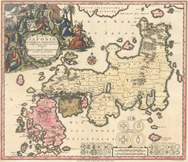
Matthäus Seutter’s Regni Japoniae Nova Mappa Geographica… (ca. 1740), engraved by his son-in-law and eventual successor Tobias Conrad Lotter
This distinctive style originated with Johann Baptist Homann in Nuremberg. His maps can be immediately identified by their large, elaborate figurative title cartouches and eye-catching, hand-colored territories in yellow, pink, and green, packed tight with place names incised in a blocky scrawl that could be described as the German cousin to Herman Moll’s beloved engraving style. Homann’s style, as well as some of the publishing practices that made his firm such a success, were copied by one of his former engravers, Augsburg-based Matthäus Seutter. Seutter then became one of the Homann firm’s principal competitors, in part by flooding the market with cartographic materials of multiple types and formats. The Seutter publishing company was subsequently purchased by Johann Michael Probst and, more importantly, Tobias Conrad Lotter, who served as Seutter’s most prized engraver. In this article, we will trace the legacies of Homann, Seutter, and Lotter from the beginning of the 18th century to the middle of the 19th century, with a special emphasis on the connections between these powerhouse publishers and the lineage of their heirs.
Johann Baptist Homann and the Birth of the “Homann Format” (1702-30)
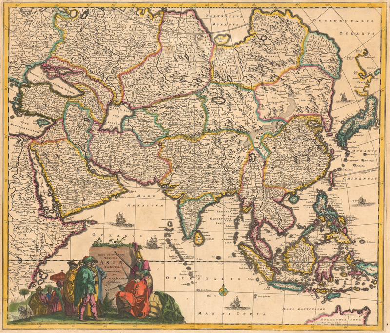
Jacob van Sandrart’s Nova et Accurata Totius Asiae Tabula (ca. 1697), engraved by Johann Baptist Homann
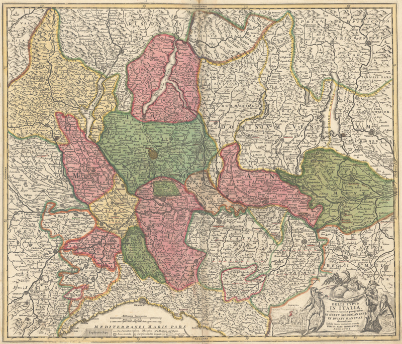
Johann Baptist Homann was the key German map publisher of his era. Born in Oberkammlach in Swabia, Bavaria in 1664, Homann relocated to Nuremberg in 1687. There, he cut his teeth as an engraver working for Jacob von Sandrart and David Funcke. In 1702, he struck out on his own and founded his map publishing firm, based out of his in-laws’ home. The first map published under his own imprint covered the duchy of Milan, a region then embroiled in the War of Spanish Succession. Milan was not an arbitrary choice—according to scholar Markus Heinz, one of Homann’s strategies as a publisher was to put out maps that coincided with contemporary events, while maintaining a level of detail and quality that ensured that the maps stayed relevant beyond their particular moment in history. In a century marked by constant wars and political strife across the European continent, this proved to be a wise business decision, drawing in customers hungry for maps to provide context in a changing world.
Belli Typus in Italia… (dated 1702, published ca. 1716), an updated edition of Johann Baptist Homann’s first map
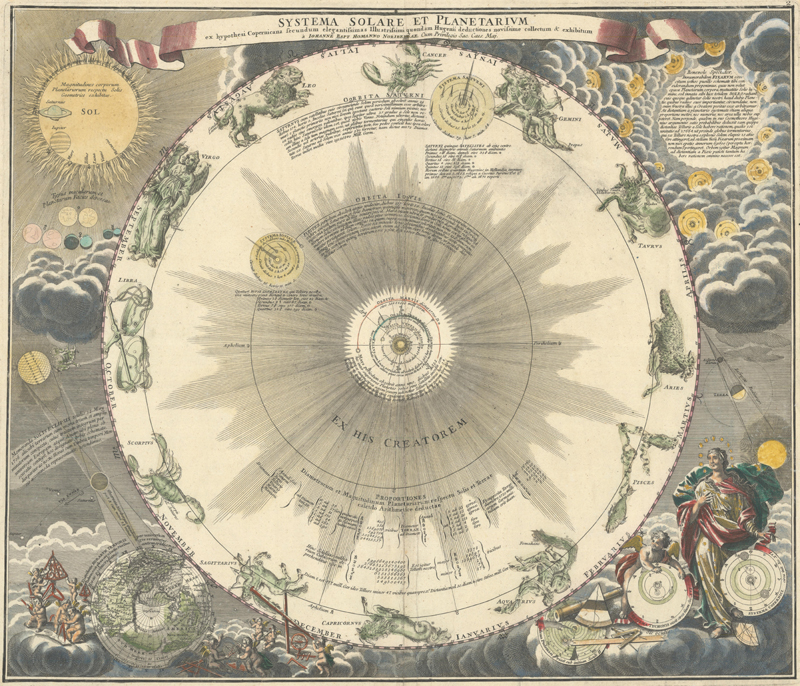
The firm developed a simple business model. Homann published maps that either could be purchased individually or bound together into an atlas. These atlases were customizable, but the firm did have a suggested table of contents and attractive printed title pages. By 1707, Homann had produced 33 maps, almost all of them copied from other maps. This was enough to compile his first atlas, Atlas Bestehend in Auserlesenen und Allerneuesten Land-Charten über die Gantze Welt. The success of this atlas enabled the firm to increase the production of new maps and to establish relationships with notable scientists and scholars, including Johann Hübner, who codified the Homann maps’ distinctive yellow/pink/green color palette (later copied by Seutter and Lotter), and the astronomer Johann Gabriel Doppelmayr, who collaborated with Homann on a series of stunning charts of the solar system, which were later collected into the Atlas Coelestis (1742).
Systema Solare et Planetarium ex Hypothesi Copernicana Secundum… (ca. 1742), from Dopplemayr/Homann’s Atlas Coelestis
The Homann firm had a catalogue of 100 maps by 1712 and was beginning to issue more maps based on newly compiled data rather than old sources. Homann was named a member of the Prussian Royal Academy of Sciences in Berlin in 1715, which granted him access to the latest cartographic information. The following year he was appointed Imperial Geographer by the Holy Roman Emperor Charles VI and received an imperial printing privilege, a proto-copyright that protected his work from being copied by other publishers. This privilege is usually found in the title cartouche of his maps, written as “Cum Privilegio Sacrae Caesareae Majestatis Geographo” or in an abbreviated form. Homann’s masterwork, Grosser Atlas über die Gantze Welt, which collected more than a 100 maps in its initial iteration, was published in 1716. The atlas was updated and published in subsequent editions for decades to come.
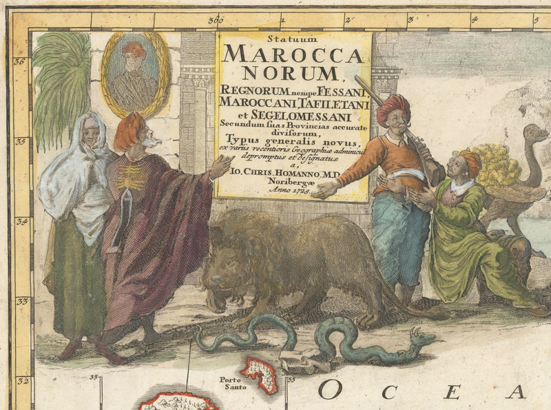
Statuum Maroccanorum… (1728), with the imprint of Johann Christoph Homann
By the time Johann Baptist Homann died in 1724, his stock had swelled to a very respectable 183 folio atlas maps. The so-called “Homann format” was well-established: maps that emphasized regions and political divisions with vivid color, filled with names of towns and cities, often with an elaborate title cartouche featuring allegorical and historical symbols. If the map was centered on a plan of a major city, it would also usually include a bird's-eye panorama of the city in question. Homann’s son, Johann Christoph Homann, inherited a very robust business after his father’s passing. But he had other business to attend to: he was still finishing up his medical studies and spent a couple years traveling abroad. The duties of managing day-to-day business at the Homann firm fell to Johann Georg Ebersberger, an engraver who was also Johann Christoph’s brother-in-law. The Johann Christoph era was a relatively fallow period for the company. The production of new maps slowed down significantly. The maps that were produced are distinguished by Johann Christoph’s imprint and his decision to start dating the maps; there were no other major changes to the Homann format.
Homann Heirs: Golden Years and Decline (1730-1848)
A world map drawn by Georg Moritz Lowitz, based on the work of Johann Matthias Haas, from an edition of the Grosser Atlas published by the Homann Heirs (ca. 1751)
Johann Christoph died young, at the age of 27, in 1730. His will split the ownership of the company between two successors: Ebersberger, the engraver and manager, and Johann Michael Franz, a school friend. Franz renamed the company Homann Heirs, and within four years, the firm’s new headquarters were set up in a grand mansion that once belonged to a Renaissance-era merchant. (It is now the site of the Stadtmuseum im Fembo-Haus.) After an extended lull in output that lasted until about 1737, the new owners launched Homann Heirs into its golden age. On Franz’s initiative, they invested in improving the quality of the maps and the production process so they could keep up with competitors, especially the firm of Matthäus Seutter (which will be discussed in the next section).
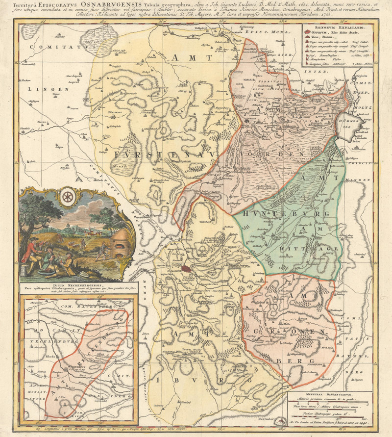
Territorii Episcopatus Osnabrugensis Tabula Geographica... (1753), a typically excellent regional map by Tobias Mayer and Homann Heirs
Johann Michael Franz spearheaded an effort to attract a community of scientist-cartographers to Homann Heirs. One of the key collaborators in this era was Johann Matthias Haas (or Hase), a historian, mathematician, and cartographer who brought the firm’s maps up to the standards of the prestigious and exacting French cartographers with his rigorous critical analysis of cartographic sources and his use of stereographic map projection. Franz’s ultimate goal was to create a state-funded cartographic institute that would help push Homann Heirs to the forefront of cartography without completely draining the firm’s coffers. In the meantime, he organized the Kosmographische Gesellschaft (ca. 1745-50), a society of scientists and cartographers, many of them already connected to Homann Heirs. This scientific community, which included Georg Moritz Lowitz and Tobias Mayer, forever changed cartography among the German-speaking states by creating precise, high-quality maps in conjunction with Homann Heirs, with critically edited sources credited in the cartouche. Any German map publisher who wanted to remain competitive had to adopt the same practices.
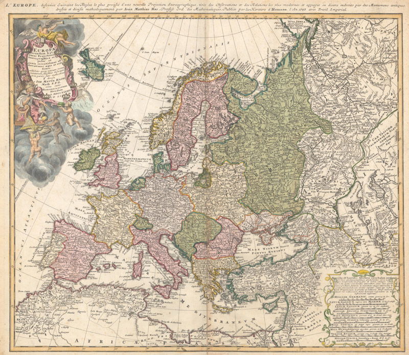
The Haas/Homann Heirs stereographic map of Europe (1743)
By the century’s midpoint, Homann Heirs were the predominant map seller for half of Europe (specifically Central, Northern, and Eastern Europe). They had 75 sales locations spread across the Holy Roman Empire and the rest of the continent, each carrying the full catalogue of Homann maps. In order to keep up the high rate of production, there were carefully copied duplicate copperplates of the best-selling regions and more than thirty colorists on the payroll. But in order for the business to reach these heights, Franz had taken out enormous loans. The state funding that he had tried to secure for his cartographic institute fell through. The scientists employed by Homann Heirs left for greener pastures. Franz departed the company to take a position at the University of Göttingen, and, in 1759, he sold his portion of the company to Jacob Heinrich Franz and Anna Felicitas, his brother and sister-in-law. Ebersberger somehow skirted the debt that his co-owner accrued, and passed his half of the company to his daughter Barbara Dorothea Monath upon his death in 1760.
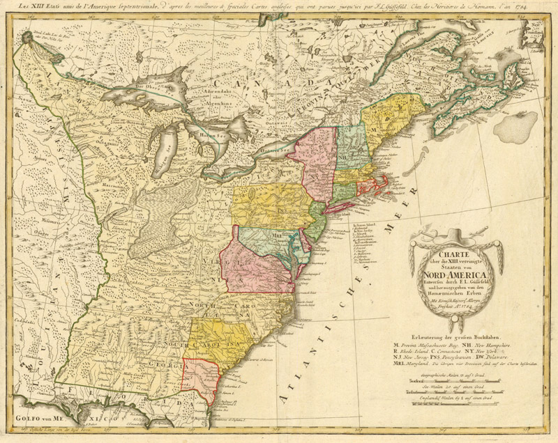
Charte über die XIII Vereinigte Staaten von Nord-America… (1784) by Franz Ludwig Güssefeld and Homann Heirs
Thus ended the flourishing phase of Homann Heirs. For the next couple decades, the company scaled back operations to pay off Franz’s debts. Under the joint ownership of Felicitas and Monath, the company enjoyed a brief resurgence when it brought in its last significant collaborator, Franz Ludwig Güssefeld. In the 1780s, Güssefeld completed 89 new maps for Homann Heirs. His work as a cartographer was highly respected, and is distinguished from earlier Homann maps, which were published in Latin, by his embrace of the German language (often with alternate French titles along the upper neatline). The company was able to update some of its most important maps, but production was quickly outpaced by the sudden upheavals of the Napoleonic Wars. Homann Heirs could not revise their maps fast enough, and the market was now flooded by growing competition from firms who successfully mimicked the Homann publishing strategy. The heirs of Franz/Felicitas and Monath sold the firm to Christoph Melchior Fembo, who took full control of Homann Heirs in 1813. Fembo proved a mediocre map-maker and publisher, and when he died in 1848, his son shuttered the business. After publishing nearly a thousand cartographic works (as well as several other prints and publications) over 146 years, the mighty reign of Homann was officially over.
Matthäus Seutter in Augsburg (1707-62)
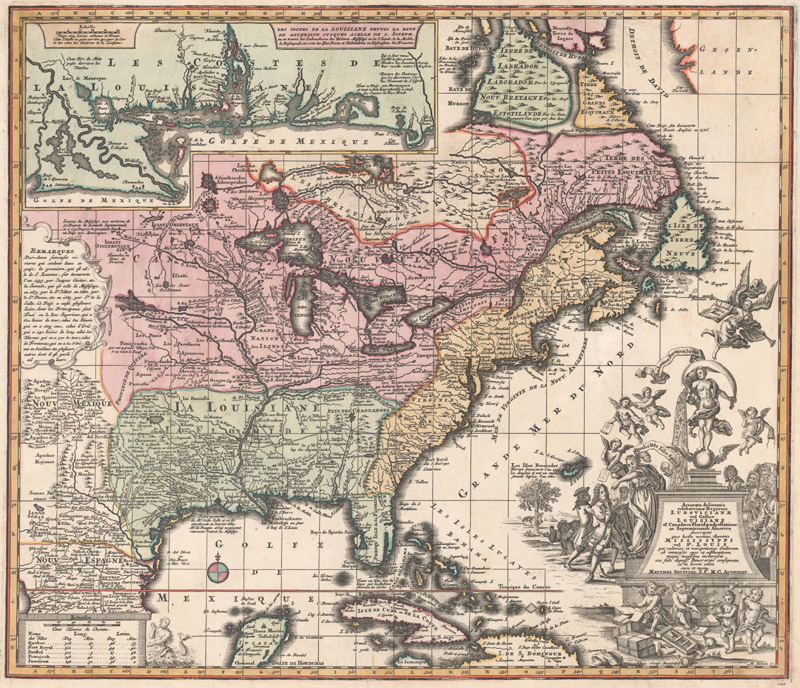
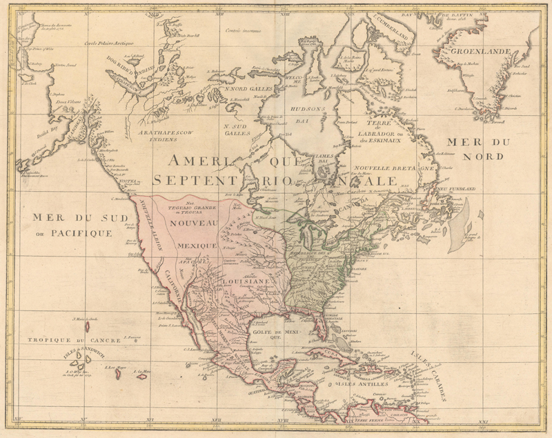
Matthäus Seutter’s Accurata Delineatio Celeberrimae Regionis Ludovicianae vel Gallice Louisiane ol. Canadae et Floridae Adpellatione in Septemtrionali America Descriptae... (ca. 1732), copied from the De Fer/Ottens map of 1719, but with an allegorical vignette satirizing the “Mississippi Bubble”
Perhaps the most significant of Homann’s German competitors was the firm of Matthäus Seutter, based 75 miles away, in Augsburg. Seutter was born in the great Bavarian city in 1678 and started his career as a brewer’s apprentice before moving to Nuremberg to study engraving under none other than Johann Baptist Homann himself. He was a skilled engraver, and upon his return to Augsburg, he began cutting maps and prints for the prominent publisher Jeremias Wolff. Sometime after 1707, he set up his own firm.
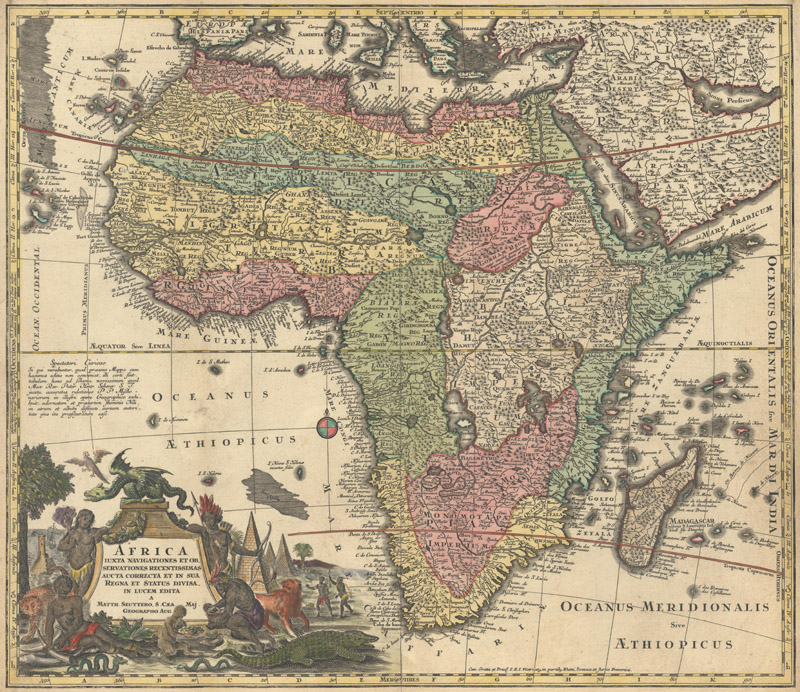
Seutter’s Africa Iuxta Navigationes et Observationes Recentissimas… (ca. 1732), largely based on Homann’s 1715 map of the continent
Seutter’s enterprise was slow to find success. The great strength of Homann Heirs during their peak years was the firm’s collaborative relationship with the academic community of Nuremberg. Although Augsburg had established itself as the main hub of the European engraving trade in the 17th century, it was not a university town and lacked the pool of scientists and cartographers that Nuremberg possessed. Therefore, the majority of the Seutter stock was copied from other sources, chief among them Homann and French cartographer Guillaume Delisle. Seutter did not just copy maps from his former master–he emulated Homann’s signature format and affordable prices too.
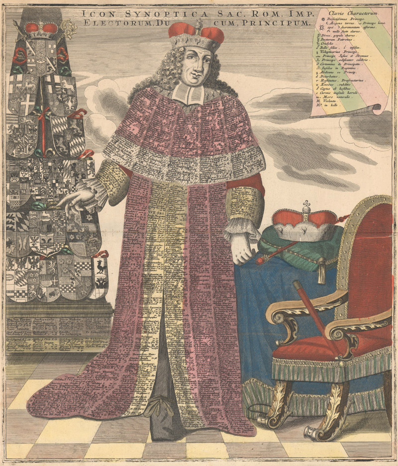
An engraving of an elector of the Holy Roman Empire with various leaders listed on his robes (ca, 1730), an example of Seutter’s varied output
What truly set Seutter apart and what ultimately made him prosper was his prolific and diverse output. In addition to the typical folio maps of the world and its regions, Seutter published an eclectic array of globes, city plans, postal route maps, battle maps, celestial charts, genealogical sheets, cartographic miscellany, and much more. He compiled a variety of atlases, from the Atlas Compendiosus (circa 1720), consisting of just 20 maps, to the Grosser Atlas (circa 1731-32), which spanned over 400 sheets. Later, in the 1740s, he would begin to publish his own small-format atlas for schoolchildren, Atlas Minor. Something of a workhorse, Seutter handled much of the engraving himself, with assistance in his later years from his sons and, especially, his son-in-law, Tobias Conrad Lotter.
Seutter’s imprint with privilege, from Mappa Geographica Circuli Metalliferi Electoratus Saxoniae cum Omnibus, quae in eo Comprehenduntur Praefecturis et Dynastiis... (ca. 1740)
After dedicating his massive Grosser Atlas to the Holy Roman Emperor Charles VI circa 1731-32, Seutter was given the title of Imperial Geographer, just like Homann before him. From that point on, his maps were then signed with “Sac. Caes. Mai. Geogr.”, “S.C.M.G.”, or “I.R.K.M.G.” (the German abbreviation). A decade later, privileges such as “Cum gratia et privilegio Sacri Romani Imperii Vicariatus in partibus Rheni, Sueviae et Juris Franconici” and “Cum Privile. S. Maj. Poloni et Elect. Saxon.” began appearing on his maps, indicating that he had been granted a printing privilege to publish maps in certain regions.
Before his demise in 1757, Seutter fathered thirteen children, but only four of them survived into their adulthood. Both of his adult daughters married engravers: the eldest, Euphrosina, married Tobias Conrad Lotter, and the youngest, Anna Sabina, married and divorced Gustav Kilian before marrying Georg Balthasar Probst. Seutter’s sons, Georg Matthäus and Albrecht Carl, both worked for a time under their father as engravers, but neither seemed especially inclined towards the map trade. Georg Matthäus left Augsburg in 1729 and it is believed that he predeceased his father, as the Seutter publishing enterprise was inherited by Albrecht Carl. In the five-year span when Albrecht Carl ran the company, he made just 15 new maps, a paltry number when compared to his industrious father.
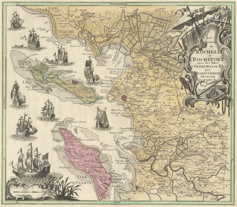
Albrecht Carl Seutter’s Les Environs de Rochelle et Rochefort avec les Isles d'Oleron et de Re (ca. 1760)
When Albrecht Carl died in 1762, his wife decided to sell the Seutter copperplates and existing map inventory. Much like the Homann firm, the Seutter map publishing house was split into two parts after the death of its founder’s son. But unlike Homann Heirs, the new owners of Seutter’s legacy completely diverged to start new, independent enterprises. Roughly two-thirds of the Seutter stock were purchased by Johann Michael Probst, the brother of Albrecht Carl’s first wife. (The Probsts were also the grandchildren of Jeremias Wolff, Matthäus Seutter’s former employer.) The rest of the Seutter estate was acquired by Tobias Conrad Lotter.
The Modest Achievements of Johann Michael Probst and Sons (1762-1809)
Johann Michael Probst’s Nova Mappa Geographica Americae Septentrionalis in suas Praecipuas Partes Divisa (1782), the firm’s edition of the Popple key map
The Probst name was already well known in Augsburg before Johann Michael Probst purchased a sizable piece of the Seutter map business. The Probsts were among the foremost engravers in the biggest engraving town in all of Europe, and their patriarch, Johann Balthasar, had married into the family of Jeremias Wolff, an art publisher of great renown. Born in 1727, Johann Michael was something of an outlier in his family, as he was not an engraver. Rather than setting out to improve the Seutter stock, he sold the maps as they were, only amending them with the engraved imprint of his firm. When Johann Michael died in 1776, his sons Johann Michael II, Johann Georg, and Johann Conrad took the reins of the business. They were more ambitious than their father, actively improving old Seutter maps while also creating over 100 new maps (in both folio and miniature sizes), enough to compile new atlases. As might be expected from a family of engravers, the new maps were expertly engraved. They were also regularly updated so that individual sheets remained contemporary. But the Probst firm’s success could not compare to Seutter’s. The Johann Michael Probst imprint ended when the two eldest sons died in 1809.They made some fine maps, but their work lacked the decorative panache that distinguished Homann’s and Seutter’s productions. Among the highlights published by the Probst family are their 1782 variant of Henry Popple’s seminal map of North America and the miniature atlas Atlas Minor ex Tabulis Geographicis (circa 1784).
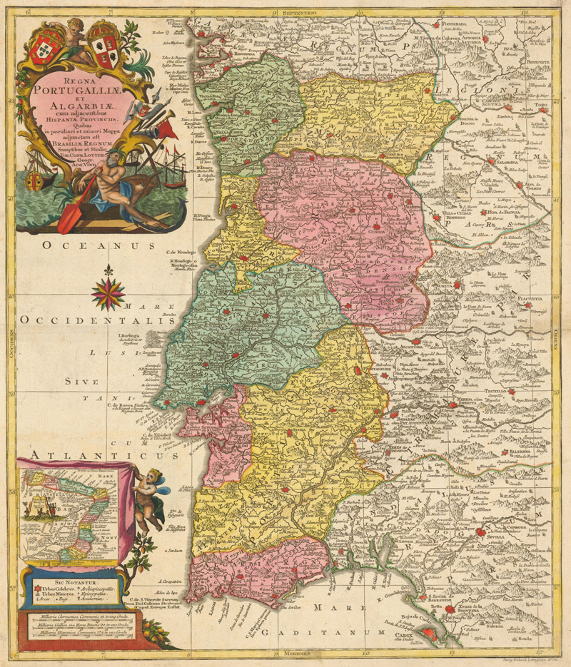
Tobias Conrad Lotter’s Regna Portugalliae et Algarbiae… (1762), similar to an early Seutter map, but with entirely reworked decorative elements
The true heir to Seutter’s legacy was Tobias Conrad Lotter, who was born in 1717. More so than his own sons, Matthäus Seutter’s biggest asset as a map publisher was Lotter, a brilliant and dedicated engraver with good business acumen. In 1757, soon after Seutter’s death, Lotter was moving to start his own publishing house, engraving original maps at a heroic pace and purchasing spare copperplates from other firms. After Albrecht Carl died in 1762, Lotter acquired the remainder of the Seutter stock not purchased by Johann Michael Probst, amounting to about 100 maps. He republished these maps using his own imprint, sometimes updating the plates with new information. Others he re-engraved entirely.
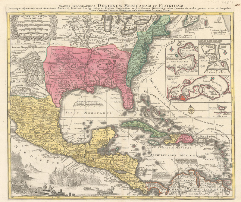
Mappa Geographica Regionem Mexicanam et Floridam Terrasque Adjacentes… (ca. 1762) with Lotter’s imprint replacing Seutter’s
Lotter’s sterling reputation as an engraver and publisher earned him commissions (including work for Amsterdam-based publisher Petrus Schenk II) and opportunities to publish material that originated with other mapmakers (such as the polymath Johann Franz Kohlbrenner’s Geographische Mauth-Charte von Bayern…). He saw what worked for Seutter and followed the strategy accordingly, issuing a high volume of maps of all types and formats. Like Homann, he also put out maps with contemporary resonance, often related to ongoing wars, which he was able to compile and engrave with remarkable speed. Lotter’s success is all the more impressive because he so often worked alone (although occasionally he would outsource work to his brother Andreas).
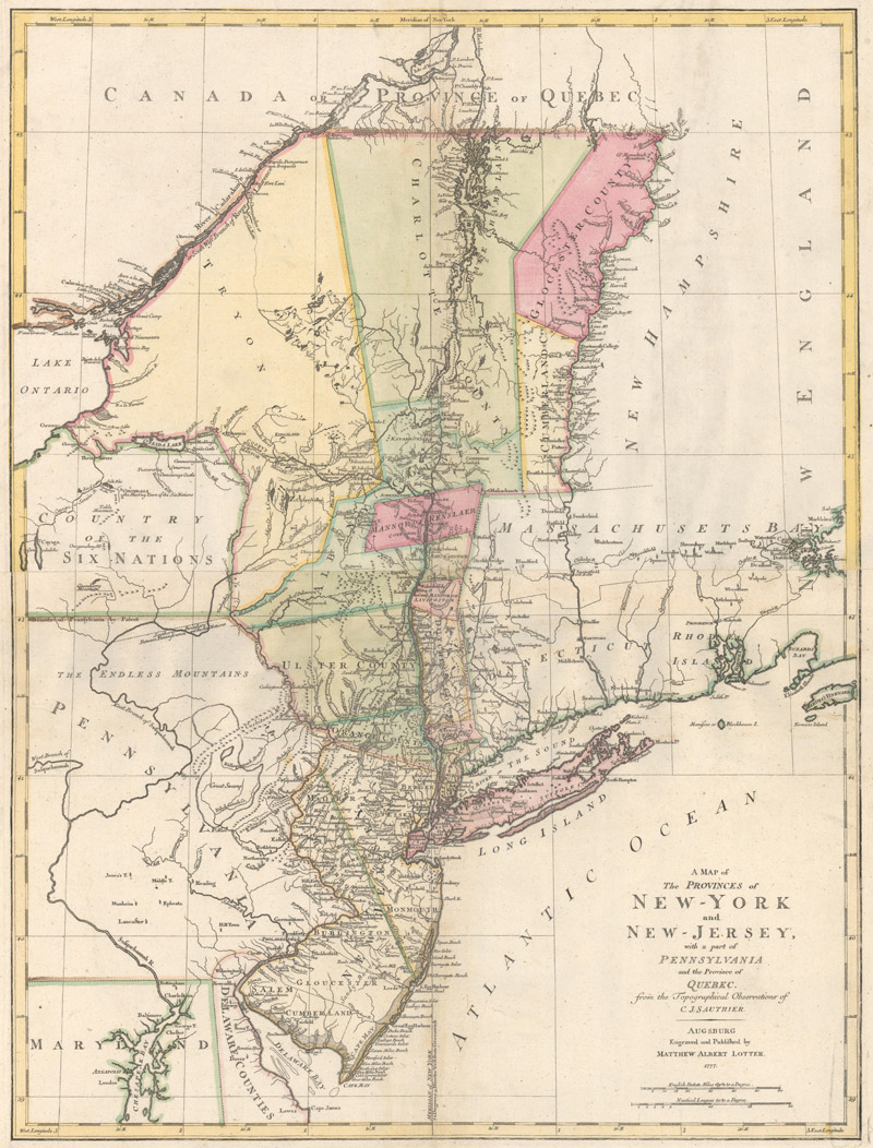
A Map of the Provinces of New-York and New-Jersey… (1777), an important Revolutionary War map “Engraved and Published by Matthew Albert Lotter”
Eventually, towards the end of the 1760s, Lotter brought on his three sons as engravers: Matthäus Albrecht, Georg Friedrich I, and Gustav Conrad. When he died in 1777, he split his inheritance between Matthäus Albrecht, Georg Friedrich I, and his grandson, Philipp Conrad (Gustav Conrad died a year before his father). Tobias Conrad Lotter had taken part of his father-in-law’s company and grew it into a real juggernaut. The size and scope of the operation that he left behind was staggering. Scholar Michael Ritter lays out the hard numbers of at least a portion of the estate: “Philipp Conrad’s share of the inheritance consisted of nearly 9,000 folio maps, some 15,000 smaller maps, about 4,000 folders for the storage of folded maps, 48 copies of Atlas Minor, more than 200 copper plates, together weighing 1,360 pounds, and some other material.” This chunk of the Lotter firm was eventually jointly purchased in 1789 by Johann Martin Will, the head of another Augsburg-based engraving and publishing dynasty, and his son-in-law Johannes Walch.
Johannes Walch’s map of North America (ca. 1790)
The Lotter firm carried on under the leadership of Matthäus Albrecht and Georg Friedrich I. When it came to their talents as engravers, both brothers were chips off the old block, especially Matthäus Albrecht, but their style of mapmaking tended towards the sober and practical, with none of their father’s striking ornamentation. Their work also lacked the high scientific standards that were being embraced by Europe’s foremost cartographers. The Lotter brothers’ handsome but unremarkable cartographic output, usually signed Matthäus Albrecht Lotter, Freres Lotter, or Gebrüder Lotter, failed to stand out in an increasingly crowded market. Augsburg was no longer the great publishing hub it once was, with fresh competition emerging from great academic cities like Vienna, Berlin, and Weimar. The Lotters lacked the resources to keep up with the granular government-funded surveys being commissioned by individual German states. As the boundaries of German states continually changed in the waning days of the Holy Roman Empire, the Lotter stock looked increasingly dated. In 1810, Matthäus Albrecht’s sons inherited the struggling Lotter firm. They produced nothing of note during their tenure, and the company ended when they died in the middle of the 19th century.
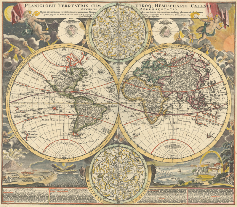
Homann’s Planiglobii Terrestris cum Utroq Hemisphaerio Caelesti Generalis Repraesentatio quam ex Novissimis Probatissimisque Recentium Geographorum... (ca. 1720)
The last original Lotter map–an apparent mediocrity published under another Augsburg-based publisher’s imprint—was issued circa 1850, just two years after the dissolution of Homman Heirs. Given their intertwined histories, it is fitting that the legacies of the three great German map publishers of the 18th century ended around the same time. But in the antique map collecting community, the legacies of Homann, Seutter, and Lotter are still very much alive. Because of the astonishing volume of work produced by the three firms, their fine maps are fairly common on the market, usually in good condition and at a relatively affordable price point. Collectors are drawn to their striking design and excellent cartographic detail. The map format and smart publishing strategies that Johann Baptist Homann devised–pushed forward by his heirs, followed by his former employee Seutter, and then further continued by Seutter’s prized engraver Lotter–have left an indelible mark on the history of cartography.
References:
Heinz, Markus, “A Programme for Map Publishing: The Homann Firm in the Eighteenth Century,” Imago Mundi, Vol. 49, 1997. https://www.jstor.org/stable/1151337
Heinz, Markus, “Homann Family,” The History of Cartography Volume Four – Cartography in the European Enlightenment, ed. Matthew H. Edney and Mary Sponberg Pedley, The University of Chicago Press, 2019. https://press.uchicago.edu/books/HOC/HOC_V4/HOC_VOLUME4_H.pdf
Ritter, Michael, “Seutter, Probst and Lotter: An Eighteenth-Century Map Publishing House in Germany,” Imago Mundi, Vol. 53, 2001. https://www.jstor.org/stable/1151567
Ritter, Michael, “Seutter, Probst, and Lotter Families,” The History of Cartography Volume Four – Cartography in the European Enlightenment, ed. Matthew H. Edney and Mary Sponberg Pedley, The University of Chicago Press, 2019. https://press.uchicago.edu/books/HOC/HOC_V4/HOC_VOLUME4_S.pdf