Showing Unsold Lots $100 to $250(remove filter)
Current Auction
112 lots
Page 1 of 3
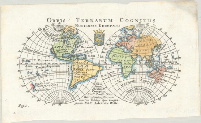
Lot 19
Subject: World
Wells, Edward
Orbis Terrarum Cognitus Hodiernis Europaeis, 1726
Size: 6.4 x 3.5 inches (16.3 x 8.9 cm)
Estimate: $240 - $300
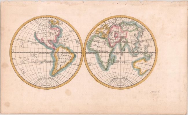
Lot 22
Subject: World
Fisher, Joshua
[Untitled - World], 1765
Size: 5.5 x 2.8 inches (14 x 7.1 cm)
Estimate: $120 - $150
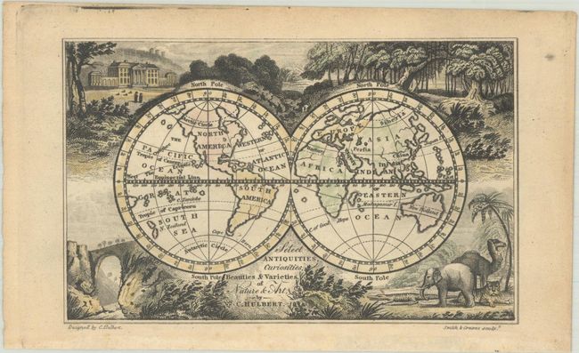
Lot 30
Subject: World
Select Antiquities, Curiosities, Beauties & Varieties of Nature & Art, 1822
Size: 4.8 x 3 inches (12.2 x 7.6 cm)
Estimate: $120 - $150
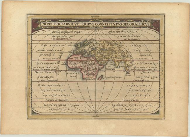
Lot 45
Subject: Ancient World
Cluver/Jansson
Orbis Terrarum Veteribus Cogniti Typus Geographicus, 1676
Size: 8.1 x 6.3 inches (20.6 x 16 cm)
Estimate: $160 - $190
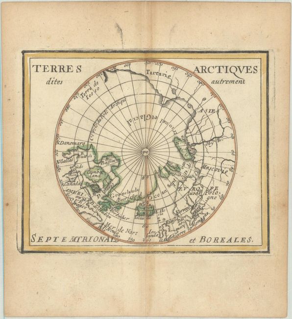
Lot 47
Subject: North Pole
Duval, Pierre
Terres Arctiques Dites Autrement Septemtrionales et Boreales, 1682
Size: 4.9 x 3.9 inches (12.4 x 9.9 cm)
Estimate: $180 - $210
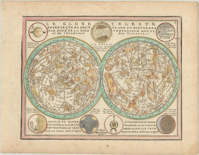
Lot 51
Subject: Celestial
Chiquet, Jacques
Le Globe Celeste Represente en Deux Plans-Hemispheres par Monsr. de la Hire Professeur Royal et de l'Academie des Sciences, 1719
Size: 8.6 x 6.6 inches (21.8 x 16.8 cm)
Estimate: $275 - $350
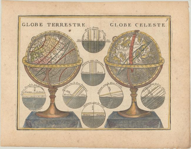
Lot 63
Subject: Cartographic Miscellany, Globes
Chiquet, Jacques
Globe Terrestre / Globe Celeste, 1719
Size: 8.6 x 6.4 inches (21.8 x 16.3 cm)
Estimate: $140 - $170
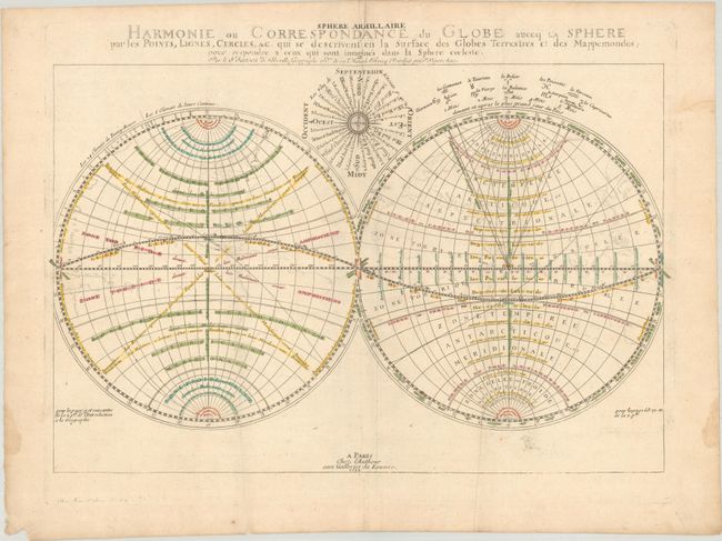
Lot 64
Subject: Cartographic Miscellany, World
Sanson, Nicolas
Harmonie ou Correspondance du Globe auecq la Sphere par les Points, Lignes, Cercles, &c..., 1699
Size: 21.3 x 14 inches (54.1 x 35.6 cm)
Estimate: $275 - $350
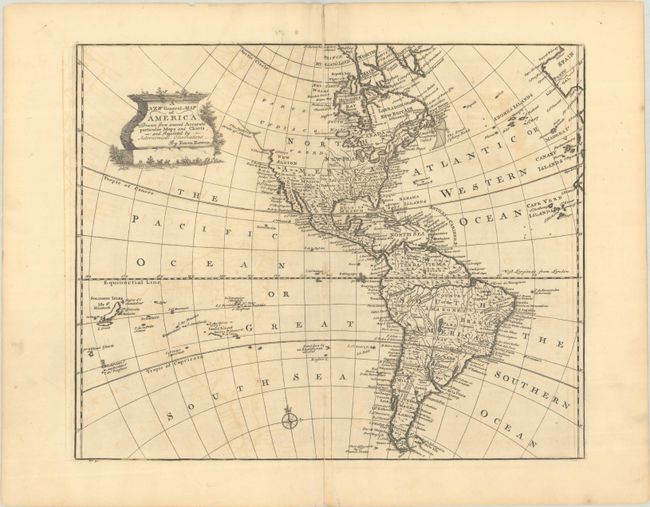
Lot 83
Subject: Western Hemisphere - America
Bowen, Emanuel
A New General Map of America, Drawn from Several Accurate Particular Maps and Charts, and Regulated by Astronomical Observations, 1747
Size: 17.1 x 14 inches (43.4 x 35.6 cm)
Estimate: $240 - $300
Price reduced by $30
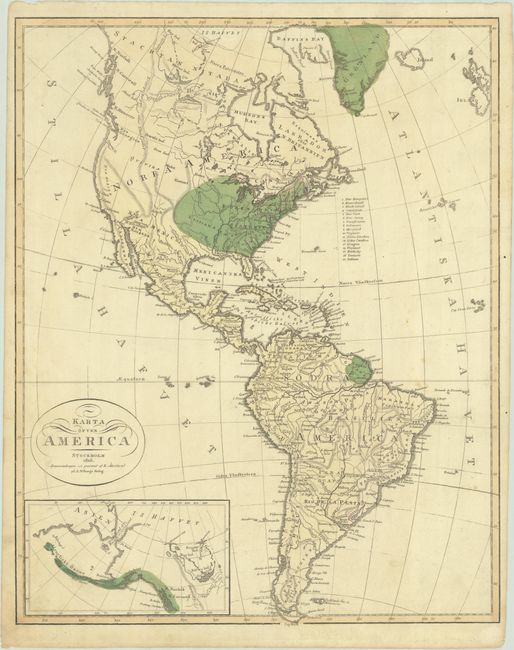
Lot 85
Subject: Western Hemisphere - America
Karta ofver America, 1818
Size: 13.7 x 17.2 inches (34.8 x 43.7 cm)
Estimate: $140 - $180
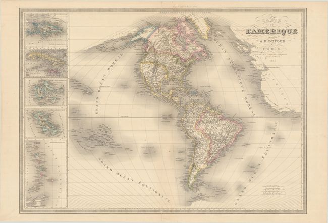
Lot 87
Subject: Western Hemisphere - America
Dufour, Auguste-Henri
Carte de l'Amerique, 1842
Size: 29.1 x 20.9 inches (73.9 x 53.1 cm)
Estimate: $200 - $230
Price reduced by $25
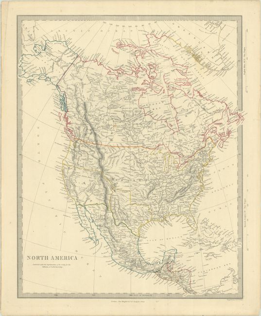
Lot 98
Subject: North America, Texas
SDUK Society for the Diffusion of Useful Knowledge
North America, 1845
Size: 12.4 x 15.3 inches (31.5 x 38.9 cm)
Estimate: $200 - $230
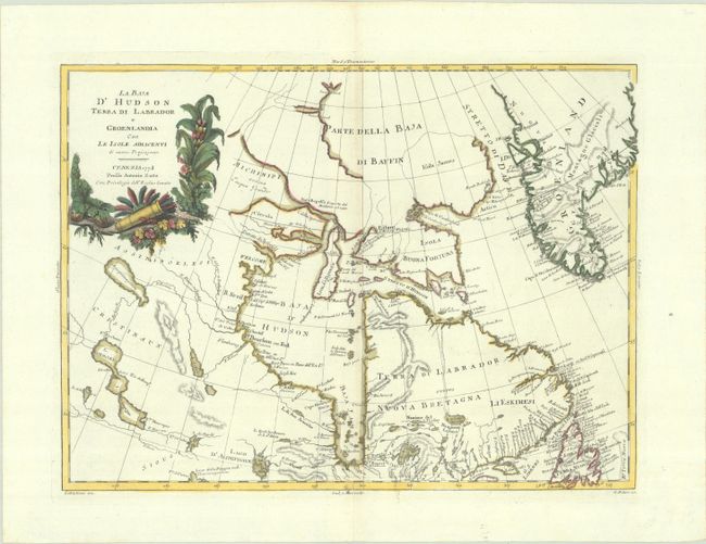
Lot 111
Subject: Eastern Canada & Greenland
Zatta, Antonio
La Baja d'Hudson Terra di Labrador e Groenlandia con le Isole Adiacenti di Nuova Projezione, 1778
Size: 16.1 x 11.8 inches (40.9 x 30 cm)
Estimate: $150 - $180
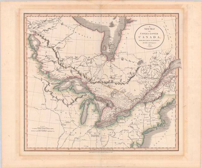
Lot 129
Subject: Northeastern United States & Canada
Cary, John
A New Map of Upper & Lower Canada, from the Latest Authorities, 1807
Size: 20.6 x 18.1 inches (52.3 x 46 cm)
Estimate: $475 - $600
Price reduced by $150!
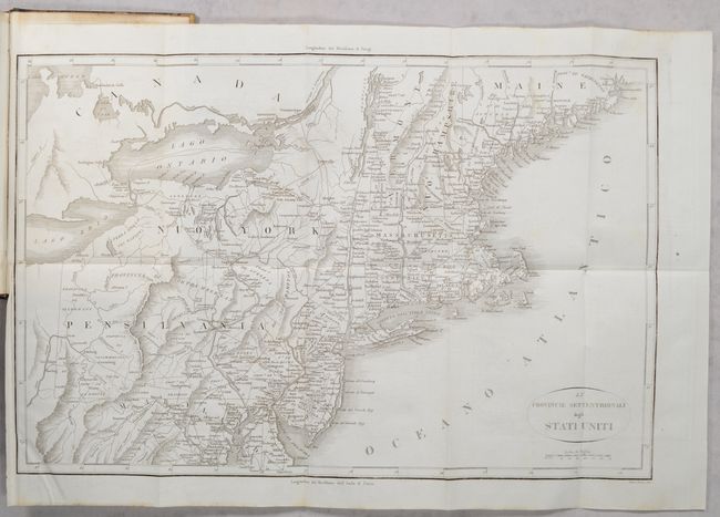
Lot 146
Subject: Eastern United States, Revolutionary War
Botta, Carlo
[2 Maps in 3 Volumes] Le Provincie Meridionali degli Stati Uniti [and] Le Provincie Settentrionali degli Stati Uniti [in] Storia della Guerra della Independenza degli Stati Uniti di America Volume Primo [and] Volume Secondo [and] Volume Terzo, 1820
Size: 5.5 x 8.5 inches (14 x 21.6 cm)
Estimate: $300 - $400
Price reduced by $20 - "The Most Valuable History of the Revolution Up to its Date" - Howes
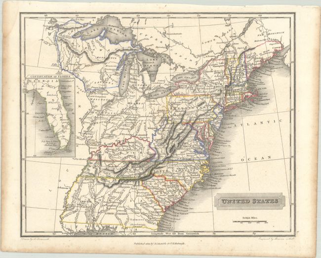
Lot 147
Subject: Eastern United States
Arrowsmith, Aaron, Jr.
United States, 1823
Size: 10 x 8.1 inches (25.4 x 20.6 cm)
Estimate: $200 - $230
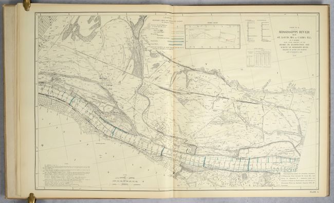
Lot 166
Subject: Mississippi River, Missouri, Illinois
U.S. Government
Atlas Illustrating Report of March 20, 1909, of Board on Examination and Survey of Mississippi River..., 1909
Size: 22.8 x 36.8 inches (57.9 x 93.5 cm)
Estimate: $300 - $400
Price reduced by $20
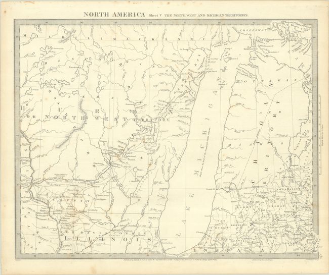
Lot 173
Subject: Upper Midwestern United States
SDUK Society for the Diffusion of Useful Knowledge
North America Sheet V The North West and Michigan Territories, 1833
Size: 15.3 x 11.9 inches (38.9 x 30.2 cm)
Estimate: $120 - $150
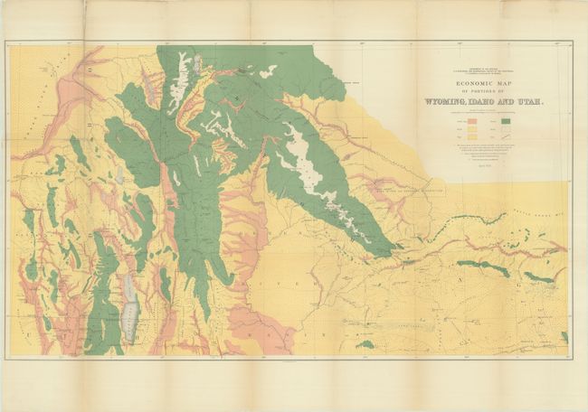
Lot 179
Subject: Western United States
Hayden, Ferdinand Vandeveer
[Lot of 3] Economic Map of Portions of Wyoming, Idaho and Utah [and] Part of Central Wyoming [and] Part of Central Wyoming, 1883
Size: See Description
Estimate: $200 - $230
Price reduced by $50
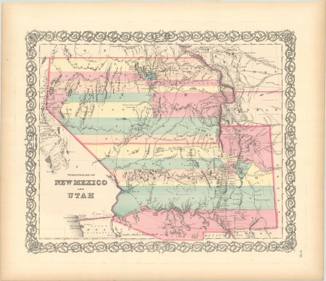
Lot 182
Subject: Southwestern United States
Colton, Joseph Hutchins
Territories of New Mexico and Utah, 1855
Size: 15.7 x 12.9 inches (39.9 x 32.8 cm)
Estimate: $220 - $250
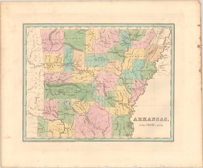
Lot 189
Subject: Arkansas, Texas
Bradford, Thomas Gamaliel
Arkansas, 1838
Size: 14.4 x 11.3 inches (36.6 x 28.7 cm)
Estimate: $180 - $220
Features Disputed Land with the Republic of Texas
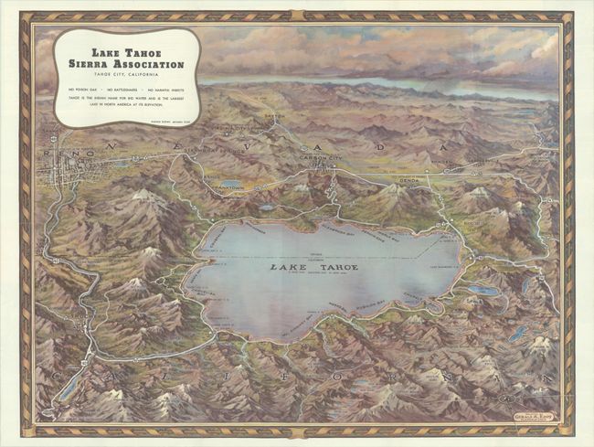
Lot 194
Subject: Lake Tahoe, California, Nevada
Eddy, Gerald
Lake Tahoe Sierra Association Tahoe City, California, 1945
Size: 22.4 x 17.3 inches (56.9 x 43.9 cm)
Estimate: $200 - $230
Price reduced by $30
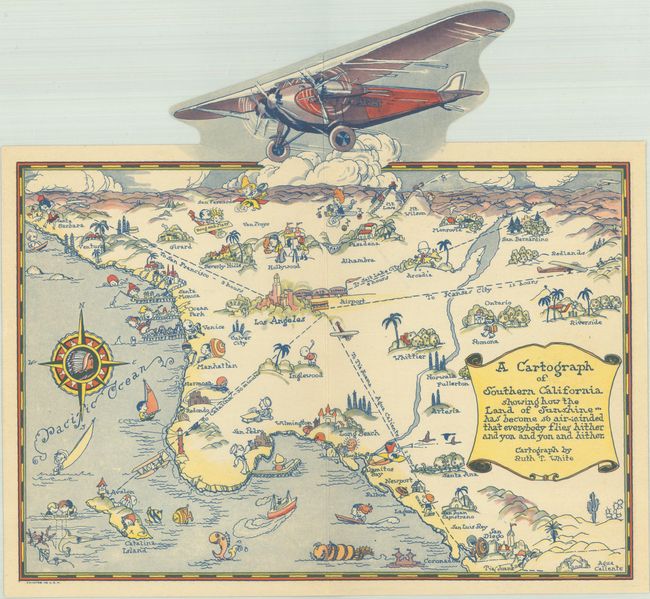
Lot 201
Subject: Southern California
White, Ruth Taylor
A Cartograph of Southern California Showing How the Land of Sunshine... Has Become So Air-Minded That Everybody Flies Hither and Yon and Yon and Hither, 1929
Size: 10.1 x 9.4 inches (25.7 x 23.9 cm)
Estimate: $275 - $350
Price reduced by $50
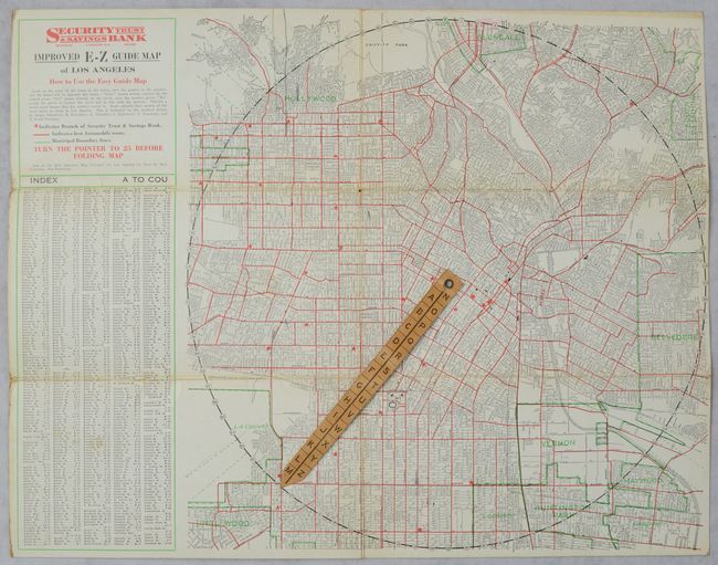
Lot 205
Subject: Los Angeles, California
Clason Map Company
Improved E-Z Guide Map of Los Angeles, 1927
Size: 16.6 x 12.8 inches (42.2 x 32.5 cm)
Estimate: $160 - $190
Lot 206
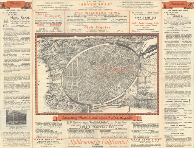
Subject: Los Angeles, California
Interesting Places In and Around Los Angeles [on verso] California Pacific International Exposition, 1935
Size: 23.9 x 18.3 inches (60.7 x 46.5 cm)
Estimate: $160 - $190
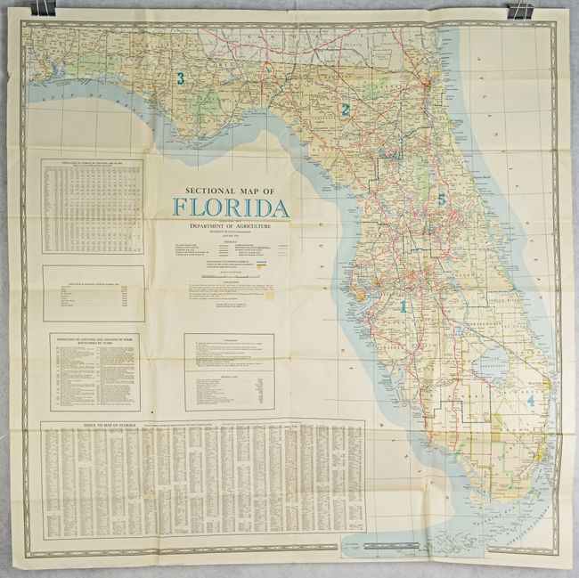
Lot 219
Subject: Florida
Matthews-Northrup Co
Sectional Map of Florida Issued by Department of Agriculture, 1938
Size: 44.8 x 44.5 inches (113.8 x 113 cm)
Estimate: $140 - $170
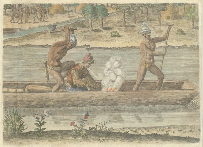
Lot 223
Subject: Florida, Natives
Bry, Theodore de
[The Murder of the Frenchman, Pierre Gambie] Welcher Gestalt Petrus Cambie / ein Frantzosz / umb Sein Leben Kommen, 1591
Size: 8.5 x 6.1 inches (21.6 x 15.5 cm)
Estimate: $275 - $350
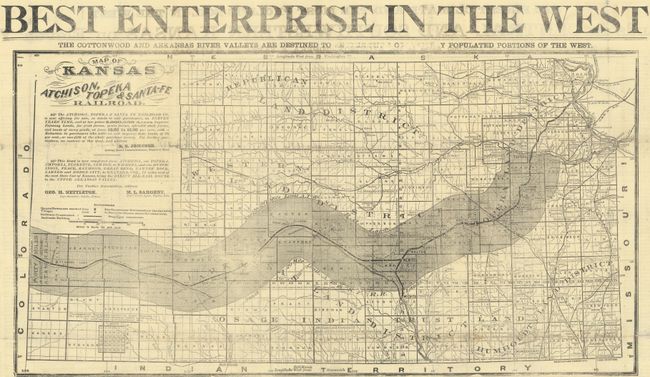
Lot 235
Subject: Kansas
Railroad Companies, (Various)
[Promotional Broadside for the Atchison, Topeka & Santa-Fe Railroad] Best Enterprise in the West, 1874
Size: 23.4 x 12.3 inches (59.4 x 31.2 cm)
Estimate: $275 - $350
Price reduced by $50
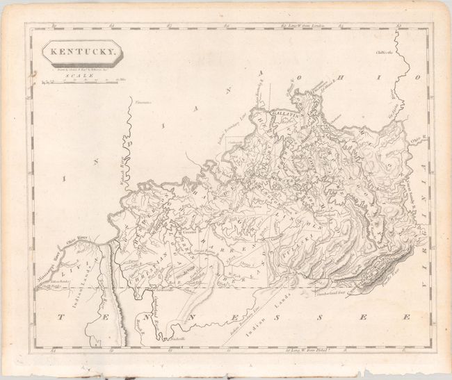
Lot 239
Subject: Kentucky
Arrowsmith & Lewis
Kentucky, 1804
Size: 9.8 x 8 inches (24.9 x 20.3 cm)
Estimate: $200 - $230
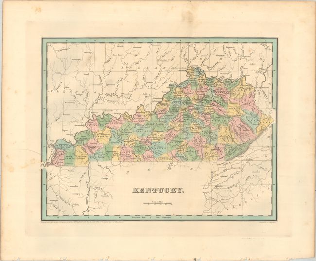
Lot 241
Subject: Kentucky
Bradford, Thomas Gamaliel
Kentucky, 1838
Size: 14.4 x 11.3 inches (36.6 x 28.7 cm)
Estimate: $140 - $170
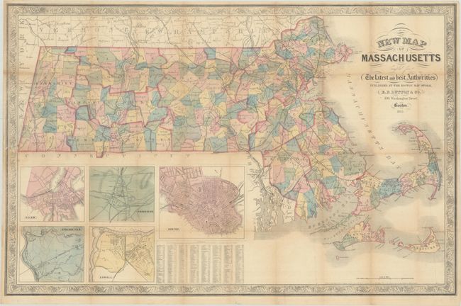
Lot 249
Subject: Massachusetts
Dutton, E. P.
New Map of Massachusetts Compiled from the Latest and Best Authorities, 1863
Size: 30.1 x 19.5 inches (76.5 x 49.5 cm)
Estimate: $160 - $190
Price reduced by $25
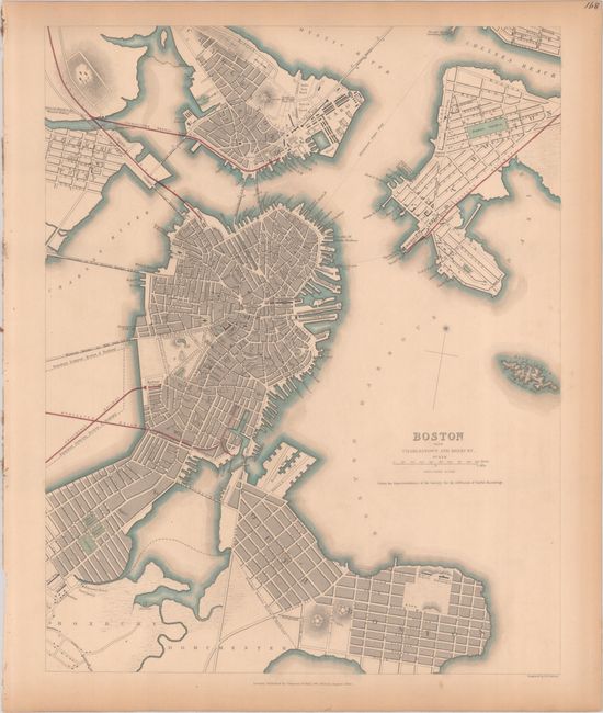
Lot 251
Subject: Boston, Massachusetts
SDUK Society for the Diffusion of Useful Knowledge
Boston with Charlestown and Roxbury, 1842
Size: 11.8 x 14.8 inches (30 x 37.6 cm)
Estimate: $200 - $230
Price reduced by $30
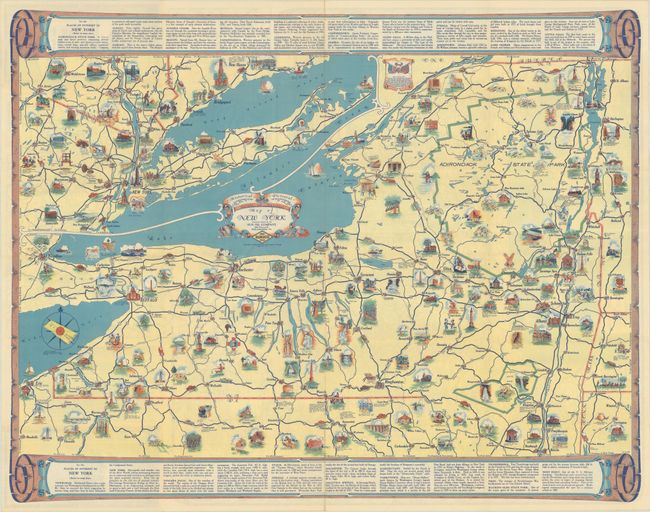
Lot 264
Subject: New York
Rand McNally & Co.
Historical Pictorial Points of Interest Map of New York, 1934
Size: 27.3 x 21.3 inches (69.3 x 54.1 cm)
Estimate: $200 - $230
Price reduced by $50
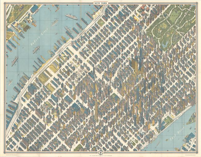
Lot 267
Subject: New York City, New York
New York, 1964
Size: 41.9 x 33 inches (106.4 x 83.8 cm)
Estimate: $240 - $300
Price reduced by $90
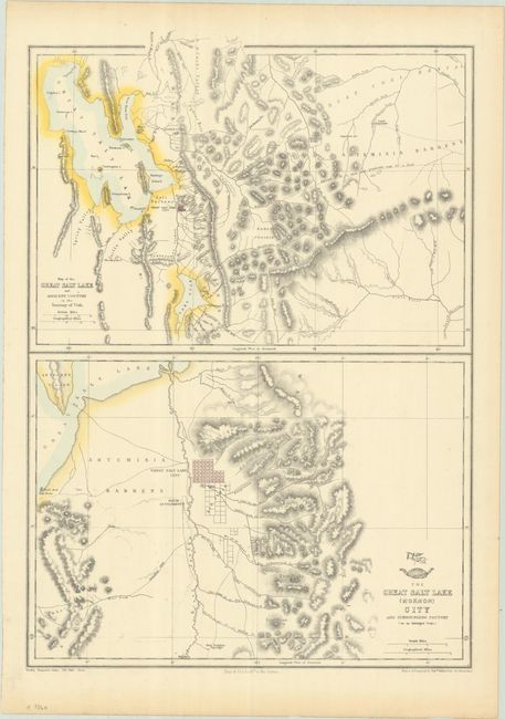
Lot 283
Subject: Salt Lake City, Utah
Weller, Edward
Map of the Great Salt Lake and Adjacent Country in the Territory of Utah [on sheet with] The Great Salt Lake (Mormon) City and Surrounding Country (on an Enlarged Scale), 1860
Size: 12.1 x 17.3 inches (30.7 x 43.9 cm)
Estimate: $160 - $190
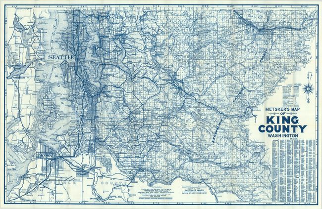
Lot 290
Subject: Seattle, Washington
Metsker
Metsker's Map of King County Washington, 1950
Size: 39 x 25 inches (99.1 x 63.5 cm)
Estimate: $140 - $170
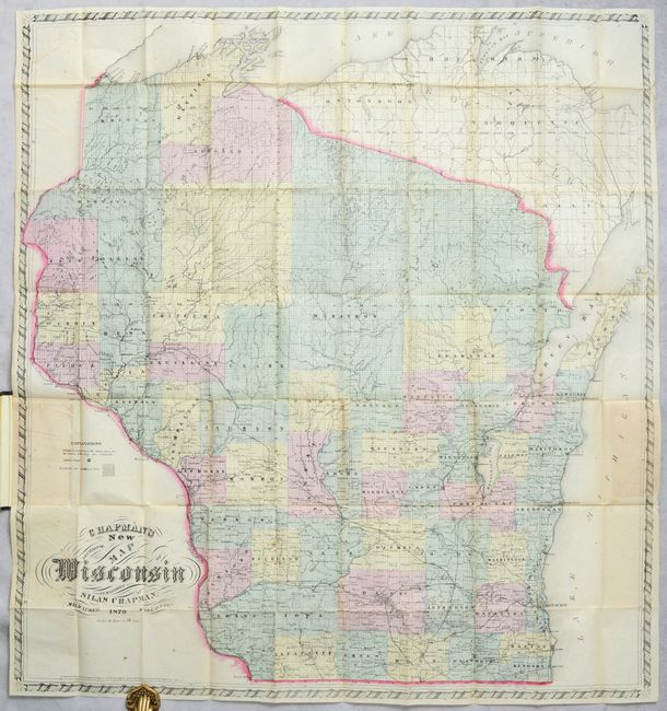
Lot 291
Subject: Wisconsin
Chapman, Silas
Chapman's New Sectional Map of Wisconsin, 1870
Size: 30.8 x 33.2 inches (78.2 x 84.3 cm)
Estimate: $300 - $375
Price reduced by $70
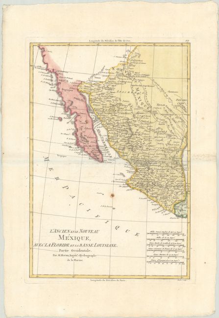
Lot 295
Subject: Southern United States, Mexico & Central America
Bonne, Rigobert
[Lot of 2] L'Ancien et le Nouveau Mexique, avec la Floride et la Basse Louisiane. Partie Occidentale [and] ... Partie Orientale, 1787
Size: 9.3 x 13.6 inches (23.6 x 34.5 cm)
Estimate: $240 - $300
Price reduced by $30
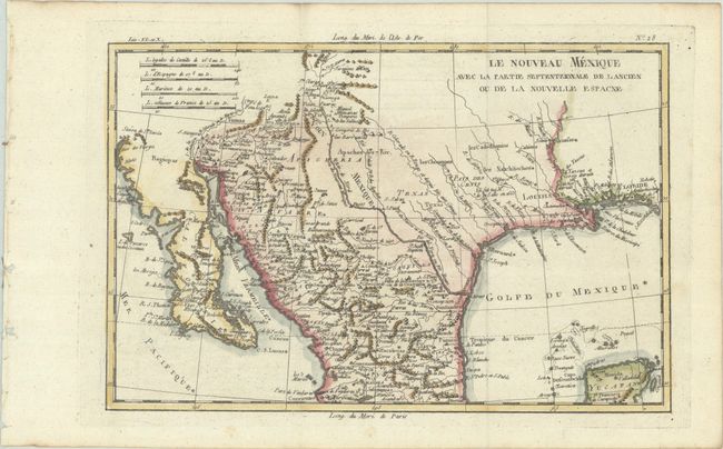
Lot 299
Subject: Southwestern United States & Mexico
Bonne, Rigobert
Le Nouveau Mexique avec la Partie Septentrionale de l Ancien ou de la Nouvelle Espagne, 1780
Size: 12.6 x 8.3 inches (32 x 21.1 cm)
Estimate: $150 - $180
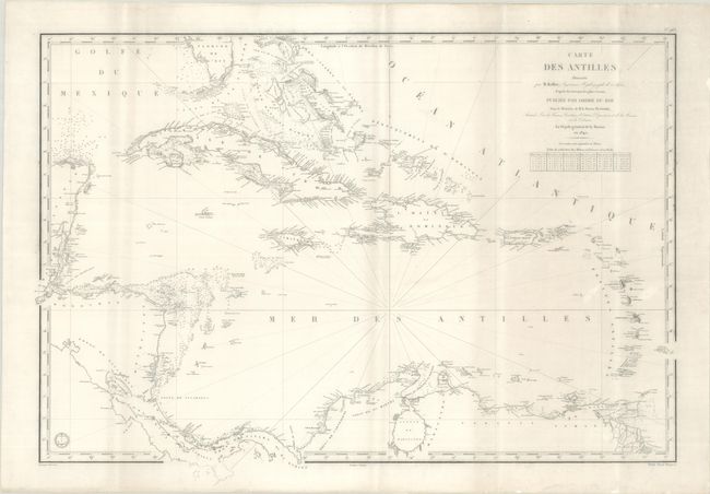
Lot 312
Subject: Caribbean
Depot de la Marine
Carte des Antilles Dressee par M. Keller..., 1842
Size: 35.1 x 24.8 inches (89.2 x 63 cm)
Estimate: $160 - $190
Lot 314
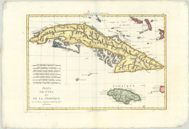
Subject: Cuba & Jamaica
Bonne, Rigobert
Isles de Cuba et de la Jamaique, 1787
Size: 13.6 x 9.3 inches (34.5 x 23.6 cm)
Estimate: $130 - $160
Lot 338
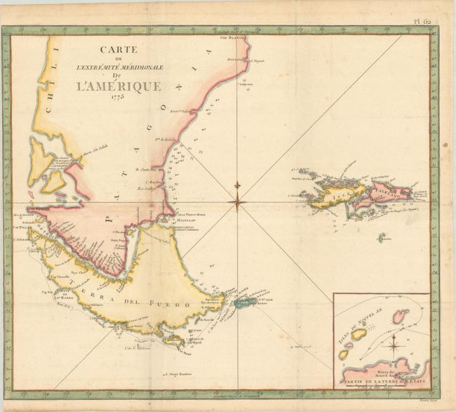
Subject: Southern South America
Cook, James (Capt.)
Carte de l'Extremite Meridionale de l'Amerique, 1775
Size: 19.6 x 16.8 inches (49.8 x 42.7 cm)
Estimate: $200 - $230
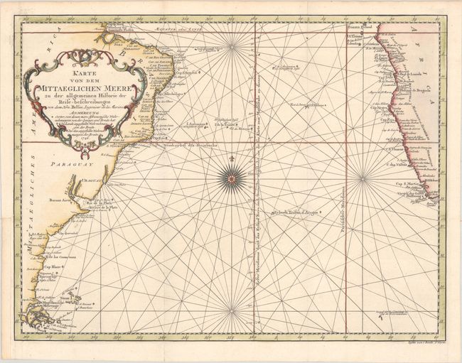
Lot 341
Subject: South Atlantic
Bellin, Jacques Nicolas
Karte von dem Mittaeglichen Meere, zu der Allgemeinen Historie der Reise-Beschreibungen, 1746
Size: 17.8 x 13.4 inches (45.2 x 34 cm)
Estimate: $160 - $190
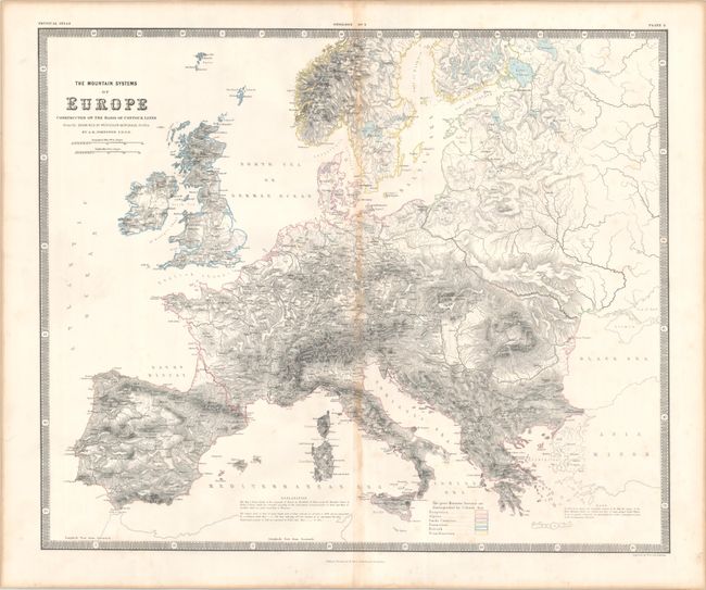
Lot 361
Subject: Europe
Johnston, W. & A.K.
The Mountain Systems of Europe Constructed on the Basis of Contour Lines..., 1856
Size: 23.4 x 19.5 inches (59.4 x 49.5 cm)
Estimate: $120 - $150
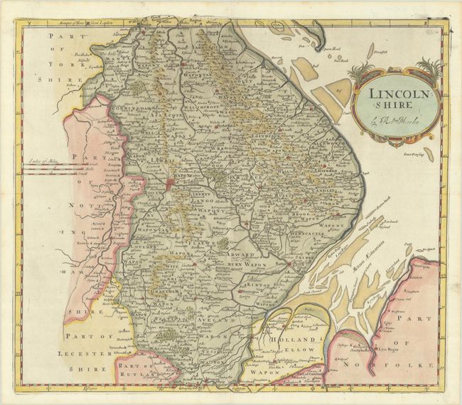
Lot 377
Subject: Eastern England
Morden, Robert
Lincolnshire, 1695
Size: 16.5 x 14.7 inches (41.9 x 37.3 cm)
Estimate: $140 - $170
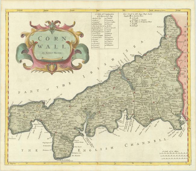
Lot 378
Subject: Southwestern England
Morden, Robert
Cornwall, 1695
Size: 17 x 14.2 inches (43.2 x 36.1 cm)
Estimate: $140 - $170
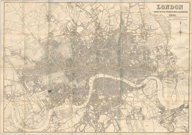
Lot 383
Subject: London, England
Dower, John
London Guide to the International Exposition , 1862
Size: 41.7 x 29.3 inches (105.9 x 74.4 cm)
Estimate: $275 - $350
Price reduced by $25
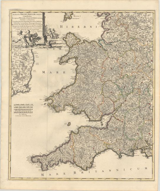
Lot 389
Subject: Western England & Wales
Wit, Frederick de
Occidentalior Regni Angliae Districtus Comprehendens Principatum Walliae et Glocestriae Ducatum Comitatus et Provincias Cornubiae, Devoniae, Somersethi, Dorcestriae..., 1721
Size: 19.4 x 22.6 inches (49.3 x 57.4 cm)
Estimate: $275 - $350
Price reduced by $50
Lot 390
Subject: Western Wales
Speed, John
Cardigan Shyre Described with the Due Forme of the Shire-Town as It Was Surveyed, 1610
Size: 20 x 15 inches (50.8 x 38.1 cm)
Estimate: $350 - $425
Price reduced by $75

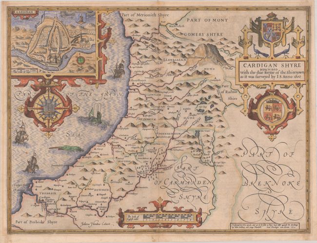
Lot 391
Subject: Southwestern Wales
Jansson, Jan
Penbrochia Comitatus et Comitatus Caermardinum, 1646
Size: 20.3 x 15.1 inches (51.6 x 38.4 cm)
Estimate: $180 - $220
Price reduced by $20
112 lots
Page 1 of 3